BUSINESS STEWARDSHIP SPEAKER SERIES – TUESDAY NOVEMBER 7th - SAVE THE DATE!!!
Retail Businesses Leveraging Resources for Conservation
What: CMRC Business Stewardship Speaker Series
When: Tuesday, November 7th from 9:00 – 10:15 AM
Where: Hudson River Foundation, 17 Battery Place, NY, NY
The event will be followed by a kick-off meeting of the New York Corporate Wetlands Restoration Partnership from 10:30 – 12:30. For more details about the NY CWRP please visit (http://www.coastalamerica.gov/text/cwrp.html).
Agenda and details to follow. For more information about the Speaker Series and Business Stewardship Initiative please visit: http://www.thecmrc.org/prog-hbp-bsp.asp.
Minutes from the most recent Business Stewardship Speaker Series can be found at: http://thecmrc.blogspot.com/2006/07/business-stewardship-speaker-series.html
RSVP to: business.stewardship@thecmrc.org. Space is limited!
Wednesday, October 18, 2006


Tuesday, October 17, 2006
In the News: A Riverfront Oasis Replaces a Bleak Lot in a Bleak Area
Far upstream from the mouth of the Atlantic Ocean, communities are working to improve the environmental quality of, and access to, their waterfronts. The impacts of these efforts are not inconsequential to the overall health of the ecosystem, as what happens in the Westchester, Mahwah and even Albany eventually trickles down to the shores of our estuary. A  recent waterfront park opening at Hunt's Point in the Bronx highlighted that strides are being made throughout the watershed to improve water quality and access to coastal resources. JB
By Michelle O'Donnell
Published: October 4, 2006
For years, the contaminated land at the end of Tiffany Street in the Hunts Point section of the Bronx jutted into the East River like nothing more than a mean and bony elbow.
On weekends, hardy neighborhood revelers planted the Puerto Rican flag there and danced and partied at the river's edge, transforming it into a happy outcropping known as La Playita, or the Little Beach. But mostly the lot lay barren amid a stretch of waste-treatment plants and factories.
So the unveiling yesterday of its transformation into Barretto Point Park, a lush five-acre waterfront spot complete with a sandy cove, a small boat ramp, sea grasses and a paved path along the river, was understandably met with glee and no shortage of wonder.
Read more:
http://www.nytimes.com/2006/10/04/nyregion/04park.html
Google Map of Hunt's Point
http://www.google.com/maps?ie=UTF8&z=12&ll=40.811341,-73.882198&spn=0.112774,0.180931&t=h&om=1
Wikipedia - Hunts Point
http://en.wikipedia.org/wiki/Hunts_Point,_Bronx
 recent waterfront park opening at Hunt's Point in the Bronx highlighted that strides are being made throughout the watershed to improve water quality and access to coastal resources. JB
By Michelle O'Donnell
Published: October 4, 2006
For years, the contaminated land at the end of Tiffany Street in the Hunts Point section of the Bronx jutted into the East River like nothing more than a mean and bony elbow.
On weekends, hardy neighborhood revelers planted the Puerto Rican flag there and danced and partied at the river's edge, transforming it into a happy outcropping known as La Playita, or the Little Beach. But mostly the lot lay barren amid a stretch of waste-treatment plants and factories.
So the unveiling yesterday of its transformation into Barretto Point Park, a lush five-acre waterfront spot complete with a sandy cove, a small boat ramp, sea grasses and a paved path along the river, was understandably met with glee and no shortage of wonder.
Read more:
http://www.nytimes.com/2006/10/04/nyregion/04park.html
Google Map of Hunt's Point
http://www.google.com/maps?ie=UTF8&z=12&ll=40.811341,-73.882198&spn=0.112774,0.180931&t=h&om=1
Wikipedia - Hunts Point
http://en.wikipedia.org/wiki/Hunts_Point,_Bronx
Friday, October 13, 2006
In the News: Hungry Critters Attack NYC Ships, Piers
Shipworms and gribbles may sound like good costumes for Halloween, but in reality they are a serious threat to vessels, piers and other waterborne structures. As it turns out, the waters of  our estuary have become clean enough to support almost ALL of the species that inhabited the region on the 19th century, some of which aren't as welcomed as others. JB
October 09, 2006
By Samanth Gross, Associated Press
NEW YORK — The city's waterfront is getting cleaner, and bothersome river critters not seen in hundreds of years are once again attacking wooden ships and piers.
The waters were once so filthy that early 20th-century sailors could be sure their boats would be safe from such threats because organisms simply couldn't survive in the muck. But scientists are now seeing a resurgence in gribbles, shrimp-like crustaceans that grow to about one-17th of an inch in length and attack wood from the outside, and shipworms, which latch onto the outside of wood and burrow inward, growing up to several feet long as they devour the material.
"As the river gets cleaner, it's easier for things to live in it," Chris Martin of the Hudson River Park Trust said of the return of the tiny mollusks and crustaceans. "We don't make the piers out of wood anymore because of them."
Read more:
http://enn.com/today.html?id=11403
Shipworms on Wikipedia
http://en.wikipedia.org/wiki/Shipworm
Picture A: Shipworm
Picture B : Gribble
 our estuary have become clean enough to support almost ALL of the species that inhabited the region on the 19th century, some of which aren't as welcomed as others. JB
October 09, 2006
By Samanth Gross, Associated Press
NEW YORK — The city's waterfront is getting cleaner, and bothersome river critters not seen in hundreds of years are once again attacking wooden ships and piers.
The waters were once so filthy that early 20th-century sailors could be sure their boats would be safe from such threats because organisms simply couldn't survive in the muck. But scientists
 are now seeing a resurgence in gribbles, shrimp-like crustaceans that grow to about one-17th of an inch in length and attack wood from the outside, and shipworms, which latch onto the outside of wood and burrow inward, growing up to several feet long as they devour the material.
 "As the river gets cleaner, it's easier for things to live in it," Chris Martin of the Hudson River Park Trust said of the return of the tiny mollusks and crustaceans. "We don't make the piers out of wood anymore because of them."
Read more:
http://enn.com/today.html?id=11403
Shipworms on Wikipedia
http://en.wikipedia.org/wiki/Shipworm
Picture A: Shipworm
Picture B : Gribble
Tuesday, October 10, 2006
Conserving our Coasts and Waterfronts: New Jersey DEP's Coastal Management Program
As part of the CMRC's Harbor Bight Policy Initiative we examine the people and programs involved in the conservation and restoration our coasts and waterfronts. These "keepers" of our shore include a variety of government agencies, 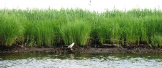 non-profit organizations, academic institutions, businesses and individuals. This installation of Conserving our Coasts and Waterfronts explores New Jersey DEP's Coastal Management Program. JB
Note: The CMRC is currently preparing a report entitled "Minding the Shore: Who is Responsible" to create a catalog of the entities involved with conserving and restoring our coasts. Stay tuned to www.thecmrc.org for its upcoming release!
New Jersey Department of Environmental Protection (NJDEP) is home to the State's Coastal Management Program (CMP), a collaborative effort that brings together many state agencies and departments to regulate and protect the coasts and waters of the region. Through the CMP, DEP manages the state's diverse coastal area that includes portions of eight counties and 126 municipalities.
The CMP began its efforts in earnest in 1972 following the passage of the Federal Coastal Zone Management Act and was formally approved in 1978. Thirty years later the Program continues to conserve the region's shores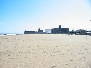 and waterfronts, most recently releasing a status report on their efforts called New Jersey's Coast 2005 (PDF).
http://www.state.nj.us/dep/cmp/
Map of NJ's Coastal Zone
http://www.state.nj.us/dep/cmp/czm_map.html
NJ Department of Environmental Protection
http://www.state.nj.us/dep/
Google Map of the NJ's Atlantic Coast
http://maps.google.com/?ie=UTF8&t=h&om=1&z=8&ll=39.669142,-74.190674&spn=1.835069,3.702393
Wikipedia - "Jersey Shore"
http://en.wikipedia.org/wiki/Jersey_Shore
Picture A. Blue Heron in Hackensack Meadowlands
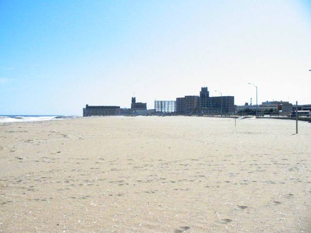
Picture B. Asbury Park Waterfront
 non-profit organizations, academic institutions, businesses and individuals. This installation of Conserving our Coasts and Waterfronts explores New Jersey DEP's Coastal Management Program. JB
Note: The CMRC is currently preparing a report entitled "Minding the Shore: Who is Responsible" to create a catalog of the entities involved with conserving and restoring our coasts. Stay tuned to www.thecmrc.org for its upcoming release!
New Jersey Department of Environmental Protection (NJDEP) is home to the State's Coastal Management Program (CMP), a collaborative effort that brings together many state agencies and departments to regulate and protect the coasts and waters of the region. Through the CMP, DEP manages the state's diverse coastal area that includes portions of eight counties and 126 municipalities.
The CMP began its efforts in earnest in 1972 following the passage of the Federal Coastal Zone Management Act and was formally approved in 1978. Thirty years later the Program continues to conserve the region's shores
 and waterfronts, most recently releasing a status report on their efforts called New Jersey's Coast 2005 (PDF).
In addition to CMP's management efforts, the Program also plays a large role in collecting and organizing New Jersey's scientific data on a wide range of topics including:
- Historical Shoreline and Bathymetric Data
- Historical Surveys, Maps and Aerial Photography
- Beach Profile Data
- Recreational Beach Water Quality
Finally, the CMP is active in ensuring that NJ's residents have ample access to the coastlines and estuaries of the State. They provide and map public access points and also work on waterfront revitalization initiatives such as the Hudson River Waterfront Walkway.
For more information:
NJDEP's Coastal Management Programhttp://www.state.nj.us/dep/cmp/
Map of NJ's Coastal Zone
http://www.state.nj.us/dep/cmp/czm_map.html
NJ Department of Environmental Protection
http://www.state.nj.us/dep/
Google Map of the NJ's Atlantic Coast
http://maps.google.com/?ie=UTF8&t=h&om=1&z=8&ll=39.669142,-74.190674&spn=1.835069,3.702393
Wikipedia - "Jersey Shore"
http://en.wikipedia.org/wiki/Jersey_Shore
Picture A. Blue Heron in Hackensack Meadowlands
Picture B. Asbury Park Waterfront
Monday, October 02, 2006
In the News: Scientists Map Canyon Below Atlantic
Ever wonder what the coast of the Harbor Bight looked like 10,000 years ago? Today, with the help of scientists from Rutgers' Institute of Marine & Coastal Sciences, we know exactly what it looks like (even if it is hundreds of feet below sea-level).
The mapping of the "Hudson Canyon," an area over one-hundred miles offshore that acted as a coastlal zone during times of lower sea levels, was completed recently by Peter Rona and other oceanographers. Using a multi-beam sonar system, Rona and his team collected data over a four-year period. The resulting guide to the ocean floor provides some insight into the "last exploration frontier" of our metropolitan region, writes the Environmental News Service. JB
Scientists Map Canyon Below Atlantic
September 05, 2006
By Jeffrey Gold, Associated Press
NEW BRUNSWICK, N.J. - Although just 100 miles off the New Jersey-New York coast, the features of the Hudson Canyon have been largely hidden beneath hundreds of feet of water. Created by the Hudson River centuries ago, parts of the massive, undersea region rival the Grand Canyon in scale. Now, for the first time, scientists have a vivid picture of what the mysterious region looks like.
A four-year study using high-tech tools has produced maps that will allow scientists to study many things, including whether methane gas trapped in frozen sediment below the sea floor is escaping and exacerbating global warming.
Also of interest is whether gas releases could spark undersea landslides that produce tsunamis. Such landslides could also cleave the undersea phone cables that handle much of the nation's overseas communications, said Peter A. Rona, a Rutgers University professor who led the team that produced the maps.
"This region, the Hudson Canyon, is on the doorstep of one of the largest metropolitan areas of the world, and it is an exploration frontier," Rona said as he examined the 3 1/2-by-5-foot maps at the Institute of Marine & Coastal Sciences at Rutgers' Cook College campus.
Read more...
http://www.enn.com/today.html?id=11195
Associated Press Article
http://articles.news.aol.com/news/_a/scientists-map-new-frontier-deep-within/20060903102009990001?cid=2449
USGS Maps
http://pubs.usgs.gov/of/2004/1441/index.html
Rutgers Institute of Marine & Coastal Sciences
http://marine.rutgers.edu/
The mapping of the "Hudson Canyon," an area over one-hundred miles offshore that acted as a coastlal zone during times of lower sea levels, was completed recently by Peter Rona and other oceanographers. Using a multi-beam sonar
 system, Rona and his team collected data over a four-year period. The resulting guide to the ocean floor provides some insight into the "last exploration frontier" of our metropolitan region, writes the Environmental News Service. JB
Scientists Map Canyon Below Atlantic
September 05, 2006
By Jeffrey Gold, Associated Press
NEW BRUNSWICK, N.J. - Although just 100 miles off the New Jersey-New York coast, the features of the Hudson Canyon have been largely hidden beneath hundreds of feet of water. Created by the Hudson River centuries ago, parts of the massive, undersea region rival the Grand Canyon in scale. Now, for the first time, scientists have a vivid picture of what the mysterious region looks like.
A four-year study using high-tech tools has produced maps that will allow scientists to study many things, including whether methane gas trapped in frozen sediment below the sea floor is escaping and exacerbating global warming.
Also of interest is whether gas releases could spark undersea landslides that produce tsunamis. Such landslides could also cleave the undersea phone cables that handle much of the nation's overseas communications, said Peter A. Rona, a Rutgers University professor who led the team that produced the maps.
"This region, the Hudson Canyon, is on the doorstep of one of the largest metropolitan areas of the world, and it is an exploration frontier," Rona said as he examined the 3 1/2-by-5-foot maps at the Institute of Marine & Coastal Sciences at Rutgers' Cook College campus.
Read more...
http://www.enn.com/today.html?id=11195
Associated Press Article
http://articles.news.aol.com/news/_a/scientists-map-new-frontier-deep-within/20060903102009990001?cid=2449
USGS Maps
http://pubs.usgs.gov/of/2004/1441/index.html
Rutgers Institute of Marine & Coastal Sciences
http://marine.rutgers.edu/
Monday, September 25, 2006
In the News: Mayor Bloomberg Announces Creation of Office of Long-term Planning and Sustainability
Mayor Bloomberg announced this past Friday that the City will create a new office of Long-Term Planning and Sustainability to focus on reducing greenhouse gases and developing "environmentally sound" policies and practices for the region. The Press Conference took place in California with Governor Schwarzenegger after touring a sustainable energy facility that highlighted the potential for green economic development. In his presentation the Mayor took a moment to highlight the value of our coasts and  waterways stating, "The water along our shoreline is cleaner than it has been in generations – but we want it cleaner still, so that we can fish, swim, and enjoy the rivers that have always been the City’s most distinctive feature." JB
FOR IMMEDIATE RELEASE September 21, 2006
MAYOR BLOOMBERG ANNOUNCES CREATION OF OFFICE OF LONG-TERM PLANNING AND SUSTAINABILITY
New Office and Advisory Board to Create Agenda to Make New York City an Environmental Leader and Guide City Efforts Towards Environmentally Sound Future
Mayor Michael R. Bloomberg today announced a series of initiatives to move forward the Administration’s plans to create an ambitious environmental agenda for New York City and its municipal government. The key components of the plan include the creation of the Office of Long-term Planning and Sustainability within the Mayor’s Office of Operations; the undertaking of a major greenhouse gas inventory for City government and the City overall; the appointment of a Sustainability Advisory Board to advise the City on environmentally sound policies and practices; that Douglas I. Foy, former Massachusetts Secretary for Commonwealth Development, will serve as a special advisor on sustainability; and the creation of a new partnership with the Earth Institute of Columbia University to provide the City with scientific research and advice on environmental and climate change-related issues.
The announcement took place during a visit with California Governor Arnold Schwarzenegger to Bloom Energy in Sunnyvale, California, where the Mayor and Governor talked about the State of California’s groundbreaking sustainability initiatives. Prior to the announcement, the Mayor and Governor toured the facility, which manufactures fuel cells that generate power by converting hydrogen into electricity and produce only water as exhaust.
“Sustainability is all about ensuring that economic growth and development today is compatible with the ability of our children and grandchildren to meet their needs in the future,” said Mayor Bloomberg. “To that end, in May I made a pledge to the New York League of Conservation Voters to establish the Office of Long-Term Planning and Sustainability, and create an advisory board comprised of New York’s leading experts, activists, and businesspeople in this field to set goals, and help shape and guide the City’s sustainability agenda.
“Like California, New York City has a long tradition of leadership in environmental protection - from creating the largest municipal park system in the nation, to pioneering water conservation, to banning second-hand smoke in public places. Now, we intend to make New York City a national leader in meeting the challenge of making ours an environmentally sustainable city. To make New York a truly sustainable city, we need a bold plan to use our land in the smartest way possible – not only by developing areas ripe for growth, but also by cleaning up brownfields so that no piece of New York City is too contaminated to be used for employment, housing, or recreation. The water along our shoreline is cleaner than it has been in generations – but we want it cleaner still, so that we can fish, swim, and enjoy the rivers that have always been the City’s most distinctive feature. We’ve made great strides in cleaning up our air but we still have too much pollution. And the constant threat of global warming means that we have to think about the urban heat island effect that makes our summer days even hotter than the greener areas around our City.”
Read more:
http://www.nyc.gov/portal/site/nycgov/menuitem.c0935b9a57bb4ef3daf2f1c701c789a0/index.jsp?pageID=mayor_press_release&catID=1194&doc_name=http%3A%2F%2Fwww.nyc.gov%2Fhtml%2Fom%2Fhtml%2F2006b%2Fpr335-06.html&cc=unused1978&rc=1194&ndi=1
Watch Video of Announcement with Mayor Bloomberg and Governor Schwarzenegger
http://www.nyc.gov/html/om/html/2006b/media/pc092106-la300k.asx
Columbia University's Earth Institute
http://www.earthinstitute.columbia.edu/news/2006/story09-22-06.php
 waterways stating, "The water along our shoreline is cleaner than it has been in generations – but we want it cleaner still, so that we can fish, swim, and enjoy the rivers that have always been the City’s most distinctive feature." JB
FOR IMMEDIATE RELEASE September 21, 2006
MAYOR BLOOMBERG ANNOUNCES CREATION OF OFFICE OF LONG-TERM PLANNING AND SUSTAINABILITY
New Office and Advisory Board to Create Agenda to Make New York City an Environmental Leader and Guide City Efforts Towards Environmentally Sound Future
Mayor Michael R. Bloomberg today announced a series of initiatives to move forward the Administration’s plans to create an ambitious environmental agenda for New York City and its municipal government. The key components of the plan include the creation of the Office of Long-term Planning and Sustainability within the Mayor’s Office of Operations; the undertaking of a major greenhouse gas inventory for City government and the City overall; the appointment of a Sustainability Advisory Board to advise the City on environmentally sound policies and practices; that Douglas I. Foy, former Massachusetts Secretary for Commonwealth Development, will serve as a special advisor on sustainability; and the creation of a new partnership with the Earth Institute of Columbia University to provide the City with scientific research and advice on environmental and climate change-related issues.
The announcement took place during a visit with California Governor Arnold Schwarzenegger to Bloom Energy in Sunnyvale, California, where the Mayor and Governor talked about the State of California’s groundbreaking sustainability initiatives. Prior to the announcement, the Mayor and Governor toured the facility, which manufactures fuel cells that generate power by converting hydrogen into electricity and produce only water as exhaust.
“Sustainability is all about ensuring that economic growth and development today is compatible with the ability of our children and grandchildren to meet their needs in the future,” said Mayor Bloomberg. “To that end, in May I made a pledge to the New York League of Conservation Voters to establish the Office of Long-Term Planning and Sustainability, and create an advisory board comprised of New York’s leading experts, activists, and businesspeople in this field to set goals, and help shape and guide the City’s sustainability agenda.
“Like California, New York City has a long tradition of leadership in environmental protection - from creating the largest municipal park system in the nation, to pioneering water conservation, to banning second-hand smoke in public places. Now, we intend to make New York City a national leader in meeting the challenge of making ours an environmentally sustainable city. To make New York a truly sustainable city, we need a bold plan to use our land in the smartest way possible – not only by developing areas ripe for growth, but also by cleaning up brownfields so that no piece of New York City is too contaminated to be used for employment, housing, or recreation. The water along our shoreline is cleaner than it has been in generations – but we want it cleaner still, so that we can fish, swim, and enjoy the rivers that have always been the City’s most distinctive feature. We’ve made great strides in cleaning up our air but we still have too much pollution. And the constant threat of global warming means that we have to think about the urban heat island effect that makes our summer days even hotter than the greener areas around our City.”
Read more:
http://www.nyc.gov/portal/site/nycgov/menuitem.c0935b9a57bb4ef3daf2f1c701c789a0/index.jsp?pageID=mayor_press_release&catID=1194&doc_name=http%3A%2F%2Fwww.nyc.gov%2Fhtml%2Fom%2Fhtml%2F2006b%2Fpr335-06.html&cc=unused1978&rc=1194&ndi=1
Watch Video of Announcement with Mayor Bloomberg and Governor Schwarzenegger
http://www.nyc.gov/html/om/html/2006b/media/pc092106-la300k.asx
Columbia University's Earth Institute
http://www.earthinstitute.columbia.edu/news/2006/story09-22-06.php
Friday, September 08, 2006
In the News: Storm damage estimates at Shore being compiled
With the recent passing of the remnants of hurricane Ernesto and tropical storm Florence churning in the Atlantic it has become apparent that this is going to be another active tropical season for the east coast. The question seems not if but when the next major system will arrive in the Harbor Bight ecosystem. Are we ready? The article below from the Asbury  Park Press shows that we have good risk management programs in place, but our overall coastal planning approach still needs significant improvement to limit the impacts of these storms on our economy and the environment. JB
Posted by the Asbury Park Press on 09/6/06
By Bob Jordan and Brian Prince
The bill from Ernesto's damage is expected to exceed $500,000 in Monmouth County, but Ocean County officials are still calculating the amount of damage inflicted by the one-time hurricane when it struck the Shore on Friday and Saturday.
Municipal officials said the tropical depression's impact also will be felt if local services or projects are delayed because of storm cleanup work.
"We may have to have a special brush and limb pickup because of the storm, and if so, it will mean taking our Public Works employees off other projects for about two weeks so they can do it," said Thomas Antus, Freehold Township administrator. "In terms of actual additional costs for cleanup, it's not much, outside of Police Department overtime during the storm event, but it will delay what Public Works can do for two weeks."
Cleanup continued Tuesday from the storm, in which gusts of up to about 60 mph felled trees and knocked down about 500 Jersey Central Power & Light Co. wires in Monmouth and Ocean counties.
Read more...
http://www.app.com/apps/pbcs.dll/article?AID=2006609060339
National Hurricane Center:
http://www.nhc.noaa.gov/
Hurricane Preparedness
http://www.nhc.noaa.gov/HAW2/english/intro.shtml
 Park Press shows that we have good risk management programs in place, but our overall coastal planning approach still needs significant improvement to limit the impacts of these storms on our economy and the environment. JB
Posted by the Asbury Park Press on 09/6/06
By Bob Jordan and Brian Prince
The bill from Ernesto's damage is expected to exceed $500,000 in Monmouth County, but Ocean County officials are still calculating the amount of damage inflicted by the one-time hurricane when it struck the Shore on Friday and Saturday.
Municipal officials said the tropical depression's impact also will be felt if local services or projects are delayed because of storm cleanup work.
"We may have to have a special brush and limb pickup because of the storm, and if so, it will mean taking our Public Works employees off other projects for about two weeks so they can do it," said Thomas Antus, Freehold Township administrator. "In terms of actual additional costs for cleanup, it's not much, outside of Police Department overtime during the storm event, but it will delay what Public Works can do for two weeks."
Cleanup continued Tuesday from the storm, in which gusts of up to about 60 mph felled trees and knocked down about 500 Jersey Central Power & Light Co. wires in Monmouth and Ocean counties.
Read more...
http://www.app.com/apps/pbcs.dll/article?AID=2006609060339
National Hurricane Center:
http://www.nhc.noaa.gov/
Hurricane Preparedness
http://www.nhc.noaa.gov/HAW2/english/intro.shtml
Tuesday, September 05, 2006
Exploring Coasts & Waterfronts: Scandinavia
As part of the CMRC's Sustainable Coasts Program we often explore the coasts and waterfronts around the world to learn from their environmental challenges and management and policy solutions. This week's Blog post examines the Scandinavian countries of Sweden and 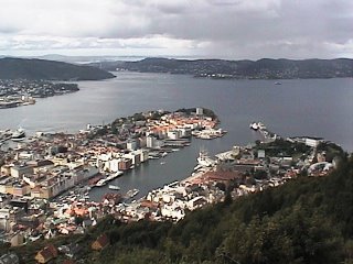 Norway and takes a deeper look at two nations with a long maritime history and deep respect for their coastal environment. JB
With the Artic Circle cutting straight across the Scandinavian countries of Norway and Sweden like the many glaciers that slice throughout their deep majestic fjords, these Nordic nations located in the far northern reaches of Europe are rich in coastal life and maritime communities. A long-standing relationship between the people of this region and the water that surrounds it have led to a healthy balance between development, access and conservation that supports the archipelago economically, socially and culturally.
Sweden's coastline is 7,600 km long (about 4000 miles) and it made up of hundreds-of-thousands of islands that are low-lying in nature. The biggest city and capital, Stockholm, has a population of about 1 million inhabitants and is located on a series of 30,000 islands that are connected by bridges and ferries. Many species and habitats are found along the Swedish coasts including rocky shorelines, sandy beaches and developed waterfronts. The Swedish people have long lived in close connection with the nearby Baltic Sea and its many tributaries that snake along the archipelago by living off the abundant fisheries of herring and salmon and crayfish that inhabit its waters.
The coast of Norway on the other hand consists of less low-lying islands and sandy beaches and more glacially influenced features such as fjords and rocky coastal outcroppings that are located adjacent to the powerful (and very cold) North Sea. Oslo, the nation's capital and largest city is located in the protected bays of of southeastern Norway and acts a major port for most of central Scandinavia. Meanwhile, Bergen the second largest city and maritime capital is located on the west coast with direct access to the North Sea. The entire region is home to fjords shaped by glaciers (the remnants of some which still exist today) and many small fishing communities up and down the coasts.
For Norway and Sweden the ocean and coasts are a significant part of daily living. The number of ferries located in the two countries number in the thousands as many communities and islands are connected only by boat. The cost of ferries in Scandinavia are incredibly low, and reflects the need (and support) for inexpensive water-based transportation. Swimming and fishing are a activity practiced by many inhabitants of the region and it is possible to fish and swim in the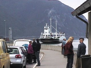 city center of Stockholm and almost the entire remainder of both coasts due to very good water quality. Greenroofs are common both in urban and rural settings and appear to contribute heavily to the health of the coastal waters due to decreased polluted runoff. Wind power is also widespread in both countries and appears to limit the need for powerplants on coastal waters.
However, all is not well in Scandinavia's coastal waters. Centuries of fishing and increasing populations have led to a serious decline in many aquatic populations. Eutrophication and toxic pollutants have had serious impacts on biodiveristy with more and more people moving into coastal areas. Eutrophication, or algae blooms due to nutrient inputs have depleted benthic fauna. In addition, increased boat usage with increasing population has led to shore erosion on many islands.
Luckily, some coordinated action has been taken to conserve and manage the region's coastal habitats and communities. Sweden, which is part of the European Union, has created a comprehensive Integrated Coastal Management Plan that focuses on the protection of its local habitats and species. In Stockholm, the County creates an annual report on its environmental objectives and their progress, one of which is "A Balanced Marine Environment." Norway, an independent nation, focuses most of their conservation at the country level. With the recent development of the oil and gas industry most management has focused on limiting the impacts of these industries. In addition, Norway has placed a major emphasis on protecting communities and historical coastal locations such as the Hanseatic Village in Bergen.
For more information:
Coastal Guide to Sweden
http://www.coastalguide.org/icm/baltic/index.html
State of the Norway Coastal Environment
http://www.environment.no/templates/themepage____2489.aspx
State of the North Sea
http://www.environment.no/templates/PageWithRightListing____2695.aspx
More Photos From Norway and Sweden
http://www.flickr.com/photos/92848001@N00/sets/72157594274909899/detail/
Google Map of Southern Norway and Sweden
http://maps.google.com/maps?f=q&hl=en&q=sweden&ie=UTF8&om=1&z=5&ll=59.778522,13.31543&spn=9.774292,36.166992
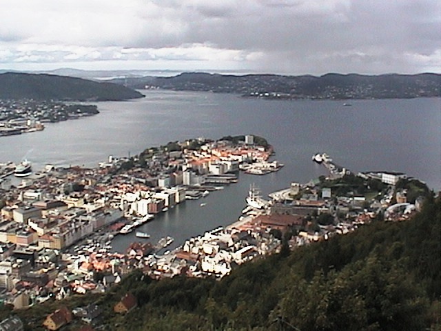 Norway and takes a deeper look at two nations with a long maritime history and deep respect for their coastal environment. JB
With the Artic Circle cutting straight across the Scandinavian countries of Norway and Sweden like the many glaciers that slice throughout their deep majestic fjords, these Nordic nations located in the far northern reaches of Europe are rich in coastal life and maritime communities. A long-standing relationship between the people of this region and the water that surrounds it have led to a healthy balance between development, access and conservation that supports the archipelago economically, socially and culturally.
Sweden's coastline is 7,600 km long (about 4000 miles) and it made up of hundreds-of-thousands of islands that are low-lying in nature. The biggest city and capital, Stockholm, has a population of about 1 million inhabitants and is located on a series of 30,000 islands that are connected by bridges and ferries. Many species and habitats are found along the Swedish coasts including
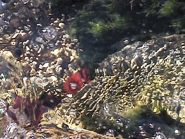 rocky shorelines, sandy beaches and developed waterfronts. The Swedish people have long lived in close connection with the nearby Baltic Sea and its many tributaries that snake along the archipelago by living off the abundant fisheries of herring and salmon and crayfish that inhabit its waters.
 The coast of Norway on the other hand consists of less low-lying islands and sandy beaches and more glacially influenced features such as fjords and rocky coastal outcroppings that are located adjacent to the powerful (and very cold) North Sea. Oslo, the nation's capital and largest city is located in the protected bays of of southeastern Norway and acts a major port for most of central Scandinavia. Meanwhile, Bergen the second largest city and maritime capital is located on the west coast with direct access to the North Sea. The entire region is home to fjords shaped by glaciers (the remnants of some which still exist today) and many small fishing communities up and down the coasts.
For Norway and Sweden the ocean and coasts are a significant part of daily living. The number of ferries located in the two countries number in the thousands as many communities and islands are connected only by boat. The cost of ferries in Scandinavia are incredibly low, and reflects the need (and support) for inexpensive water-based transportation. Swimming and fishing are a activity practiced by many inhabitants of the region and it is possible to fish and swim in the
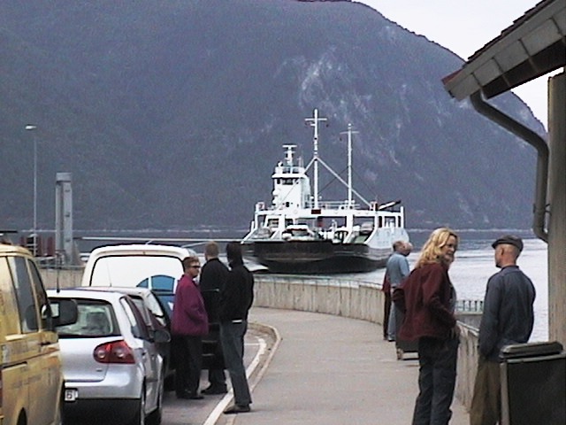 city center of Stockholm and almost the entire remainder of both coasts due to very good water quality. Greenroofs are common both in urban and rural settings and appear to contribute heavily to the health of the coastal waters due to decreased polluted runoff. Wind power is also widespread in both countries and appears to limit the need for powerplants on coastal waters.
 However, all is not well in Scandinavia's coastal waters. Centuries of fishing and increasing populations have led to a serious decline in many aquatic populations. Eutrophication and toxic pollutants have had serious impacts on biodiveristy with more and more people moving into coastal areas. Eutrophication, or algae blooms due to nutrient inputs have depleted benthic fauna. In addition, increased boat usage with increasing population has led to shore erosion on many islands.
Luckily, some coordinated action has been taken to conserve and manage the region's coastal habitats and communities. Sweden, which is part of the European Union, has created a comprehensive Integrated Coastal Management Plan that focuses on the protection of its local habitats and species. In Stockholm, the County creates an annual report on its environmental objectives and their progress, one of which is "A Balanced Marine Environment." Norway, an independent nation, focuses most of their conservation at the country level. With the recent development of the oil and gas industry most management has focused on limiting the impacts of these industries. In addition, Norway has placed a major emphasis on protecting communities and historical coastal locations such as the Hanseatic Village in Bergen.
For more information:
Coastal Guide to Sweden
http://www.coastalguide.org/icm/baltic/index.html
State of the Norway Coastal Environment
http://www.environment.no/templates/themepage____2489.aspx
State of the North Sea
http://www.environment.no/templates/PageWithRightListing____2695.aspx
More Photos From Norway and Sweden
http://www.flickr.com/photos/92848001@N00/sets/72157594274909899/detail/
Google Map of Southern Norway and Sweden
http://maps.google.com/maps?f=q&hl=en&q=sweden&ie=UTF8&om=1&z=5&ll=59.778522,13.31543&spn=9.774292,36.166992
Thursday, August 17, 2006
Moby Discusses the Importance of Coastal Conservation in Recent Interview
International recording artist and CMRC Benefit performer Moby recently spoke to the need for the increased conservation and restoration of our coastal resources in the New York - New Jersey Harbor Bight during an interview with the Artisan News Service. The interview, conducted at East River Park on the lower east side of Manhattan,  highlighted the pressing issues surrounding our natural coastlines and urban waterfronts.
JB
In Moby's own words:
"The issue of cleaning up our waterways is incredibly important."
He also added:
"People are now just rediscovering that New York is a coastal city. Manhattan is an island and one of the things that makes it so special is that it is surrounded by water."
To see the interview in its entirety please visit:
http://www.rootv.com/?channel=Music+News&clipid=81577
Additional Coverage of the Benefit
http://3rliving.blogspot.com/2006/07/late-post-pictures-from-cmrc.html
Photos
http://www.flickr.com/photos/72353731@N00/189544163/in/set-72157594199116395/
 highlighted the pressing issues surrounding our natural coastlines and urban waterfronts.
JB
In Moby's own words:
"The issue of cleaning up our waterways is incredibly important."
He also added:
"People are now just rediscovering that New York is a coastal city. Manhattan is an island and one of the things that makes it so special is that it is surrounded by water."
To see the interview in its entirety please visit:
http://www.rootv.com/?channel=Music+News&clipid=81577
Additional Coverage of the Benefit
http://3rliving.blogspot.com/2006/07/late-post-pictures-from-cmrc.html
Photos
http://www.flickr.com/photos/72353731@N00/189544163/in/set-72157594199116395/
Monday, August 14, 2006
In the News: Walking on the City’s Wild Side
For some, getting away from it all means a flight from JFK and a week at a remote beach in the tropics. For others, it simply means taking a ferry from Manhattan and hiking around Staten Island's shoreline for 6 days. Reporter Andy Newman of the NY Times recently did just that 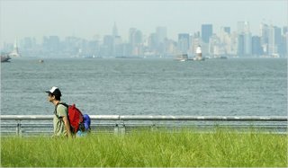 and explored the 57-mile coast of Staten Island, finding some amazing natural resources and equally interesting characters along the way. JB
August 13, 2006
By Andy Newman
There is a place in this city where teenagers go crabbing from the old railroad bridge, where people consider themselves residents of a town of half a dozen rather than of a metropolis of eight million, where the waterfront still harbors ancient secrets along with the inevitable clash of development interests.
It’s called Staten Island. It is the fastest growing county in New York State, yet it remains, in pockets, and in its peculiar way, the Alaska of New York City.
That is, a place where nature, however debased, still plays a role in daily life and where there is room to pursue a dream, whether that means amassing a mansion-full of musty antiques or a yard full of cars up on blocks patrolled by roosters, or building an artwork along a quarter mile of beachfront, or simply drinking a beer outside the corner store without having to hide it in a paper bag.
This Staten Island, somehow urban, rural and suburban at once, is hard to spot from the typical perspective of the nonislander taking a sight-seeing round-trip ferry from Manhattan or driving through to New Jersey and points west. But on a leisurely journey by foot, the island blossoms.
A recent six-day trek along the roads and trails and beaches that trace and skirt Staten Island’s 57-mile coastline turned up endless surprises, along with sufficient blackberries and sassafras leaves to sustain a hiker from one pizza place to the next.
Such a journey around Staten Island, the sixth-largest island in the continental United States, was not unprecedented. In 1679, two Dutch missionaries, Jasper Dankers and Peter Sluyter, rowed over from Brooklyn. They found the island aswarm with tasty wildlife — “well provided with wild turkeys, geese, snipe and woodhens” — but otherwise fairly inhospitable. After getting lost, they came upon an Englishwoman’s farmstead. They asked “for something to drink, and also for someone to show us the road, but she refused the last, although we were willing to pay for it,” they wrote. “She was a cross woman.”
Three hundred and twenty-seven years later, the same flinty pioneer spirit can still be found on the island. And while snipe and woodhens are not so common, there are still plenty of geese, and wild turkeys, too.
Read more:
http://www.nytimes.com/2006/08/13/nyregion/13staten.html
Google Map of Staten Island
http://maps.google.com/maps?f=q&hl=en&q=&ie=UTF8&ll=40.573805,-74.182434&spn=0.230005,0.462799&t=k&om=1
 and explored the 57-mile coast of Staten Island, finding some amazing natural resources and equally interesting characters along the way. JB
August 13, 2006
By Andy Newman
There is a place in this city where teenagers go crabbing from the old railroad bridge, where people consider themselves residents of a town of half a dozen rather than of a metropolis of eight million, where the waterfront still harbors ancient secrets along with the inevitable clash of development interests.
It’s called Staten Island. It is the fastest growing county in New York State, yet it remains, in pockets, and in its peculiar way, the Alaska of New York City.
That is, a place where nature, however debased, still plays a role in daily life and where there is room to pursue a dream, whether that means amassing a mansion-full of musty antiques or a yard full of cars up on blocks patrolled by roosters, or building an artwork along a quarter mile of beachfront, or simply drinking a beer outside the corner store without having to hide it in a paper bag.
This Staten Island, somehow urban, rural and suburban at once, is hard to spot from the typical perspective of the nonislander taking a sight-seeing round-trip ferry from Manhattan or driving through to New Jersey and points west. But on a leisurely journey by foot, the island blossoms.
A recent six-day trek along the roads and trails and beaches that trace and skirt Staten Island’s 57-mile coastline turned up endless surprises, along with sufficient blackberries and sassafras leaves to sustain a hiker from one pizza place to the next.
Such a journey around Staten Island, the sixth-largest island in the continental United States, was not unprecedented. In 1679, two Dutch missionaries, Jasper Dankers and Peter Sluyter, rowed over from Brooklyn. They found the island aswarm with tasty wildlife — “well provided with wild turkeys, geese, snipe and woodhens” — but otherwise fairly inhospitable. After getting lost, they came upon an Englishwoman’s farmstead. They asked “for something to drink, and also for someone to show us the road, but she refused the last, although we were willing to pay for it,” they wrote. “She was a cross woman.”
Three hundred and twenty-seven years later, the same flinty pioneer spirit can still be found on the island. And while snipe and woodhens are not so common, there are still plenty of geese, and wild turkeys, too.
Read more:
http://www.nytimes.com/2006/08/13/nyregion/13staten.html
Google Map of Staten Island
http://maps.google.com/maps?f=q&hl=en&q=&ie=UTF8&ll=40.573805,-74.182434&spn=0.230005,0.462799&t=k&om=1
Thursday, August 10, 2006
Business Stewardship Speaker Series Kicks-Off With Presentations From Credit Suisse, 1% For the Planet and NYC Audubon
BUSINESS STEWARDSHIP SPEAKER SERIES
MINUTES FOR JULY, 25th 2006
CORPORATIONS LEVERAGING RESOURCES FOR COASTAL CONSERVATION
Business Stewardship Panel
CMRC Executive Director Joel Banslaben welcomed all to the kick-off of the Business Stewardship Speaker Series at 8:30 AM on July 25th. The topic for the event, Corporations Leveraging Resources for Coastal Conservation was introduced. The seminar was hosted by the Hudson River Foundation at 17 Battery Place, Manhattan, NY.
Yigal Gelb – Program Director, NYC Audubon
Mr. Gelb discussed the Harbor Herons Monitoring partnership and how the collaboration between Fuji Film and NYC Audubon allowed the organization to overcome the challenge of determining nesting and feeding routes of several wading birds. The partnership provided NYC Audubon with airtime in the Fuji Film blimp to track four species while in flight.
Yigal provided background on the Harbor Herons project and the need for aerial monitoring. The Harbor Herons consist of several species including the Black Crown Night Heron, Great Egret, Snowy Egret and Glossy Ibis. NYC Audubon is trying to determine if birds from other areas are using different feeding grounds and are feeding sites equally important?
The results of the partnership provided Audubon with important information about nesting and feeding grounds. They found that four separate nesting/feeding systems exist in Pelham Bay Park, NJ Meadowlands, Jamaica Bay and Staten Island. Furthermore they found that feeding grounds are necessary and birds cannot use other wetlands.
Yigal also provided insight into how the partnership with Fuji Film came about. The idea came from an Audubon member and staff then followed up with a contact that could arrange conversation between the two organizations. NYC Audubon provided details of their monitoring plans and the need for the aerial resources and Fuji Film agreed to assist with the project.
Alison Johnson – Credit Suisse Foundation
Ms. Johnson described recent trends in corporate philanthropy and volunteerism. Credit Suisse is a large company with 5000 employees locally that provide human resources for volunteer projects in their local communities. Larger corporations are often looking to donate resources to an effort to enhance public image and provide workers with connection to their local community.
Alison discussed how Credit Suisse recently revisited its corporate philanthropy strategic plan. After evaluation, Credit Suisse decided to direct their corporate philanthropy toward community participation and volunteerism. Credit Suisse now only works with organizations that can provide volunteer opportunities for their employees and fit within the three tenets of Credit Suisse’s corporate giving strategy:
o Internal Culture Building - Focus on building relationships between employees and community giving where employees initiate the relationship with local organizations.
o Team Building - more money is given when teams of employees are involved, as opposed to old system of individual donation matching.
o Social Responsibility and Community Development - focus on local communities.
Credit Suisse also has a Mini Grant Program that provides “Dollars for Doers,” where the work of an employee is rewarded with a donation. Ms. Johnson also mentioned that Credit Suisse is looking into involvement with local environmental issues and suggested that organizations look into Business for Social Responsibility (BSR), Committee to Encourage Corporate Philanthropy (CECP), the Foundation Center, New York Regional Association of Grantmakers (NYRAG) and the Corporate Volunteer Network of NY (CVNY).
Terry Kellogg – Executive Director, One Percent for the Planet
Mr. Kellogg described One Percent’s effort to create partnerships for sustainable business and healthy ecosystems and discussed the trends in our society where individuals and companies that are outsiders to policy-making often effect the greatest change. One Percent is working to address how business can change their model from “how can we be the most sustainable company” to “how can we effect the greatest change while also protecting business interests.”
Terry provided some background on the organization which was started by Yvon Chouinard and Craig Matthews when they realized their companies were thriving because of their conservation focus. Member companies give one percent of their sales revenues to environmental organizations and enter into a license agreement to use logo and promote business stewardship. One Percent certifies member’s donations and maintains a database of approved recipients while assisting to maintain relationships between member organizations and businesses.
One Percent has grown from around 100 members to nearly 400 in the past year and includes companies from 36 states and 16 nations. Mr. Kellogg highlighted that each business provides one percent of gross revenues and that this is a very significant contribution for most companies. However, more often than not businesses are benefiting as a result due to consumers being increasingly aware of corporate practices before investing financially.
The meeting was adjourned at 10:00 AM. The next Business Stewardship Speaker Series event on Retail Business and Conservation Opportunities will take place in October 2006.
Read more about the Business Stewardship Initiative:
http://www.thecmrc.org/prog-hbp-bsp.asp
MINUTES FOR JULY, 25th 2006
CORPORATIONS LEVERAGING RESOURCES FOR COASTAL CONSERVATION
Business Stewardship Panel
CMRC Executive Director Joel Banslaben welcomed all to the kick-off of the Business Stewardship Speaker Series at 8:30 AM on July 25th. The topic for the event, Corporations Leveraging Resources for Coastal Conservation was introduced. The seminar was hosted by the Hudson River Foundation at 17 Battery Place, Manhattan, NY.
Yigal Gelb – Program Director, NYC Audubon
Mr. Gelb discussed the Harbor Herons Monitoring partnership and how the collaboration between Fuji Film and NYC Audubon allowed the organization to overcome the challenge of determining nesting and feeding routes of several wading birds. The partnership provided NYC Audubon with airtime in the Fuji Film blimp to track four species while in flight.
Yigal provided background on the Harbor Herons project and the need for aerial monitoring. The Harbor Herons consist of several species including the Black Crown Night Heron, Great Egret, Snowy Egret and Glossy Ibis. NYC Audubon is trying to determine if birds from other areas are using different feeding grounds and are feeding sites equally important?
The results of the partnership provided Audubon with important information about nesting and feeding grounds. They found that four separate nesting/feeding systems exist in Pelham Bay Park, NJ Meadowlands, Jamaica Bay and Staten Island. Furthermore they found that feeding grounds are necessary and birds cannot use other wetlands.
Yigal also provided insight into how the partnership with Fuji Film came about. The idea came from an Audubon member and staff then followed up with a contact that could arrange conversation between the two organizations. NYC Audubon provided details of their monitoring plans and the need for the aerial resources and Fuji Film agreed to assist with the project.
Alison Johnson – Credit Suisse Foundation
Ms. Johnson described recent trends in corporate philanthropy and volunteerism. Credit Suisse is a large company with 5000 employees locally that provide human resources for volunteer projects in their local communities. Larger corporations are often looking to donate resources to an effort to enhance public image and provide workers with connection to their local community.
Alison discussed how Credit Suisse recently revisited its corporate philanthropy strategic plan. After evaluation, Credit Suisse decided to direct their corporate philanthropy toward community participation and volunteerism. Credit Suisse now only works with organizations that can provide volunteer opportunities for their employees and fit within the three tenets of Credit Suisse’s corporate giving strategy:
o Internal Culture Building - Focus on building relationships between employees and community giving where employees initiate the relationship with local organizations.
o Team Building - more money is given when teams of employees are involved, as opposed to old system of individual donation matching.
o Social Responsibility and Community Development - focus on local communities.
Credit Suisse also has a Mini Grant Program that provides “Dollars for Doers,” where the work of an employee is rewarded with a donation. Ms. Johnson also mentioned that Credit Suisse is looking into involvement with local environmental issues and suggested that organizations look into Business for Social Responsibility (BSR), Committee to Encourage Corporate Philanthropy (CECP), the Foundation Center, New York Regional Association of Grantmakers (NYRAG) and the Corporate Volunteer Network of NY (CVNY).
Terry Kellogg – Executive Director, One Percent for the Planet
Mr. Kellogg described One Percent’s effort to create partnerships for sustainable business and healthy ecosystems and discussed the trends in our society where individuals and companies that are outsiders to policy-making often effect the greatest change. One Percent is working to address how business can change their model from “how can we be the most sustainable company” to “how can we effect the greatest change while also protecting business interests.”
Terry provided some background on the organization which was started by Yvon Chouinard and Craig Matthews when they realized their companies were thriving because of their conservation focus. Member companies give one percent of their sales revenues to environmental organizations and enter into a license agreement to use logo and promote business stewardship. One Percent certifies member’s donations and maintains a database of approved recipients while assisting to maintain relationships between member organizations and businesses.
One Percent has grown from around 100 members to nearly 400 in the past year and includes companies from 36 states and 16 nations. Mr. Kellogg highlighted that each business provides one percent of gross revenues and that this is a very significant contribution for most companies. However, more often than not businesses are benefiting as a result due to consumers being increasingly aware of corporate practices before investing financially.
The meeting was adjourned at 10:00 AM. The next Business Stewardship Speaker Series event on Retail Business and Conservation Opportunities will take place in October 2006.
Read more about the Business Stewardship Initiative:
http://www.thecmrc.org/prog-hbp-bsp.asp
Monday, August 07, 2006
In the News: Massive Manatee Is Spotted in Hudson River
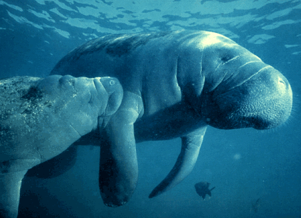
Sea life continues to thrive in the NY - NJ Harbor Estuary and with greater frequency large aquatic species are found within the waters of the inner Harbor and Hudson River. This past week a 1,000 pound manatee was observed swimming northward along the waterfront of Manhattan to the disbelief of many boaters and eyewitnesses. While the manatee does not frequently inhabit waters this far away from its tropical home, they  have been sited in Long Island and Rhode Island in the past states the NY Times. JB
August 7, 2006
By Jennifer Lee
Added to the chronicles of great beasts that have descended upon New York City in the year 2006 is one that is arguably the greatest of them all. A beast, upwards of 1,000 pounds and a cousin to the elephant, which dwarfs the coyote, the deer and the dolphin that preceded it. A beast that, at hundreds of miles north of its natural habitat, has most likely made the longest and most arduous journey among them. A beast, with a pudgy-nosed face and a sweet-potato-shaped body, that could even be considered cute: a manatee.
Over the past week, boaters and bloggers have been energetically tracking a manatee in its lumbering expedition along the Atlantic Coast and up the Hudson River.
John H. Vargo, the publisher of Boating on the Hudson magazine, put out an alert last week, much to the incredulity of some boaters.
“Some were laughing about it, because it couldn’t possibly be true,” Mr. Vargo said.
The manatee has been spotted at 23rd Street near Chelsea Piers, West 125th Street, and later in Westchester County. It appeared to be healthy.
Read more:
http://www.nytimes.com/2006/08/07/nyregion/07manatee.html
Manatee Facts
http://www.savethemanatee.org/manfcts.htm
 have been sited in Long Island and Rhode Island in the past states the NY Times. JB
August 7, 2006
By Jennifer Lee
Added to the chronicles of great beasts that have descended upon New York City in the year 2006 is one that is arguably the greatest of them all. A beast, upwards of 1,000 pounds and a cousin to the elephant, which dwarfs the coyote, the deer and the dolphin that preceded it. A beast that, at hundreds of miles north of its natural habitat, has most likely made the longest and most arduous journey among them. A beast, with a pudgy-nosed face and a sweet-potato-shaped body, that could even be considered cute: a manatee.
Over the past week, boaters and bloggers have been energetically tracking a manatee in its lumbering expedition along the Atlantic Coast and up the Hudson River.
John H. Vargo, the publisher of Boating on the Hudson magazine, put out an alert last week, much to the incredulity of some boaters.
“Some were laughing about it, because it couldn’t possibly be true,” Mr. Vargo said.
The manatee has been spotted at 23rd Street near Chelsea Piers, West 125th Street, and later in Westchester County. It appeared to be healthy.
Read more:
http://www.nytimes.com/2006/08/07/nyregion/07manatee.html
Manatee Facts
http://www.savethemanatee.org/manfcts.htm
Friday, August 04, 2006
In the News: New bill aims to keep ocean between N.Y. and Jersey clean
After decades of being literally "dumped" on, the NY-NJ Bight may be finally receiving the protection it rightly deserves. New legislation introduced by two members of Congress would create a Clean Ocean Zone for 19,000 square miles of valuable marine habitat located offshore of New Jersey and New York. The Act, fostered by the conservation organization Clean Ocean Action, would significantly limit future dumping  of waste materials into the coastal waters of our region and would also prevent the mining of non-renewable natural resources from the Bight. This would be a great step forward for our coasts and oceans writes the Star-Ledger. JB
Sunday, July 23, 2006
By Claire Heininger
Once notorious for washing syringes, poisoned fish, raw sewage and worse onto New Jersey's beaches, ocean water along the coastline has come a long way since its polluted height in the 1980s. A bill to be introduced in Congress tomorrow aims to keep it that way.
The New Jersey/New York Clean Ocean Zone Act would permanently ban construction of new dumpsites, extracting of national resources, building of new pipelines and other damaging measures within the NY/NJ Bight, a 19,000-square-mile area wedged between the coasts of New Jersey and New York.
Formerly home to eight ocean dumpsites, the Bight remains vulnerable despite decades of temporary clean-up regulations, said U.S. Rep. Frank Pallone, Jr. (D-6th Dist.), a co-sponsor of the bill.
"After 20, 30 years of success and having the oceans being clean, we don't want to backtrack," Pallone said yesterday at a ceremony in Seaside Park to announce the legislation. "If we're going to have permanent success, we need a permanent solution."
Recent policy shifts away from coastline protection -- particularly the House of Representatives' vote last month to lift a quarter century-old ban on offshore gas and oil drilling -- have increased the urgency to create a clean ocean zone, said Cindy Zipf, executive director of Clean Ocean Action.
Read more:
http://www.nj.com/search/index.ssf?/base/news-4/115362961174340.xml?starledger?nnj&coll=1
Clean Ocean Action Website
www.cleanoceanaction.org
Google Map of the NY-NJ Bight
http://maps.google.com/?ie=UTF8&ll=40.103286,-73.135986&spn=1.861243,3.702393&t=h&om=1
 of waste materials into the coastal waters of our region and would also prevent the mining of non-renewable natural resources from the Bight. This would be a great step forward for our coasts and oceans writes the Star-Ledger. JB
Sunday, July 23, 2006
By Claire Heininger
Once notorious for washing syringes, poisoned fish, raw sewage and worse onto New Jersey's beaches, ocean water along the coastline has come a long way since its polluted height in the 1980s. A bill to be introduced in Congress tomorrow aims to keep it that way.
The New Jersey/New York Clean Ocean Zone Act would permanently ban construction of new dumpsites, extracting of national resources, building of new pipelines and other damaging measures within the NY/NJ Bight, a 19,000-square-mile area wedged between the coasts of New Jersey and New York.
Formerly home to eight ocean dumpsites, the Bight remains vulnerable despite decades of temporary clean-up regulations, said U.S. Rep. Frank Pallone, Jr. (D-6th Dist.), a co-sponsor of the bill.
"After 20, 30 years of success and having the oceans being clean, we don't want to backtrack," Pallone said yesterday at a ceremony in Seaside Park to announce the legislation. "If we're going to have permanent success, we need a permanent solution."
Recent policy shifts away from coastline protection -- particularly the House of Representatives' vote last month to lift a quarter century-old ban on offshore gas and oil drilling -- have increased the urgency to create a clean ocean zone, said Cindy Zipf, executive director of Clean Ocean Action.
Read more:
http://www.nj.com/search/index.ssf?/base/news-4/115362961174340.xml?starledger?nnj&coll=1
Clean Ocean Action Website
www.cleanoceanaction.org
Google Map of the NY-NJ Bight
http://maps.google.com/?ie=UTF8&ll=40.103286,-73.135986&spn=1.861243,3.702393&t=h&om=1
Wednesday, August 02, 2006
In the News: Debate Rages on Housing at Planned Brooklyn Park
Brooklyn Bridge Park has the potential to be one of the greatest waterfront parks in the world someday. The only problem is that it has yet to be created. In 2002, the Port Authority and other local, State and Federal agencies agreed to develop an 85-acre park on old maritime piers located just south of the Brooklyn Bridge. However, with construction costs at $150 million and  maintenance at $15 million a year the plan included private development within the boundaries of the park in order to generate a revenue stream. Now government agencies, non-profits, developers and local residents are continuing to debate "When is a park not a park?" writes the NY Times. JB
By Sam Roberts
July 23, 2006
If 1,200 or so high-rise apartments, a hotel and other private buildings occupy about one-tenth of the land reserved for a park project, is it still a park?
The city and state are poised to transform a 1.3-mile stretch of derelict docks and warehouses in Brooklyn Heights into a ribbon of recreation. The 85-acre site, which offers breathtaking views of Manhattan, would include lawns, rolling hills, ball fields, bikeways, a marina, a restaurant, a hotel and, to the dismay of some neighborhood residents, three new luxury apartment towers ranging in height from 95 to 315 feet, along with parking.
The debate over the Brooklyn Bridge Park reprises controversies over the West Side of Manhattan and raises fundamental urban planning questions: When is a park not a park? And how far should government go in granting concessions to developers — in this case, allowing profitmaking housing on public land — to subsidize nonessential public services?
Both sides in the debate, which is also being played out in court, ascribe dark motives to their opponents.
Last week, the Sierra Club weighed in, declaring that “the park had been co-opted by the interests of real estate developers” and warning that “for the very first time, private housing, parking and what might also be a private marina” were being planned inside a park.
Supporters of the plan say that the critics would go to any lengths — even no park — to discourage people from driving into the neighborhood or traipsing through from subways and buses.
“The opposition is people who may have their views blocked, people who on principle oppose commercial development of any kind within the context of creation of a park, and people who may feel they agreed to the concept but now that they know what it is they oppose it,” said Adrian Benepe, the city’s parks commissioner. “Some of the opponents like the neighborhood the way it is and don’t want outsiders,” he continued.
As a park, the site presents challenges — it sits isolated below the Heights and much of it is cut off by the Brooklyn-Queens Expressway. Still, until recently, the project seemed a paradigm of cooperative, if prolonged, planning.
Read more:
http://www.nytimes.com/2006/07/23/nyregion/23bridge.html
Brooklyn Bridge Park Conservancy
http://www.brooklynbridgepark.org/
Brooklyn Bridge Development Corporation
http://www.empire.state.ny.us/BBPDC/
Google Map of Future Site of Brooklyn Bridge Park
http://maps.google.com/?ie=UTF8&ll=40.698568,-73.994508&spn=0.014414,0.028925&t=h&om=1
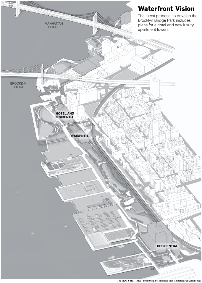 maintenance at $15 million a year the plan included private development within the boundaries of the park in order to generate a revenue stream. Now government agencies, non-profits, developers and local residents are continuing to debate "When is a park not a park?" writes the NY Times. JB
By Sam Roberts
July 23, 2006
If 1,200 or so high-rise apartments, a hotel and other private buildings occupy about one-tenth of the land reserved for a park project, is it still a park?
The city and state are poised to transform a 1.3-mile stretch of derelict docks and warehouses in Brooklyn Heights into a ribbon of recreation. The 85-acre site, which offers breathtaking views of Manhattan, would include lawns, rolling hills, ball fields, bikeways, a marina, a restaurant, a hotel and, to the dismay of some neighborhood residents, three new luxury apartment towers ranging in height from 95 to 315 feet, along with parking.
The debate over the Brooklyn Bridge Park reprises controversies over the West Side of Manhattan and raises fundamental urban planning questions: When is a park not a park? And how far should government go in granting concessions to developers — in this case, allowing profitmaking housing on public land — to subsidize nonessential public services?
Both sides in the debate, which is also being played out in court, ascribe dark motives to their opponents.
Last week, the Sierra Club weighed in, declaring that “the park had been co-opted by the interests of real estate developers” and warning that “for the very first time, private housing, parking and what might also be a private marina” were being planned inside a park.
Supporters of the plan say that the critics would go to any lengths — even no park — to discourage people from driving into the neighborhood or traipsing through from subways and buses.
“The opposition is people who may have their views blocked, people who on principle oppose commercial development of any kind within the context of creation of a park, and people who may feel they agreed to the concept but now that they know what it is they oppose it,” said Adrian Benepe, the city’s parks commissioner. “Some of the opponents like the neighborhood the way it is and don’t want outsiders,” he continued.
As a park, the site presents challenges — it sits isolated below the Heights and much of it is cut off by the Brooklyn-Queens Expressway. Still, until recently, the project seemed a paradigm of cooperative, if prolonged, planning.
Read more:
http://www.nytimes.com/2006/07/23/nyregion/23bridge.html
Brooklyn Bridge Park Conservancy
http://www.brooklynbridgepark.org/
Brooklyn Bridge Development Corporation
http://www.empire.state.ny.us/BBPDC/
Google Map of Future Site of Brooklyn Bridge Park
http://maps.google.com/?ie=UTF8&ll=40.698568,-73.994508&spn=0.014414,0.028925&t=h&om=1
Tuesday, August 01, 2006
In the News: Strong comeback for a local crop
Restoring the once-great shellfisheries of the Harbor Bight is no simple task, but with the assistance of local law-makers, scientists and conservation organizations some bivalves are on their way to returning to a healthy equilibrium in the Great South Bay and Peconic Estuary. For  decades, shellfishing was a way of life in many coastal communities. However, with excessive coastal development and overharvesting of the fishery, the stocks plummeted leaving many without jobs and an ecosystem without several key species. Now conservation plans are beginning to take root, but it will be many years until bivalves like the scallop return to abundance writes Newsday. JB
By T.W. Farnam
July 25, 2006
Long Island baymen caught 6,000 pounds of scallops last year, triple the haul of the previous year and more than for any year since 1997, according to the state Department of Environmental Conservation.
Last year's harvest was also particularly widespread, with some areas producing that haven't had scallops in decades.
"What's interesting and intriguing about this is that we're not just seeing scallops in one area," said Gordon Colvin, head of marine resources for the department. "It's exactly what you need -- you need to have as much of the available habitat range being occupied.
"Baymen found scallops in areas of the Great South Bay and Flanders Bay farther west than they have been since 1985, the year that a "brown tide" -- a fast-spreading algae bloom -- decimated the shellfish and much of the submerged eel grass that sheltered them, scientists said.
"Yeah, there were a few more scallops last year," said Kenny Clark, 46, of Shelter Island. He was able to catch scallops into the beginning of January last season. "We'll just see about next year," he said.
Colvin cautioned that the results of one year's scallop harvest do not mean a permanent resurgence, as the shellfish must re-create their entire population each year and scallop reproduction is dependent on a number of environmental factors.
Even with last year's big harvest, Long Island's bay scallops are a long way from their former bounty; last year's catch was less than 2 percent of the average for the two decades before the first brown tide, according to the department.
 Peconic Bay scallops were once the prize catch of East End baymen. From 1964 through 1985, baymen harvested an average 338,463 pounds of scallops annually, with a dockside value of $3.3 million, in 2005 dollars; last year, they caught 6,070 pounds, with a value of $153,258.
To bring back the scallops, regulators and scientists created two new spawning grounds in Orient Harbor and Northwest Harbor, in hopes that a dense spawning area -- with lots of scallops dropped in the water there -- will mean more successful mating and that large numbers of larvae will be able to outlast predators' attacks. He was able to catch scallops into the beginning of January last season. "We'll just see about next year," he said.
Read more:
http://www.newsday.com/news/local/longisland/ny-liscal0725,0,7093010.story?coll=ny-longisland-homepage
Additional Coverage: Health of bays gets iffy grade
http://www.newsday.com/news/local/longisland/ny-libay254828551jul25,0,1904139.story?coll=ny-longisland-homepage
Peconic Estuary Program
http://www.peconicestuary.org/
South Shore Estuary Program
http://www.estuary.cog.ny.us/
Google Map of Great South Bay and Peconic Estuary
http://maps.google.com/?ie=UTF8&om=1&ll=40.819006,-72.832489&spn=0.460396,0.925598
 decades, shellfishing was a way of life in many coastal communities. However, with excessive coastal development and overharvesting of the fishery, the stocks plummeted leaving many without jobs and an ecosystem without several key species. Now conservation plans are beginning to take root, but it will be many years until bivalves like the scallop return to abundance writes Newsday. JB
By T.W. Farnam
July 25, 2006
Long Island baymen caught 6,000 pounds of scallops last year, triple the haul of the previous year and more than for any year since 1997, according to the state Department of Environmental Conservation.
Last year's harvest was also particularly widespread, with some areas producing that haven't had scallops in decades.
"What's interesting and intriguing about this is that we're not just seeing scallops in one area," said Gordon Colvin, head of marine resources for the department. "It's exactly what you need -- you need to have as much of the available habitat range being occupied.
"Baymen found scallops in areas of the Great South Bay and Flanders Bay farther west than they have been since 1985, the year that a "brown tide" -- a fast-spreading algae bloom -- decimated the shellfish and much of the submerged eel grass that sheltered them, scientists said.
"Yeah, there were a few more scallops last year," said Kenny Clark, 46, of Shelter Island. He was able to catch scallops into the beginning of January last season. "We'll just see about next year," he said.
Colvin cautioned that the results of one year's scallop harvest do not mean a permanent resurgence, as the shellfish must re-create their entire population each year and scallop reproduction is dependent on a number of environmental factors.
Even with last year's big harvest, Long Island's bay scallops are a long way from their former bounty; last year's catch was less than 2 percent of the average for the two decades before the first brown tide, according to the department.
 Peconic Bay scallops were once the prize catch of East End baymen. From 1964 through 1985, baymen harvested an average 338,463 pounds of scallops annually, with a dockside value of $3.3 million, in 2005 dollars; last year, they caught 6,070 pounds, with a value of $153,258.
To bring back the scallops, regulators and scientists created two new spawning grounds in Orient Harbor and Northwest Harbor, in hopes that a dense spawning area -- with lots of scallops dropped in the water there -- will mean more successful mating and that large numbers of larvae will be able to outlast predators' attacks. He was able to catch scallops into the beginning of January last season. "We'll just see about next year," he said.
Read more:
http://www.newsday.com/news/local/longisland/ny-liscal0725,0,7093010.story?coll=ny-longisland-homepage
Additional Coverage: Health of bays gets iffy grade
http://www.newsday.com/news/local/longisland/ny-libay254828551jul25,0,1904139.story?coll=ny-longisland-homepage
Peconic Estuary Program
http://www.peconicestuary.org/
South Shore Estuary Program
http://www.estuary.cog.ny.us/
Google Map of Great South Bay and Peconic Estuary
http://maps.google.com/?ie=UTF8&om=1&ll=40.819006,-72.832489&spn=0.460396,0.925598
Tuesday, July 18, 2006
Business Stewardship Speaker Series: Tuesday, July 25!
BUSINESS STEWARDSHIP SPEAKER SERIES KICK-OFF
TUESDAY, JULY 25th
The CMRC will kick-off its Business Stewardship Speaker Series on Tuesday, July 25th from 8:30 AM – 10:00 AM at the Hudson River Foundation. The Speaker Series will showcase the experiences of businesses and conservation organizations working together to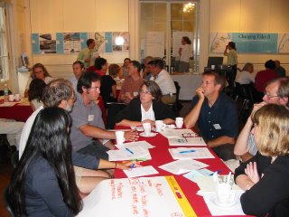 implement conservation initiatives in the NY – NJ Harbor Bight. The topic of the first panel event will be: Business Stewardship in the Harbor Estuary: Corporations Leveraging Resources for Coastal Conservation.
The event will include presentations by:
Zipcar – Profitable Business Model that Increases Environmental Quality
NYC Audubon – Fuji Film Harbor Herons Monitoring Project
And more experiences from businesses and conservation organizations!
A 45-minute panel session will be followed by a Q&A with coffee and a light breakfast provided by the CMRC and Hudson River Foundation.
What: Business Stewardship Speaker Series
Where: Hudson River Foundation, lower Manhattan (http://www.hudsonriver.org/)
Date: Tuesday, July 25th
Time: 8:30 AM – 10:00 AM
Space is limited! RSVP to business.stewardship@thecmrc.org to reserve your seat now!!!
For more information on the Business Stewardship Initiative: http://www.thecmrc.org/prog-hbp-bsp.asp
BUSINESS STEWARDSHIP WORKGROUP MEETING MINUTES MAY 18th, 2006
Workgroup Members in Attendance:
Mark Caserta - 3R Living
Porter-Ann Gaines - Metropolitan Waterfront Alliance
Alison Johnson - Credit Suisse
Blake Nicolazzo - Patagonia
Joel Banslaben - Coastal Marine Resource Center
Business Stewardship Initiative
The Business Stewardship Workgroup convened its kick-off meeting on Thursday, May 18, 2006 from 11:00 AM – 1:00 PM at the offices of the Metropolitan Waterfront Alliance (457 Madison Avenue). An agenda and powerpoint overview of the Business Stewardship Initiative were provided to the attendees by Joel Banslaben.
Attendees discussed the success and challenges of the Business Stewardship Workgroup held on February 16th at the Hudson River Foundation. Most thought it was an excellent first step toward creating a dialog on business stewardship in the Harbor Estuary but all acknowledged that the final session on creating the program was less productive than initially envisioned. One of the major successes noted by attendees was the sharing of stewardship experiences between businesses, environmental organizations and government agencies during the various panel discussions.
Alison Johnson (Credit Suisse) presented briefly on the state of philanthropy in corporations in the region. She stated that many of the investment banks were leaning away from simply providing financial contributions and were instead promoting active involvement by employees in different volunteer projects. Some of the larger corporations have developed programs that provide employees with a paid day off work to participate in community service projects.
Blake Nicolazzo (Patagonia) added that at the retail level many companies were actively supporting on-the-ground environmental initiatives with relatively small grants for action-oriented projects. In addition, some retailers are providing their staff with the opportunity to participate in volunteer projects with compensation. Patagonia also provides meeting space for non-profit organizations at its retail locations
Workgroup Objectives and Timeline
Attendees then discussed the development of a Business Stewardship Program for the New York – New Jersey Harbor Estuary and surrounding Bight that leverages financial, operational and human resources for coastal conservation efforts. Major conclusions included focusing on specific coastal issues (habitat, species) and geographic interests (ecosystems, business districts). In addition, a targeted business sector approach was discussed and the following were identified as of interest: corporations, retail, waterfront dependent, real estate development, and restaurants.
The role of the workgroup was then discussed and it was agreed that the workgroup would meet periodically with a goal of defining a Business Stewardship Program by early 2007. The program would include four major activities that include the Business Stewardship Speaker Series, a Business Stewardship Volunteer Network, a “Stewards of the Estuary” recognition program and a business stewardship resource guide. Each workgroup member offered to participate in one or more of the above activities.
Developing the Program
The workgroup decided that the Business Stewardship Speaker Series was the first task to focus on to build on the momentum of the Workshop earlier in the year. Blake Nicolazzo, Emily Farnworth (Environmental Resources Management) and Tony MacDonald (Monmouth University) will all be assisting with the development of the series. Participants suggested that the next event take place in mid July and focus on corporations in the Harbor Estuary. To gather as many attendees as possible a time of 8:30 – 10:00 AM was agreed upon. The session will include presentations of three panel speakers and will be followed by a Q&A afterwards. Future speaker series events were tentatively scheduled for September, November and January and will focus on retail, waterfront dependent, real estate development, and restaurants sectors.
The Business Stewardship Volunteer Network was the next item of discussion. Alison Johnson and Joel Banslaben agreed to work on the development of this component of the Program. The major items of discussion were on how to bring together the resources of the business community with conservation opportunities in the region. Different regions (Gowanus, Hackensack, South Bronx, Queens, Jamaica Bay, Long Island, NJ) were identified as focus areas as were specific habitat/species areas (Harbor Herons, oysters, marshlands). Next steps will be determining how to identify specific businesses and conservation opportunities.
The “Stewards of the Estuary” Recognition Program was discussed briefly and all thought that it was important to provide good press and visibility to make the program work. A goal was set to kick-off the program in early 2007 with first business “Stewards of the Estuary” being identified in fall 2007.
The final activity discussed was the development of the Harbor Estuary Business Stewardship Guide that would be disseminated to local businesses with information about the Harbor Estuary and basic next steps for information about becoming a steward. Mark Caserta (3R Living) and Emily Farnworth will be working to outline the next steps for this effort. Most agreed that it would be best to target the outputs toward specific audiences (i.e. real estate developers, restaurants) and provide the information in a succinct and easy to read format.
The meeting was adjourned at 1:15 PM and attendees agreed to meet next in early July.
TUESDAY, JULY 25th
The CMRC will kick-off its Business Stewardship Speaker Series on Tuesday, July 25th from 8:30 AM – 10:00 AM at the Hudson River Foundation. The Speaker Series will showcase the experiences of businesses and conservation organizations working together to
 implement conservation initiatives in the NY – NJ Harbor Bight. The topic of the first panel event will be: Business Stewardship in the Harbor Estuary: Corporations Leveraging Resources for Coastal Conservation.
The event will include presentations by:
Zipcar – Profitable Business Model that Increases Environmental Quality
NYC Audubon – Fuji Film Harbor Herons Monitoring Project
And more experiences from businesses and conservation organizations!
A 45-minute panel session will be followed by a Q&A with coffee and a light breakfast provided by the CMRC and Hudson River Foundation.
What: Business Stewardship Speaker Series
Where: Hudson River Foundation, lower Manhattan (http://www.hudsonriver.org/)
Date: Tuesday, July 25th
Time: 8:30 AM – 10:00 AM
Space is limited! RSVP to business.stewardship@thecmrc.org to reserve your seat now!!!
For more information on the Business Stewardship Initiative: http://www.thecmrc.org/prog-hbp-bsp.asp
BUSINESS STEWARDSHIP WORKGROUP MEETING MINUTES MAY 18th, 2006
Workgroup Members in Attendance:
Mark Caserta - 3R Living
Porter-Ann Gaines - Metropolitan Waterfront Alliance
Alison Johnson - Credit Suisse
Blake Nicolazzo - Patagonia
Joel Banslaben - Coastal Marine Resource Center
Business Stewardship Initiative
The Business Stewardship Workgroup convened its kick-off meeting on Thursday, May 18, 2006 from 11:00 AM – 1:00 PM at the offices of the Metropolitan Waterfront Alliance (457 Madison Avenue). An agenda and powerpoint overview of the Business Stewardship Initiative were provided to the attendees by Joel Banslaben.
Attendees discussed the success and challenges of the Business Stewardship Workgroup held on February 16th at the Hudson River Foundation. Most thought it was an excellent first step toward creating a dialog on business stewardship in the Harbor Estuary but all acknowledged that the final session on creating the program was less productive than initially envisioned. One of the major successes noted by attendees was the sharing of stewardship experiences between businesses, environmental organizations and government agencies during the various panel discussions.
Alison Johnson (Credit Suisse) presented briefly on the state of philanthropy in corporations in the region. She stated that many of the investment banks were leaning away from simply providing financial contributions and were instead promoting active involvement by employees in different volunteer projects. Some of the larger corporations have developed programs that provide employees with a paid day off work to participate in community service projects.
Blake Nicolazzo (Patagonia) added that at the retail level many companies were actively supporting on-the-ground environmental initiatives with relatively small grants for action-oriented projects. In addition, some retailers are providing their staff with the opportunity to participate in volunteer projects with compensation. Patagonia also provides meeting space for non-profit organizations at its retail locations
Workgroup Objectives and Timeline
Attendees then discussed the development of a Business Stewardship Program for the New York – New Jersey Harbor Estuary and surrounding Bight that leverages financial, operational and human resources for coastal conservation efforts. Major conclusions included focusing on specific coastal issues (habitat, species) and geographic interests (ecosystems, business districts). In addition, a targeted business sector approach was discussed and the following were identified as of interest: corporations, retail, waterfront dependent, real estate development, and restaurants.
The role of the workgroup was then discussed and it was agreed that the workgroup would meet periodically with a goal of defining a Business Stewardship Program by early 2007. The program would include four major activities that include the Business Stewardship Speaker Series, a Business Stewardship Volunteer Network, a “Stewards of the Estuary” recognition program and a business stewardship resource guide. Each workgroup member offered to participate in one or more of the above activities.
Developing the Program
The workgroup decided that the Business Stewardship Speaker Series was the first task to focus on to build on the momentum of the Workshop earlier in the year. Blake Nicolazzo, Emily Farnworth (Environmental Resources Management) and Tony MacDonald (Monmouth University) will all be assisting with the development of the series. Participants suggested that the next event take place in mid July and focus on corporations in the Harbor Estuary. To gather as many attendees as possible a time of 8:30 – 10:00 AM was agreed upon. The session will include presentations of three panel speakers and will be followed by a Q&A afterwards. Future speaker series events were tentatively scheduled for September, November and January and will focus on retail, waterfront dependent, real estate development, and restaurants sectors.
The Business Stewardship Volunteer Network was the next item of discussion. Alison Johnson and Joel Banslaben agreed to work on the development of this component of the Program. The major items of discussion were on how to bring together the resources of the business community with conservation opportunities in the region. Different regions (Gowanus, Hackensack, South Bronx, Queens, Jamaica Bay, Long Island, NJ) were identified as focus areas as were specific habitat/species areas (Harbor Herons, oysters, marshlands). Next steps will be determining how to identify specific businesses and conservation opportunities.
The “Stewards of the Estuary” Recognition Program was discussed briefly and all thought that it was important to provide good press and visibility to make the program work. A goal was set to kick-off the program in early 2007 with first business “Stewards of the Estuary” being identified in fall 2007.
The final activity discussed was the development of the Harbor Estuary Business Stewardship Guide that would be disseminated to local businesses with information about the Harbor Estuary and basic next steps for information about becoming a steward. Mark Caserta (3R Living) and Emily Farnworth will be working to outline the next steps for this effort. Most agreed that it would be best to target the outputs toward specific audiences (i.e. real estate developers, restaurants) and provide the information in a succinct and easy to read format.
The meeting was adjourned at 1:15 PM and attendees agreed to meet next in early July.
In the News: Monkfish captains may face $100G losses
As part of the CMRC's Sustainable Coasts Program, we work to create solutions to the environmental and economic challenges of coastal communities. Sometimes the decisions that are made to conserve aquatic natural resources can have a significant financial impact on those  who make a living off the ocean. For the monkfishery, declining numbers of the species led to a limit on the number of days that commerical fisherman could be at sea to 12 days a year. The consequent economic impacts to the fishing community could be in the millions of dollars writes the Asbury Park Press. JB
Asbury Park Press
By Kirk Moore
The latest fishing crisis in New England has spilled into New Jersey waters, where monkfish captains are seeing their permitted work days at sea slashed to just 12 a year.
In a business predicated on 40 days at sea, that means individual boat owners will each lose about $100,000 in revenue this year, estimates Barnegat Light monkfish captain Eric Svelling.
"With about 20 monkfish boats in town, those are small businesses that are going to lose $2 million," Svelling said. That's a big hit in the small fishing community of 800 people at the northern tip of Long Beach Island.
Last week, the Borough Council drew up a resolution urging federal officials and New Jersey's congressional delegation to intervene in the monkfish action. The reduction in fishing time, called days at sea, comes amid draconian cutbacks across the board in New England's cod and related fisheries.
Read more:
http://www.app.com/apps/pbcs.dll/article?AID=2006606280401
who make a living off the ocean. For the monkfishery, declining numbers of the species led to a limit on the number of days that commerical fisherman could be at sea to 12 days a year. The consequent economic impacts to the fishing community could be in the millions of dollars writes the Asbury Park Press. JB Asbury Park Press
By Kirk Moore
The latest fishing crisis in New England has spilled into New Jersey waters, where monkfish captains are seeing their permitted work days at sea slashed to just 12 a year.
In a business predicated on 40 days at sea, that means individual boat owners will each lose about $100,000 in revenue this year, estimates Barnegat Light monkfish captain Eric Svelling.
"With about 20 monkfish boats in town, those are small businesses that are going to lose $2 million," Svelling said. That's a big hit in the small fishing community of 800 people at the northern tip of Long Beach Island.
Last week, the Borough Council drew up a resolution urging federal officials and New Jersey's congressional delegation to intervene in the monkfish action. The reduction in fishing time, called days at sea, comes amid draconian cutbacks across the board in New England's cod and related fisheries.
Read more:
http://www.app.com/apps/pbcs.dll/article?AID=2006606280401
Monday, July 17, 2006
CMRC Benefit Raises Awareness for Coastal Conservation and Stewardship
The CMRC Benefit at East River Park on Thursday, July 13th was a huge success! Thank you for your support!!! Congratulations to our "Stewards of the Estuary" Lillian Borrone and Vice 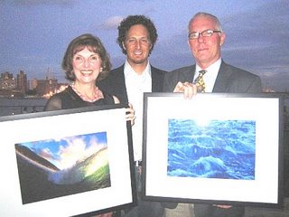 Admiral Paul Gaffney (Represented by Urban Coast Institute Director Tony MacDonald).
A Special thanks to our CMRC Benefit Host Moby and Performers Laura Dawn and Daron Murphy!
The CMRC also greatly appreciates the support of our 2006 Benefit Sponsors: Patagonia, Nautica, Brooklyn Beer, Outside Magazine, 3R Living, Leblon Rum, Zipcar, Grant Myrdal Photography, Pure Food and Wine, Jurlique Soho, Rough Guides, Interrupcion, One Lucky Duck Foods and Aveda.
Many thanks to our dedicated volunteers and the event planning firm, Penta Dynamic Solutions. The event raised an amazing amount of awareness for the conservation and restoration issues of the NY - NJ Harbor Bight. The CMRC is dedicated to bringing together the resources necessary for the conservation of our estuaries, oceans, waterfronts and communities for decades to come! JB
More Pictures can be found at:
http://www.kodakgallery.com/I.jsp?c=8cuy4adr.46tjv7j3&x=0&y=-ugpnso


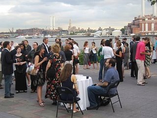

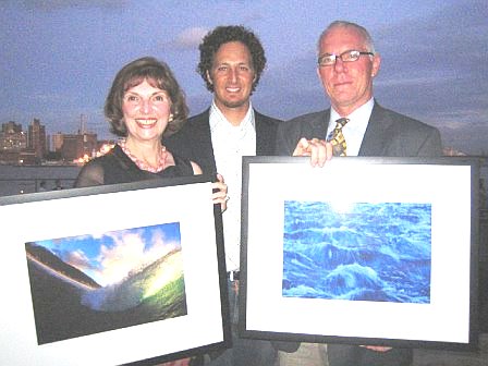 Admiral Paul Gaffney (Represented by Urban Coast Institute Director Tony MacDonald).
A Special thanks to our CMRC Benefit Host Moby and Performers Laura Dawn and Daron Murphy!
The CMRC also greatly appreciates the support of our 2006 Benefit Sponsors: Patagonia, Nautica, Brooklyn Beer, Outside Magazine, 3R Living, Leblon Rum, Zipcar, Grant Myrdal Photography, Pure Food and Wine, Jurlique Soho, Rough Guides, Interrupcion, One Lucky Duck Foods and Aveda.
Many thanks to our dedicated volunteers and the event planning firm, Penta Dynamic Solutions. The event raised an amazing amount of awareness for the conservation and restoration issues of the NY - NJ Harbor Bight. The CMRC is dedicated to bringing together the resources necessary for the conservation of our estuaries, oceans, waterfronts and communities for decades to come! JB
More Pictures can be found at:
http://www.kodakgallery.com/I.jsp?c=8cuy4adr.46tjv7j3&x=0&y=-ugpnso
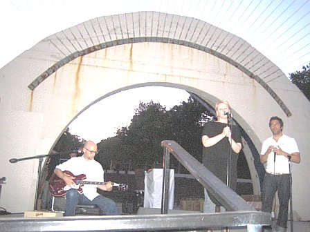

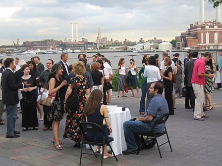
Tuesday, July 11, 2006
CMRC Benefit With Moby This Thursday July 13th at East River Park!!!
 The CMRC and Moby are looking forward to a great celebration of our coasts and oceans this Thursday at East River Park honoring “Stewards of the Estuary” Lillian Borrone and Vice Admiral Paul Gaffney!
If you are haven’t already click here to purchase your tickets today and join in the festivities!!!
Each attendee will receive an awesome gift bag with gear from Patagonia, clothing from Nautica and cool stuff from 3R Living, Outside Magazine, Grant Myrdal Photography, Jurlique, Pure Foods and many, many more!
Directions for the event are below. Feel free to contact us at 646-515-9290 or info@thecmrc.org with questions. JB
The CMRC & Moby cordially invite you…
Click here to purchase tickets
CMRC BENEFIT
July 13th East River Park Amphitheater
HOSTED BY MOBY
6:30-9:30PM
The Coastal Marine Resource Center invites you
to a waterfront celebration!
With Stewards of the Estuary
Lillian Borrone & Admiral Paul Gaffney
Cocktails. Dancing. Hors D’oeuvres.
Live acoustic performance by Moby.
Advance tickets are $100/$125 @ the door
 CMRC Benefit Sponsors: Patagonia, Nautica, Outside Magazine, 3R Living, Grant Myrdal Photography, Leblon Rum
Gift Bags from our Sponsors are limited to first 100 tickets!
Click here to purchase tickets
CMRC Benefit Hosting Committee: Robert Bailey, Morgan Rae Berk, Rachel Cardone, Tony MacDonald, Blake Nicolazzo, Dorothy Rosciszewski, Christine Santora
www.theCMRC.org
Click here for HOPSTOP.COM directions
Click here to purchase tickets
Friday, July 07, 2006
In the News: Rebuilding Jamaica Bay, One Load of Sand at a Time
Due to a combination of factors including rising ocean levels, increased boat wakes and navigational dredging our marshes and wetlands are disappearing. In Jamaica Bay, which has historically contained some of the largest salt marshes in the NY - NJ Harbor Bight, the rate of habitat loss has been unprecedented with acres  of valuable shoreline being lost every year. Fortunately, a collaboration between local environmental groups, elected officials and government agencies has led to a restoration project that will rebuild some of the salt marshes in Jamaica Bay writes the NY Times. JB
By Nicholas Confessore
July 7, 2006
Over the past few decades, for reasons nobody fully understands, the salt marshes of Jamaica Bay have been washing away. The grasses that anchor the bay's island archipelago have slowly withered, leaving the sand to drift off with the tides, the disintegration accelerating as time went on until nearly 50 acres of marsh disappeared with each passing year.
"It was a war of attrition," said Dan Mundy, the founder of the environmental group Jamaica Bay Ecowatchers, as he stood yesterday on Elders Point Island, a marsh island that has shrunk to a fraction of its original size. "Every day, we're losing thousands of square feet."
But during the last month, work began on an ambitious $13 million campaign to rebuild the salt marshes, which would otherwise disappear over the next 15 years if the current rate of attrition were to continue. It is the first major reclamation effort targeted at Jamaica Bay — a 12,000-acre estuary where numerous clam, crab, fish and bird species can be found — and one of the largest environmental projects in the city's history.
"We have to make sure the marshlands and the ecosystem they support are around for future generations," Representative Anthony D. Weiner, a Democrat whose Congressional district includes many neighborhoods in Brooklyn and Queens that ring the bay, said at a news conference and marsh tour yesterday that commemorated the early stages of the reclamation.
Mr. Weiner led efforts to gain financing for the project, a combined effort by the Army Corps of Engineers, the New York State Department of Environmental Conservation, the National Park Service and the Port Authority of New York and New Jersey.
Read more:
http://www.nytimes.com/2006/07/07/nyregion/07bay.html
Google Map of Jamaica Bay:
http://maps.google.com/?ie=UTF8&ll=40.605351,-73.837051&spn=0.115209,0.2314&t=h&om=1
Jamaica Bay Wikipedia Page:
http://en.wikipedia.org/wiki/Jamaica_Bay
 of valuable shoreline being lost every year. Fortunately, a collaboration between local environmental groups, elected officials and government agencies has led to a restoration project that will rebuild some of the salt marshes in Jamaica Bay writes the NY Times. JB
By Nicholas Confessore
July 7, 2006
Over the past few decades, for reasons nobody fully understands, the salt marshes of Jamaica Bay have been washing away. The grasses that anchor the bay's island archipelago have slowly withered, leaving the sand to drift off with the tides, the disintegration accelerating as time went on until nearly 50 acres of marsh disappeared with each passing year.
"It was a war of attrition," said Dan Mundy, the founder of the environmental group Jamaica Bay Ecowatchers, as he stood yesterday on Elders Point Island, a marsh island that has shrunk to a fraction of its original size. "Every day, we're losing thousands of square feet."
But during the last month, work began on an ambitious $13 million campaign to rebuild the salt marshes, which would otherwise disappear over the next 15 years if the current rate of attrition were to continue. It is the first major reclamation effort targeted at Jamaica Bay — a 12,000-acre estuary where numerous clam, crab, fish and bird species can be found — and one of the largest environmental projects in the city's history.
"We have to make sure the marshlands and the ecosystem they support are around for future generations," Representative Anthony D. Weiner, a Democrat whose Congressional district includes many neighborhoods in Brooklyn and Queens that ring the bay, said at a news conference and marsh tour yesterday that commemorated the early stages of the reclamation.
Mr. Weiner led efforts to gain financing for the project, a combined effort by the Army Corps of Engineers, the New York State Department of Environmental Conservation, the National Park Service and the Port Authority of New York and New Jersey.
Read more:
http://www.nytimes.com/2006/07/07/nyregion/07bay.html
Google Map of Jamaica Bay:
http://maps.google.com/?ie=UTF8&ll=40.605351,-73.837051&spn=0.115209,0.2314&t=h&om=1
Jamaica Bay Wikipedia Page:
http://en.wikipedia.org/wiki/Jamaica_Bay
Subscribe to:
Posts (Atom)