Balancing the needs of aquatic species with the financial concerns of fishermen in New Jersey, the State recently suspended the harvesting of horseshoe crabs and provided $168,000 in aid to local fishing businesses. The move alleviates the environmental pressures being placed on crab and should provide more time for the species to reproduce while also enhancing the overall ecosystem by providing food for migratory shorebirds who feed on horseshoe crab eggs. Fisherman weren't completely happy with the outcome however, countering that the species was healthy and could sustain continued commercial harvesting states this recent article by the Asbury Park Press. JB
Posted by the Asbury Park Press on 03/31/06
BY KIRK MOORE
TOMS RIVER BUREAU
GALLOWAY - New Jersey's last 34 licensed horseshoe crab harvesters could get $168,000 in financial aid over two years while the state enforces a moratorium on taking the crabs for commercial fishing bait, state environmental Commissioner Lisa Jackson and environmental activists said Thursday.
Faced with the Corzine administration's apparent determination to shut down the horseshoe crab business for two years — to maximize the crab eggs available to feed migrating shorebirds — the state Marine Fisheries Council last night voted to go along.
To oppose the Department of Environmental Protection could have led to legislative action to shut down crab harvests, said council Chairman Gilbert Ewing Jr., who voted with the majority against a move to reject the moratorium.
Read more...
http://www.app.com/apps/pbcs.dll/article?AID=/20060331/NEWS03/603310381/1007
Friday, March 31, 2006


In the News: Swimmers From the North Delight Scientists and Sightseers
Efforts to clean up the often neglected NY - NJ Harbor Estuary have increasingly shown benefits for people and wildlife alike. Over the past five years, one particularly noticeable marine mammal, the harbor seal, has visited the region with more and more regularity. Recently, several seals were spotted off Hoffman and Swinburne Islands in the lower New York Harbor/Bay. The question that many scientists continue to ask though is, "are the harbor seals visiting with more frequency because of improved water and habitat quality and, if so, what pollutants are they being exposed to when visiting the highly urbanized waters of our estuary?" The results of studies looking into those questions will take some time to come to light, but in the meanwhile scientists and local residents are enjoying the presence of this charismatic species in our waters writes the NY Times. JB
By Andy Newman
Published: March 25, 2006
The inhabitants of Hoffman and Swinburne Islands, man-made piles in Lower New York Bay off Staten Island, have tended to be there not because they particularly want to be, but because they have to.
In the 19th century, the islands were a holding area for new immigrants feared to be carrying diseases. Later, they housed soldiers with venereal disease, quarantined parrots and, until the 1940's, merchant marines in training.
 But yesterday the 20 plump bathers lazing on rocks in front of ruined hospital buildings and paddling the flat waters off Swinburne had come of their own free will, and they seemed to be having a fine time. And for the scientists and students on a nearby boat, this was a very good thing.
The bathers were harbor seals, bewhiskered 250-pound ambassadors from the icy north, and they appeared as oblivious to the traffic whizzing by on the Verrazano Narrows Bridge two miles away as the drivers above were to them.
A few seals were first noticed on the islands in 2001, after decades of absence from New York Harbor. But as the seal population along the Atlantic coast has continued to recover and their wintering range has extended southward, the seasonal seals of Swinburne have returned and flourished.
Read more...
http://www.nytimes.com/2006/03/25/nyregion/25seals.html
CRESLI harbor seal page
http://www.cresli.org/cresli/seals/hbrseals.html
By Andy Newman
Published: March 25, 2006
The inhabitants of Hoffman and Swinburne Islands, man-made piles in Lower New York Bay off Staten Island, have tended to be there not because they particularly want to be, but because they have to.
In the 19th century, the islands were a holding area for new immigrants feared to be carrying diseases. Later, they housed soldiers with venereal disease, quarantined parrots and, until the 1940's, merchant marines in training.
 But yesterday the 20 plump bathers lazing on rocks in front of ruined hospital buildings and paddling the flat waters off Swinburne had come of their own free will, and they seemed to be having a fine time. And for the scientists and students on a nearby boat, this was a very good thing.
The bathers were harbor seals, bewhiskered 250-pound ambassadors from the icy north, and they appeared as oblivious to the traffic whizzing by on the Verrazano Narrows Bridge two miles away as the drivers above were to them.
A few seals were first noticed on the islands in 2001, after decades of absence from New York Harbor. But as the seal population along the Atlantic coast has continued to recover and their wintering range has extended southward, the seasonal seals of Swinburne have returned and flourished.
Read more...
http://www.nytimes.com/2006/03/25/nyregion/25seals.html
CRESLI harbor seal page
http://www.cresli.org/cresli/seals/hbrseals.html
Monday, March 27, 2006
Conserving our Coasts & Waterfronts: The New York City Council's Committee on Waterfronts
As part of the CMRC's Harbor Bight Policy Initiative we periodically explore the different government agencies, elected officials, conservation organizations, and academic institutions that are involved with coastal conservation in the Harbor Bight. This week's installation takes a brief look at the New York City Council's Committee on Waterfronts and their recent efforts to protect and restore our coastal marine resources. JB
The New York City Council is composed of 51 elected officials who are responsible for representing the voices of millions of constituents throughout the five boroughs. A majority of the City Council's work takes place in multiple committees and subcommittees that focus on specific topics of concern such as education, health and the environment. One of the most important of these groups for our coastlines is the NYC Council's Committee on Waterfronts.
Previously chaired by Councilman David Yassky, the Committee recently inducted a new representative, Michael Nelson of Brooklyn, as its Chair for the upcoming term. Other members of the Waterfronts Committee include:
The New York City Council is composed of 51 elected officials who are responsible for representing the voices of millions of constituents throughout the five boroughs. A majority of the City Council's work takes place in multiple committees and subcommittees that focus on specific topics of concern such as education, health and the environment. One of the most important of these groups for our coastlines is the NYC Council's Committee on Waterfronts.
Previously chaired by Councilman David Yassky, the Committee recently inducted a new representative, Michael Nelson of Brooklyn, as its Chair for the upcoming term. Other members of the Waterfronts Committee include:
- Joseph P. Addabbo, Jr.
- Gale A. Brewer
- Vincent J. Gentile
- Alan J. Gerson
- Melissa Mark Viverito
- James Vacca
As part of the Committee's responsibilities, its members convene monthly to introduce new legislation and discuss important waterfront matters. The most recent meeting of the Committee was held on February 16th, 2006, and was classified as an "organizational meeting" to set the agenda for the group in the current legislative session. Several topics were identified during that meeting as critical to maintaining the waterfronts of the Harbor as an environmental and economic resource in our region. Major agenda items included:
- Port Maintenance and Development
- Waterborne Transportation
- Parks and Open Spaces
- Environment
In addition, the City Council and its committees are responsible for introducing legislation that affects the residents, businesses and natural resources in the region. Recently, multiple laws were introduced by the City Council's committees that would potentially benefit the local coastal environment and our waterfronts. They are:
Int. No. 97 by Council Members McMahon, Fidler, Foster, Gentile, Koppell, Mark-Viverito, Nelson, Recchia Jr., Sanders Jr., Weprin, Lappin, Liu and Lanza. A local law to amend the administrative code of the city of New York in relation to reducing the emission of pollutants from marine vessels that handle, transport or dispose of the City's solid waste and recyclable materials.
Int. No. 188 by Council Members Yassky, Brewer, Fidler, Gentile, Koppell, Mark-Viverito, Monserrate, Nelson, Recchia Jr., Sanders Jr., Weprin, Foster, Vallone Jr. and Lanza. A local law to amend the administrative code of the city of New York, in relation to creating a plan to combat illegal dumping into the waterways of New York City.
Int. No. 189 by Council Members Yassky, Brewer, Fidler, Gentile, Mark-Viverito, Nelson, Recchia Jr., Sanders Jr., Weprin, Foster, Vallone Jr. and Lanza. A local law to amend the administrative code of the City of New York, in relation to increasing fines for violations of the law for illegal dumping along Waterfront property into New York City waterways.
Each of these pieces of important legislation, if and when adopted, will certainly have a positive impact on our local coastal resources. The New York City Council Committee on Waterfronts is a great example of democracy in action and with their continued good work we can look forward to increased conservation and restoration of the Harbor Bight.
For more information...
NYC City Council
http://www.nyccouncil.info/index.cfm
Committee on Waterfronts
http://www.nyccouncil.info/issues/committee.cfm?committee_id=104<sbdkey=5123
Monday, March 20, 2006
Exploring Our Coasts & Waterfronts: Barbados, West Indies
CMRC's Sustainable Coasts Program periodically explores different shores and waterfronts to facilitate an information exchange among coastal communities and increase the knowledge of regional conservation and management practices worldwide. As part of this effort, the CMRC examines the social and economic history of these areas and describes the environmental issues facing coastal communities today. In this issue of Exploring Our Coasts & Waterfronts, we focus on the socio-economic and conservation issues found in the eastern Caribbean island of Barbados. JB
Located deep in the Lesser Antilles, Barbados is the easternmost island found in the windward Caribbean. Its unique geographic positioning, rich history and heavily British influenced culture make the island one of the most desirable locations to live and visit in the Northern Hemisphere. Barbados is positioned approximately 100 miles east of the islands of St. Lucia, St. Vincent and Grenada and is several hundred miles north of the South American Countries of Venezuela, Guyana and Suriname.
The island itself is relatively small measuring about 20 miles long by 10 miles wide. However, the country is packed with a high diversity of natural resources that include traditionally productive agricultural lands and amazing coastal ecosystems that are home to numerous tropical species of wildlife and plants. In addition, Barbados is one of the most highly populated areas of the eastern Caribbean, with almost 300,000 individuals inhabiting the island, and many, many more coming to visit each year.
Barbados - known by many as the "little England of the Caribbean" - was under British control for nearly 350 years leading up to its independence in 1966. For several hundred years the economy of Barbados was strongly agricultural, anchored by a thriving sugar industry and byproducts such as rum and molasses. In addition, the region produced several other local agricultural crops including yams, sweet potatoes, peanuts and cut flowers. Today Barbados is a independent state of the Commonwealth and keeps close ties with UK culture (especially in their love of the sport of cricket).
More recently, the local economy has shifted dramatically towards revenues from tourism associated activities. In 1970, tourism officially overtook agriculture as the island's number one source of income. Today nearly 75% of the islands GDP is derived from visitors to the island who come from near and far to enjoy the wonderful natural resources and exceptional weather the island has to offer.
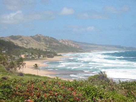
The environmental resources of Barbados continue to be the centerpiece of the economy and "Bajan" (pronounced bay-jun) culture. Numerous beaches fringe the island and many coastal communities are based on ocean uses that have historically included fishing, swimming and boating. On the country's east coast, near Bathsheba, amazing beaches, rolling mountains and powerful surf are on display. The Bathsheba region has remained quite rural over the years and still retains its agricultural feel.
Near the west coast centers of Speightstown and Holetown the beaches are considerably calmer, and consequently many of the island's resorts have set up along the coast. The end result of the increasing development pressures has led to some environmental issues along the coast. However, the region is still rich in coastal resources, including amazing coral reefs with a multitude of colorful aquatic species such as barracuda and groupers; several species of sea turtles; and, many birds that patrol the nearshore zone for sustenance.
Bridgetown, the country's capital, is located in the protected southwest of the island. This area, when combined with the southern portion of the island, is the most developed and home to a large portion of the population. The capital contains major ports for both the local fishing fleet (flying fish is the national dish) and a thriving cruise industry. The southern portion of the island still contains many beautiful beaches despite the large amount of development.
The environmental challenges have recently come to the forefront of Barbados life. Continuing development of the tourism industry, especially in the coastal zone, has led to management issues such as habitat and species impacts, as well as increased pollution from stormwater runoff. While many beaches in the eastern shore have remained unspoiled, the western shore now has numerous shore protection structures, including seawalls, jetties and groins that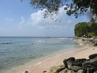 accelerate erosion. Increasing pressures on infrastructure due to the rapid development of coastal resorts and golf courses has led to many pollutants draining directly to the ocean due to the limited treatment facilities and catchment basins. In addition, the popularity of eco-tourism related activities has led to a very active nearshore zone that is affected many aquatic species. Most notably, the practice of feeding sea-turtles has led to obesity in many of the local turtles.
Fortunately, a few groups are actively minding the shores to ensure that the coasts of Barbados remain both environmentally and economically viable. The Barbados Sea Turtle Project works to conserve the green, hawksbill, leatherback and loggerhead turtles that are found in the area's waters. The Project especially focuses on protecting the eggs and breeding beaches found along the shores of the island and also is examining the interaction of humans with different species to assist in developing a sustainable eco-tourism industry.
In addition, the Barbados government has a Coastal Zone Management Unit that focuses on conservation and management activities in throughout the islands shores. The Unit has created an Integrated Coastal Zone Management Plan that put forward guidelines and next steps for the conservation of the island's coasts that looks to examine and manage the following:
Barbados is an amazing country with impressive natural resources and a near perfect climate. For many years, the unique location of the island made it a hidden secret of the Caribbean. More recently, tourism has provided a great economic asset for the Bajan community, bringing travelers from the entire globe to its shores. However, the increase in tourism has also brought along development and associated environmental issues, especially for coastal ecosystems. Several organizations and businesses have focused their efforts on protecting the environmental and economic assets but only time will tell whether Barbados will be able to create a balance between development and conservation in the future.
For more information...
Barbados Sea Turtle Project
http://www.barbadosseaturtles.org/Default.htm
Barbados Coastal Zone Management Plan
http://www.globaloceans.org/country/Barbados.html
Green Globe 21
http://www.greenglobe21.com/default.aspx
Wikipedia Information on Barbados
http://en.wikipedia.org/wiki/Barbados
Lonely Planet Barbados Guide
http://www.lonelyplanet.com/worldguide/destinations/caribbean/barbados/
Google Map of Barbados
http://maps.google.com/?ll=13.187137,-59.563065&spn=0.295494,0.462799&t=k
Located deep in the Lesser Antilles, Barbados is the easternmost island found in the windward Caribbean. Its unique geographic positioning, rich history and heavily British influenced culture make the island one of the most desirable locations to live and visit in the Northern Hemisphere. Barbados is positioned approximately 100 miles east of the islands of St. Lucia, St. Vincent and Grenada and is several hundred miles north of the South American Countries of Venezuela, Guyana and Suriname.

The island itself is relatively small measuring about 20 miles long by 10 miles wide. However, the country is packed with a high diversity of natural resources that include traditionally productive agricultural lands and amazing coastal ecosystems that are home to numerous
 tropical species of wildlife and plants. In addition, Barbados is one of the most highly populated areas of the eastern Caribbean, with almost 300,000 individuals inhabiting the island, and many, many more coming to visit each year.
Barbados - known by many as the "little England of the Caribbean" - was under British control for nearly 350 years leading up to its independence in 1966. For several hundred years the economy of Barbados was strongly agricultural, anchored by a thriving sugar industry and byproducts such as rum and molasses. In addition, the region produced several other local agricultural crops including yams, sweet potatoes, peanuts and cut flowers. Today Barbados is a independent state of the Commonwealth and keeps close ties with UK culture (especially in their love of the sport of cricket).
More recently, the local economy has shifted dramatically towards revenues from tourism associated activities. In 1970, tourism officially overtook agriculture as the island's number one source of income. Today nearly 75% of the islands GDP is derived from visitors to the island who come from near and far to enjoy the wonderful natural resources and exceptional weather the island has to offer.
The environmental resources of Barbados continue to be the centerpiece of the economy and "Bajan" (pronounced bay-jun) culture. Numerous beaches fringe the island and many coastal communities are based on ocean uses that have historically included fishing, swimming and boating. On the country's east coast, near Bathsheba, amazing beaches, rolling mountains and powerful surf are on display. The Bathsheba region has remained quite rural over the years and still retains its agricultural feel.
Near the west coast centers of Speightstown and Holetown the beaches are considerably calmer, and consequently many of the island's resorts have set up along the coast. The end result of the increasing development pressures has led to some environmental issues along the coast. However, the region is still rich in coastal resources, including amazing coral reefs with a multitude of colorful aquatic species such as barracuda and groupers; several species of sea turtles; and, many birds that patrol the nearshore zone for sustenance.
Bridgetown, the country's capital, is located in the protected southwest of the island. This area, when combined with the southern portion of the island, is the most developed and home to a large portion of the population. The capital contains major ports for both the local fishing fleet (flying fish is the national dish) and a thriving cruise industry. The southern portion of the island still contains many beautiful beaches despite the large amount of development.
The environmental challenges have recently come to the forefront of Barbados life. Continuing development of the tourism industry, especially in the coastal zone, has led to management issues such as habitat and species impacts, as well as increased pollution from stormwater runoff. While many beaches in the eastern shore have remained unspoiled, the western shore now has numerous shore protection structures, including seawalls, jetties and groins that
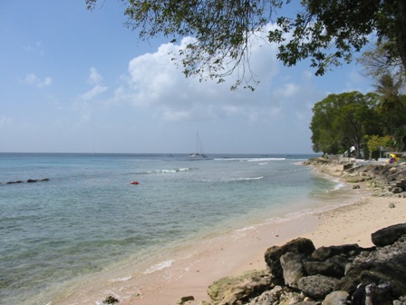 accelerate erosion. Increasing pressures on infrastructure due to the rapid development of coastal resorts and golf courses has led to many pollutants draining directly to the ocean due to the limited treatment facilities and catchment basins. In addition, the popularity of eco-tourism related activities has led to a very active nearshore zone that is affected many aquatic species. Most notably, the practice of feeding sea-turtles has led to obesity in many of the local turtles.
 Fortunately, a few groups are actively minding the shores to ensure that the coasts of Barbados remain both environmentally and economically viable. The Barbados Sea Turtle Project works to conserve the green, hawksbill, leatherback and loggerhead turtles that are found in the area's waters. The Project especially focuses on protecting the eggs and breeding beaches found along the shores of the island and also is examining the interaction of humans with different species to assist in developing a sustainable eco-tourism industry.
In addition, the Barbados government has a Coastal Zone Management Unit that focuses on conservation and management activities in throughout the islands shores. The Unit has created an Integrated Coastal Zone Management Plan that put forward guidelines and next steps for the conservation of the island's coasts that looks to examine and manage the following:
- integrated coastal zone management
- sustainable development
- marine environmental protection
- sustainable use and conservation of marine living resources
Barbados is an amazing country with impressive natural resources and a near perfect climate. For many years, the unique location of the island made it a hidden secret of the Caribbean. More recently, tourism has provided a great economic asset for the Bajan community, bringing travelers from the entire globe to its shores. However, the increase in tourism has also brought along development and associated environmental issues, especially for coastal ecosystems. Several organizations and businesses have focused their efforts on protecting the environmental and economic assets but only time will tell whether Barbados will be able to create a balance between development and conservation in the future.
For more information...
Barbados Sea Turtle Project
http://www.barbadosseaturtles.org/Default.htm
Barbados Coastal Zone Management Plan
http://www.globaloceans.org/country/Barbados.html
Green Globe 21
http://www.greenglobe21.com/default.aspx
Wikipedia Information on Barbados
http://en.wikipedia.org/wiki/Barbados
Lonely Planet Barbados Guide
http://www.lonelyplanet.com/worldguide/destinations/caribbean/barbados/
Google Map of Barbados
http://maps.google.com/?ll=13.187137,-59.563065&spn=0.295494,0.462799&t=k
Monday, March 06, 2006
In the News: Long Beach Sand Replenishment Project?
The City of Long Beach, New York, will have a public meeting on Tuesday, March 7 to discuss the fate of a proposed Army Corps of Engineers (ACOE) sand replenishment project that claims to offer protection to residents and businesses in the City by creating a barrier from hurricanes and nor'easters. The project, which has been proposed for several years by the ACOE, is being presented with recent modifications that would change the overall impacts of the effort. However, local residents and the Surfrider Foundation are continuing to fight the project, citing the impacts it will have on the environment, recreational opportunties, and the local economy states the following Newsday article. JB
March 4, 2006
One of the main questions arising from a proposed $98-million project to protect the Long Beach shoreline is whether it's worth spending money to fight Mother Nature.
Some feel such sand-replenishment projects are a waste of money because erosion is an unstoppable process. Others argue that people have interrupted natural processes by building ports, dams and jetties, thereby making it necessary to replenish the shoreline."
The only way to engineer with nature is to replenish the sand from one place to another," said Gilbert W. Hanse, director of emergency preparedness for the Town of Babylon. "That's what dredging does. It takes the sand from one area and puts it where it's needed."I
n the past 10 years, Gilgo Beach in Babylon has been replenished three times with 1 million cubic yards of sand from the Fire Island inlet. The projects' cost, $27 million, was borne by the state and federal governments, Hanse said.
The town, Hanse said, is hoping to do it again next year. The beach is now 170 feet wide; the goal is to get it back to 330 feet.
The sand, Hanse said, is a shock absorber."
If that sand in that beach and the sand dunes are not there, the waves will attack any structure that is in the way," he said. "The sand is doing its job. It is providing protection."
Jeff Kupferman, a resident of Long Beach for 45 years, is doubtful that a $98-million replenishment project in his community is worth it."
I have great concerns that a tremendous amount of money is spent," he said. "I don't know that it will provide the amount of protection they say it will."
As the chairman of the Long Beach Action Committee for Surfrider Foundation, a non-profit, environmental organization that works to protect oceans, waves, and beaches, Kupferman is concerned the replenishment of the shore would do more harm than good."
I don't care what you put on the beach, all this new stuff is going to be washed away," he added. "I don't know if the benefit of the project warrants us losing our beautiful beach and the marine life."
Read More...
http://www.newsday.com/news/local/longisland/ny-lieros0304,0,3119674,print.story?coll=ny-homepage-bigpix2005
Additional converage
http://www.newsday.com/news/local/longisland/ny-lilong0304,0,3287327.story?coll=ny-homepage-bigpix2005
Google Map of Long Beach, NY
http://maps.google.com/?ll=40.57902,-73.679123&spn=0.115255,0.2314&t=h
March 4, 2006
One of the main questions arising from a proposed $98-million project to protect the Long Beach shoreline is whether it's worth spending money to fight Mother Nature.
Some feel such sand-replenishment projects are a waste of money because erosion is an unstoppable process. Others argue that people have interrupted natural processes by building ports, dams and jetties, thereby making it necessary to replenish the shoreline."
The only way to engineer with nature is to replenish the sand from one place to another," said Gilbert W. Hanse, director of emergency preparedness for the Town of Babylon. "That's what dredging does. It takes the sand from one area and puts it where it's needed."I
n the past 10 years, Gilgo Beach in Babylon has been replenished three times with 1 million cubic yards of sand from the Fire Island inlet. The projects' cost, $27 million, was borne by the state and federal governments, Hanse said.
The town, Hanse said, is hoping to do it again next year. The beach is now 170 feet wide; the goal is to get it back to 330 feet.
The sand, Hanse said, is a shock absorber."
If that sand in that beach and the sand dunes are not there, the waves will attack any structure that is in the way," he said. "The sand is doing its job. It is providing protection."
Jeff Kupferman, a resident of Long Beach for 45 years, is doubtful that a $98-million replenishment project in his community is worth it."
I have great concerns that a tremendous amount of money is spent," he said. "I don't know that it will provide the amount of protection they say it will."
As the chairman of the Long Beach Action Committee for Surfrider Foundation, a non-profit, environmental organization that works to protect oceans, waves, and beaches, Kupferman is concerned the replenishment of the shore would do more harm than good."
I don't care what you put on the beach, all this new stuff is going to be washed away," he added. "I don't know if the benefit of the project warrants us losing our beautiful beach and the marine life."
Read More...
http://www.newsday.com/news/local/longisland/ny-lieros0304,0,3119674,print.story?coll=ny-homepage-bigpix2005
Additional converage
http://www.newsday.com/news/local/longisland/ny-lilong0304,0,3287327.story?coll=ny-homepage-bigpix2005
Google Map of Long Beach, NY
http://maps.google.com/?ll=40.57902,-73.679123&spn=0.115255,0.2314&t=h
CMRC Participates in National Ocean Sciences Bowl in Stony Brook
The CMRC particpated in the 2006 National Ocean Sciences Bowl (NOSB) regional "Bay Scallop Bowl" this past Sunday and assisted SUNY Stony Brook with the day's events along with many other volunteers from the coastal and ocean community. During the event, 16 high school teams compete against each other in a series of rounds of ocean science-related questions with a regional champion being crowned at the end of the day. Multiple supporters and volunteers came together to make the 2006 NOSB a great success! Below is more information from SUNY Stony Brook's Marine Sciences Research Center. JB
The Bay Scallop Bowl is a regional competition of the National Ocean Sciences Bowl (NOSB) held annually in New York. The bowl is hosted by the Marine Sciences Research Center of Stony Brook University and takes place on the Stony Brook University campus on a Saturday in February or early March. The competition features teams of high school students competing for cash prizes and a chance to represent New York in the NOSB final competition.
The National Ocean Science Bowl (NOSB) is an annual competition for high school students and is sponsored by the Washington DC-based Consortium for Oceanographic Research and Education (CORE.) CORE represents the nation’s leading marine research institutions, laboratories, and aquaria, sponsors the NOSB. The National Marine Educators Association (NMEA) and federal government provide base funding for the NOSB, but local host institutions must meet the costs of running their regional competitions. The objective of the NOSB is to raise awareness an understanding on the oceans and coastal resources among the nation’s high school students. Each year, the NOSB orchestrates 20-25 regional competitions distributed around the nation’s coastal areas, including the Great Lakes region. Regional competitions are held in February or early March. The winning teams from each regional event meet in the NOSB finals, held in late April at a different coastal location each year. The top-finishing teams in the NOSB finals receive great prizes featuring all expenses paid multi-day trips to oceanographic laboratories around the country.
New York’s schools are among the best in the nation and our high school students do extremely well in science fairs and national science competitions, such as that sponsored by the Intel Corporation. Many Long Island high schools offer courses in oceanography or marine biology. The average interest and knowledge level about the marine environment among Long Island high school students is high.
The Marine Sciences Research Center is among the world’s great institutions for study and instruction in the marine sciences. It has a long history of working with state and municipal governments, the business community, non-governmental organizations, and the people of coastal New York to better understand and manage the marine environment that is so important to the state’s economy and lifestyle. The Center has conducted extensive programs and activities over the past thirty years involving local school districts, teachers, and students. As the locus for marine science research and education in New York, MSRC is the natural host for a New York NOSB regional competition.
SUNY Stony Brook's Regional Bay Scallop Bowl
http://alpha1.msrc.sunysb.edu/~BSB/
NY Seagrant NOSB Information
http://www.seagrant.sunysb.edu/Pages/SBUPR-OceanSci022206.htm
Core's National Ocean Sciences Bowl Site
http://www.nosb.org/
The Bay Scallop Bowl is a regional competition of the National Ocean Sciences Bowl (NOSB) held annually in New York. The bowl is hosted by the Marine Sciences Research Center of Stony Brook University and takes place on the Stony Brook University campus on a Saturday in February or early March. The competition features teams of high school students competing for cash prizes and a chance to represent New York in the NOSB final competition.
The National Ocean Science Bowl (NOSB) is an annual competition for high school students and is sponsored by the Washington DC-based Consortium for Oceanographic Research and Education (CORE.) CORE represents the nation’s leading marine research institutions, laboratories, and aquaria, sponsors the NOSB. The National Marine Educators Association (NMEA) and federal government provide base funding for the NOSB, but local host institutions must meet the costs of running their regional competitions. The objective of the NOSB is to raise awareness an understanding on the oceans and coastal resources among the nation’s high school students. Each year, the NOSB orchestrates 20-25 regional competitions distributed around the nation’s coastal areas, including the Great Lakes region. Regional competitions are held in February or early March. The winning teams from each regional event meet in the NOSB finals, held in late April at a different coastal location each year. The top-finishing teams in the NOSB finals receive great prizes featuring all expenses paid multi-day trips to oceanographic laboratories around the country.
New York’s schools are among the best in the nation and our high school students do extremely well in science fairs and national science competitions, such as that sponsored by the Intel Corporation. Many Long Island high schools offer courses in oceanography or marine biology. The average interest and knowledge level about the marine environment among Long Island high school students is high.
The Marine Sciences Research Center is among the world’s great institutions for study and instruction in the marine sciences. It has a long history of working with state and municipal governments, the business community, non-governmental organizations, and the people of coastal New York to better understand and manage the marine environment that is so important to the state’s economy and lifestyle. The Center has conducted extensive programs and activities over the past thirty years involving local school districts, teachers, and students. As the locus for marine science research and education in New York, MSRC is the natural host for a New York NOSB regional competition.
SUNY Stony Brook's Regional Bay Scallop Bowl
http://alpha1.msrc.sunysb.edu/~BSB/
NY Seagrant NOSB Information
http://www.seagrant.sunysb.edu/Pages/SBUPR-OceanSci022206.htm
Core's National Ocean Sciences Bowl Site
http://www.nosb.org/
In the News: Dock workers rally to keep port open
The battle for the region's waterfront continued on Sunday in Red Hook when dock workers expressed their dissatisfaction with New York City's plan to remove the container port from Brooklyn and replace it with luxury condos. Local waterfront workers from American Stevedoring claim that jobs are being lost in the region due to the pressures of residential development, leaving the majority of them without a source of income. The Economic Development Corporation (EDC) seems to indicate that the jobs will be retained, however EDC President was recently quoted as saying that the Cocoa employees were "the lowest-rung workers" on the docks. As long as development pressures continue and the values of waterfront real estate rise there will be a conflict with dock related economic activities writes Newsday in the following article. JB
March 6, 2006
Burly Teamsters and Longshoremen joined politicians at City Hall Sunday to demand Mayor Bloomberg keep Brooklyn's last working waterfront open for business.
Shouting "Cocoa beans, not condos," dozens of workers who unload and warehouse raw cocoa at American Stevedoring International in Red Hook blasted the Bloomberg administration for pushing the container port out of business.
The news conference and rally at City Hall is the latest chapter in the "cocoa crisis," which pits the port operator against powerful interests inside and outside the mayor's office.
Andrew Alper, president of the Economic Development Corp., the city agency that runs the terminal, was a main target of their wrath. In January, he said he is willing to allow the cocoa business to leave New York, and called the employees "the lowest-rung workers."
American Stevedoring said it employees 623 people to unload cocoa, lumber and other commodities.But next year, the company's lease expires and the city will block its renewal. The space will be used for more cruise ships and a park. Luxury condominiums are planned nearby.
Councilman David Yassky (D-Brooklyn) said the Economic Development Corp. should lose its contract to administer waterfront operations because it is not fulfilling it mission to retain and expand such business.
Read more...
http://www.newsday.com/news/local/newyork/am-port0306,0,7842480.story?coll=ny-main-tabheads3
NYC's Economic Development Corporation
http://www.newyorkbiz.com/
American Stevedoring
http://www.asiterminals.com/
March 6, 2006
Burly Teamsters and Longshoremen joined politicians at City Hall Sunday to demand Mayor Bloomberg keep Brooklyn's last working waterfront open for business.
Shouting "Cocoa beans, not condos," dozens of workers who unload and warehouse raw cocoa at American Stevedoring International in Red Hook blasted the Bloomberg administration for pushing the container port out of business.
The news conference and rally at City Hall is the latest chapter in the "cocoa crisis," which pits the port operator against powerful interests inside and outside the mayor's office.
Andrew Alper, president of the Economic Development Corp., the city agency that runs the terminal, was a main target of their wrath. In January, he said he is willing to allow the cocoa business to leave New York, and called the employees "the lowest-rung workers."
American Stevedoring said it employees 623 people to unload cocoa, lumber and other commodities.But next year, the company's lease expires and the city will block its renewal. The space will be used for more cruise ships and a park. Luxury condominiums are planned nearby.
Councilman David Yassky (D-Brooklyn) said the Economic Development Corp. should lose its contract to administer waterfront operations because it is not fulfilling it mission to retain and expand such business.
Read more...
http://www.newsday.com/news/local/newyork/am-port0306,0,7842480.story?coll=ny-main-tabheads3
NYC's Economic Development Corporation
http://www.newyorkbiz.com/
American Stevedoring
http://www.asiterminals.com/
Friday, March 03, 2006
In the News: Atlantic City Developers Are All In
Coastal development continues at a rapid pace up and down the eastern seaboard. In Atlantic City, NJ, the construction of new homes and condominiums is proceeding at an unprecedented rate, adding valuable dollars to the local economy. However, all of the development is taking place on a barrier beach island that is very susceptible to coastal storms that include hurricanes and nor'easters. As well, the region is also home to several low-income communities. The long-term impacts both environmentally and socially will not be known for some time, but for the moment economic forces are the main driver in Atlantic City's coastal development writes the NY Times. JB
The view outward from Brett Wartenberg's 20th-floor luxury condominium in Atlantic City is a thing of beauty, a sweeping panorama of the Atlantic Ocean, the historic Absecon Lighthouse and the shoreline of nearby Brigantine.
But glance straight down, onto the streets of the Southeast Inlet neighborhood, and the majesty fades. Decrepit row houses patched with plywood are scattered among vacant lots; plastic bags of trash slump against them. Pigeons peck on empty Doritos bags and stray cats prowl the deserted streets.
Dr. Wartenberg, 41, a chiropractor whose full-time home is in Medford, N.J., is unfazed. He paid in the $400,000's more than a year ago for his new condo at the Bella, a redevelopment of an existing apartment building. High-floor units in the project are already listed at substantially more than he paid.
"Atlantic City has the highest potential for appreciation — other shore towns are tapped out," he said. "If you bought in Vegas 10 or 15 years ago, people said, 'Why?' No one asks that question anymore."
Developers are moving in hungrily on Atlantic City, where the sea and beach spread out invitingly. But with nearly half of the city's households defined by the federal government as low-income and F.B.I. statistics showing a crime rate more than three times the national average, a question lingers in some minds: "If we build it, will they buy?"
At the moment, the Bella stands alone, like a debutante in a deserted parking lot. But it shouldn't be for long. New retail, restaurant and entertainment venues, combined with the availability of large tracts of land, are making the city a potent lure for developers.
Atlantic City is the late bloomer of the Jersey Shore, where the value of modest duplexes has risen to millions from Cape May to Belmar and second-home buyers have arrived even in long-forlorn Asbury Park. More than 1,500 luxury housing units in Atlantic City — the first such residential construction in 20 years — are now in the pipeline, though a complex approval process could stall some.
Read more...
http://www.nytimes.com/2006/03/03/realestate/03second.html
Google Map of Atlantic City
http://maps.google.com/?ll=39.345981,-74.51889&spn=0.469408,0.671539&t=h
The view outward from Brett Wartenberg's 20th-floor luxury condominium in Atlantic City is a thing of beauty, a sweeping panorama of the Atlantic Ocean, the historic Absecon Lighthouse and the shoreline of nearby Brigantine.
But glance straight down, onto the streets of the Southeast Inlet neighborhood, and the majesty fades. Decrepit row houses patched with plywood are scattered among vacant lots; plastic bags of trash slump against them. Pigeons peck on empty Doritos bags and stray cats prowl the deserted streets.
Dr. Wartenberg, 41, a chiropractor whose full-time home is in Medford, N.J., is unfazed. He paid in the $400,000's more than a year ago for his new condo at the Bella, a redevelopment of an existing apartment building. High-floor units in the project are already listed at substantially more than he paid.
"Atlantic City has the highest potential for appreciation — other shore towns are tapped out," he said. "If you bought in Vegas 10 or 15 years ago, people said, 'Why?' No one asks that question anymore."
Developers are moving in hungrily on Atlantic City, where the sea and beach spread out invitingly. But with nearly half of the city's households defined by the federal government as low-income and F.B.I. statistics showing a crime rate more than three times the national average, a question lingers in some minds: "If we build it, will they buy?"
At the moment, the Bella stands alone, like a debutante in a deserted parking lot. But it shouldn't be for long. New retail, restaurant and entertainment venues, combined with the availability of large tracts of land, are making the city a potent lure for developers.
Atlantic City is the late bloomer of the Jersey Shore, where the value of modest duplexes has risen to millions from Cape May to Belmar and second-home buyers have arrived even in long-forlorn Asbury Park. More than 1,500 luxury housing units in Atlantic City — the first such residential construction in 20 years — are now in the pipeline, though a complex approval process could stall some.
Read more...
http://www.nytimes.com/2006/03/03/realestate/03second.html
Google Map of Atlantic City
http://maps.google.com/?ll=39.345981,-74.51889&spn=0.469408,0.671539&t=h
Tuesday, February 28, 2006
Conserving our Coasts and Waterfronts: The New York - New Jersey Harbor Estuary Program
As part of the CMRC's Harbor Bight Policy Initiative, we will be exploring the programs and people involved of the conservation and restoration our coasts and waterfronts and updating their latest activities. The list of the “keepers” of our shores includes a wide array of entities such as government agencies, non-profit organizations, academic institutions, community-based organizations, businesses and even individuals. The eventual goal of this effort is to create an interactive catalog of activities, updated on an annual basis, that highlights the entities that are involved with minding our shores. The first installation of this effort explores one of our regions major conservation programs, the New York - New Jersey Harbor Estuary Program. JB
Stretching from the Tappan Zee Bridge to the Mouth of the Atlantic Ocean, the New York - Jersey Harbor Estuary is a highly valuable coastal ecosystem located in one of the most populated places on earth. The Harbor Estuary includes waterways such as the Lower and Upper New York Harbor, Raritan Bay, the Arthur and Kill van Kulls, portions of the Long Island Sound and Hudson River, and the Passaic and Hackensack Rivers in New Jersey.
An estuary is an area where salt and fresh water mix, and within the Harbor Estuary salinities (a measure of saltiness) vary as one moves closer to, or further from, the Atlantic Ocean. This in turn creates a multitude of habitats that have historically attracted numerous animal and fish species, and subsequently humans, to its shores. The amount of coastline in the Harbor Estuary is truly amazing, as the region includes hundreds of miles of natural shoreline, but unfortunately much of the ecosystem has been significantly impacted by human development. Home to miles of urban waterfront, the Harbor Estuary is constantly facing the pressures of development and pollution.
In 1987, the National Estuary Program, a Federal Program established by Congress to protect and restore our nation’s estuarine ecosystems, was created. The Program quickly identified the New York - New Jersey Harbor Estuary as an "Estuary of National Significance" the following year. Thus the Harbor Estuary Program, or HEP as it is often referred to, was born. Over the next decade the program created with the assistance of its many partners its Comprehensive Conservation and Management Plan (CCMP). Completed in 1997, the CCMP outlined the environmental challenges in the ecosystem and created an implementation plan for solving those issues.
In 2004, HEP created a list of Targets and Goals, inspired by the Chesapeake Bay Program, that outlined focus areas for the next decade of the program. The following Goals were identified as important to the long-term health of the ecosystem:
Goal 1 - Fishing and Swimming: All of the Harbor waters will meet the Fishable/Swimmable goal of the Clean Water Act.
Goal 2 - Habitat and Ecological Health: Preserve, manage, and enhance the Estuary’s vital habitat, ecological function, and biodiversity so that the Harbor is a system of diverse natural communities.
Goal 3 - Public Access: Ensure that all residents in the core area of the Harbor have a public waterfront access site within thirty minutes of their home for boating, fishing, swimming and/or waterfront leisure (e.g. walking, bird watching, and picnicking), without harming important habitat areas.
Goal 4 - Clean Sediment and Navigation: The Port of New York and New Jersey will be an integral and complementary part of the world-class NY-NJ Harbor Estuary, that is environmentally sustainable, economically efficient, and safe for commercial and recreational navigation.
Goal 5 - Stewardship: Everyone who lives or works in the Estuary watershed acts a steward for the ecosystem.
Another major component to the Targets and Goals was the creation of very specific targets to achieve the five goals mentioned above. A series of well developed targets very clearly outline the steps that are needed to improve ecosystem health and community access and involvement.
In order to implement the CCMP, Targets and Goals, and other efforts, HEP works through a collaborative process of workgroups and committees. The Policy and Management Committees are key decision-makers in the Program and each is composed of several agency representatives as well as members of the Citizens Advisory Committee (CAC) and Science and Technical Advisory Committee (STAC). Several other more "focused" workgroups and committees works on specific issues that include Habitat, Nutrients, Toxics, Sediment/Navigation, and Pathogens. The Citizens Advisory Committee is the final piece of the puzzle and is the link between community-based organizations and individuals to the program.
To date, HEP has been able to make major strides in the conservation and restoration of the ecosystem. Hundreds of acres of coastal habitat have been either acquired or restored through the Habitat Workgroup while water quality has improved due to the hard work of several partners of the Program. However, the limited budget of the Program, as well as the time constraints of partners involved in the effort, have limited the potential impact HEP is capable of. As a result, several non-profit organizations, such as the CMRC and Hudson River Foundation, have set out to find additional resources for the implementation of HEP’s Targets and Goals. Only with adequate resource will the amazing natural resources of the Harbor Estuary thrive and be enjoyed by all of its residents.
The best way to get involved with the Harbor Estuary Program is to attend a CAC or Habitat Workgroup meeting. Please view their respective webpages (listed below) and signup for their list-servs that constantly update recipients of the latest news and events in the Harbor Estuary. If you have additional questions, please email the CMRC at info@thecmrc.org.
For More Information:
The New York - New Jersey Harbor Estuary Program
www.harborestuary.org
Google Map of the New York - New Jersey Harbor Estuary
http://maps.google.com/?ll=40.626461,-74.029999&spn=0.460691,0.925598
HEP Citizens Advisory Committee
http://www.seagrant.sunysb.edu/hep/cac.htm
HEP Habitat Workgroup
http://www.seagrant.sunysb.edu/hep/habitat.htm
HEP Targets and Goals
http://www.seagrant.sunysb.edu/hep/targets.htm
Estuary Related Links
http://www.seagrant.sunysb.edu/hep/links.htm
Stretching from the Tappan Zee Bridge to the Mouth of the Atlantic Ocean, the New York - Jersey Harbor Estuary is a highly valuable coastal ecosystem located in one of the most populated places on earth. The Harbor Estuary includes waterways such as the Lower and Upper New York Harbor, Raritan Bay, the Arthur and Kill van Kulls, portions of the Long Island Sound and Hudson River, and the Passaic and Hackensack Rivers in New Jersey.
An estuary is an area where salt and fresh water mix, and within the Harbor Estuary salinities (a measure of saltiness) vary as one moves closer to, or further from, the Atlantic Ocean. This in turn creates a multitude of habitats that have historically attracted numerous animal and fish species, and subsequently humans, to its shores. The amount of coastline in the Harbor Estuary
 is truly amazing, as the region includes hundreds of miles of natural shoreline, but unfortunately much of the ecosystem has been significantly impacted by human development. Home to miles of urban waterfront, the Harbor Estuary is constantly facing the pressures of development and pollution.
 In 1987, the National Estuary Program, a Federal Program established by Congress to protect and restore our nation’s estuarine ecosystems, was created. The Program quickly identified the New York - New Jersey Harbor Estuary as an "Estuary of National Significance" the following year. Thus the Harbor Estuary Program, or HEP as it is often referred to, was born. Over the next decade the program created with the assistance of its many partners its Comprehensive Conservation and Management Plan (CCMP). Completed in 1997, the CCMP outlined the environmental challenges in the ecosystem and created an implementation plan for solving those issues.
In 2004, HEP created a list of Targets and Goals, inspired by the Chesapeake Bay Program, that outlined focus areas for the next decade of the program. The following Goals were identified as important to the long-term health of the ecosystem:
Goal 1 - Fishing and Swimming: All of the Harbor waters will meet the Fishable/Swimmable goal of the Clean Water Act.
Goal 2 - Habitat and Ecological Health: Preserve, manage, and enhance the Estuary’s vital habitat, ecological function, and biodiversity so that the Harbor is a system of diverse natural communities.
Goal 3 - Public Access: Ensure that all residents in the core area of the Harbor have a public waterfront access site within thirty minutes of their home for boating, fishing, swimming and/or waterfront leisure (e.g. walking, bird watching, and picnicking), without harming important habitat areas.
Goal 4 - Clean Sediment and Navigation: The Port of New York and New Jersey will be an integral and complementary part of the world-class NY-NJ Harbor Estuary, that is environmentally sustainable, economically efficient, and safe for commercial and recreational navigation.
Goal 5 - Stewardship: Everyone who lives or works in the Estuary watershed acts a steward for the ecosystem.
Another major component to the Targets and Goals was the creation of very specific targets to achieve the five goals mentioned above. A series of well developed targets very clearly outline the steps that are needed to improve ecosystem health and community access and involvement.
In order to implement the CCMP, Targets and Goals, and other efforts, HEP works through a collaborative process of workgroups and committees. The Policy and Management Committees are key decision-makers in the Program and each is composed of several agency representatives as well as members of the Citizens Advisory Committee (CAC) and Science and
 Technical Advisory Committee (STAC). Several other more "focused" workgroups and committees works on specific issues that include Habitat, Nutrients, Toxics, Sediment/Navigation, and Pathogens. The Citizens Advisory Committee is the final piece of the puzzle and is the link between community-based organizations and individuals to the program.
To date, HEP has been able to make major strides in the conservation and restoration of the ecosystem. Hundreds of acres of coastal habitat have been either acquired or restored through the Habitat Workgroup while water quality has improved due to the hard work of several partners of the Program. However, the limited budget of the Program, as well as the time constraints of partners involved in the effort, have limited the potential impact HEP is capable of. As a result, several non-profit organizations, such as the CMRC and Hudson River Foundation, have set out to find additional resources for the implementation of HEP’s Targets and Goals. Only with adequate resource will the amazing natural resources of the Harbor Estuary thrive and be enjoyed by all of its residents.
The best way to get involved with the Harbor Estuary Program is to attend a CAC or Habitat Workgroup meeting. Please view their respective webpages (listed below) and signup for their list-servs that constantly update recipients of the latest news and events in the Harbor Estuary. If you have additional questions, please email the CMRC at info@thecmrc.org.
For More Information:
The New York - New Jersey Harbor Estuary Program
www.harborestuary.org
Google Map of the New York - New Jersey Harbor Estuary
http://maps.google.com/?ll=40.626461,-74.029999&spn=0.460691,0.925598
HEP Citizens Advisory Committee
http://www.seagrant.sunysb.edu/hep/cac.htm
HEP Habitat Workgroup
http://www.seagrant.sunysb.edu/hep/habitat.htm
HEP Targets and Goals
http://www.seagrant.sunysb.edu/hep/targets.htm
Estuary Related Links
http://www.seagrant.sunysb.edu/hep/links.htm
Friday, February 24, 2006
In the News: Port Agency to Break Lease in Bid to Block Dubai Sale
Ports and maritime operations play a significant role in the economy, environment, and security of our coasts and waterfronts in the Harbor Estuary. A recent deal made by the Federal government would provide a long-term operations contract to a company based in the United Arab Emirates, a deal that many have questioned on security and economic concerns. One of the six ports potentially affected by this deal would be Port Newark, which is owned by the Port Authority of New York and New Jersey, our region's major maritime agency. The Port Authority's stance on the deal in essence wishes to prevent operations from being transfered to Dubai Ports World comments the NY Times in the article below. JB
The Port Authority of New York and New Jersey will break the lease of a big container terminal at Port Newark to stop a company based in Dubai from taking over part of the operation there, the agency's chairman said yesterday.
Anthony R. Coscia, the chairman, said the company that holds a lease on the terminal through 2030 violated the contract by selling a half-interest in it to Dubai Ports World without seeking the landlord's approval. He said the Port Authority would ask a judge in New Jersey Superior Court in Newark today to affirm its right to end the lease.
"Fundamentally, this is a landlord-tenant dispute," said Mr. Coscia, who is a lawyer. "We're terminating their lease because they sublet illegally."
Separately, the State of New Jersey sued the federal government in United States District Court in Trenton yesterday afternoon to block the Dubai deal. The lawsuit said Bush administration officials failed to fulfill their duty to fully investigate the national security implications of the transaction.
The Dubai company has agreed to pay $6.8 billion to buy Peninsular & Oriental Steam Navigation, a port operator based in London. One of the subsidiaries it would acquire, P & O Ports North America, owns half of the company that operates the Port Newark Container Terminal.
Read more:
http://www.nytimes.com/2006/02/24/nyregion/24suit.html
More on Port Operations Deal:
http://www.nytimes.com/2006/02/24/politics/24ports.html
Port Authority of New York & New Jersey:
http://www.panynj.gov/
The Port Authority of New York and New Jersey will break the lease of a big container terminal at Port Newark to stop a company based in Dubai from taking over part of the operation there, the agency's chairman said yesterday.
Anthony R. Coscia, the chairman, said the company that holds a lease on the terminal through 2030 violated the contract by selling a half-interest in it to Dubai Ports World without seeking the landlord's approval. He said the Port Authority would ask a judge in New Jersey Superior Court in Newark today to affirm its right to end the lease.
"Fundamentally, this is a landlord-tenant dispute," said Mr. Coscia, who is a lawyer. "We're terminating their lease because they sublet illegally."
Separately, the State of New Jersey sued the federal government in United States District Court in Trenton yesterday afternoon to block the Dubai deal. The lawsuit said Bush administration officials failed to fulfill their duty to fully investigate the national security implications of the transaction.
The Dubai company has agreed to pay $6.8 billion to buy Peninsular & Oriental Steam Navigation, a port operator based in London. One of the subsidiaries it would acquire, P & O Ports North America, owns half of the company that operates the Port Newark Container Terminal.
Read more:
http://www.nytimes.com/2006/02/24/nyregion/24suit.html
More on Port Operations Deal:
http://www.nytimes.com/2006/02/24/politics/24ports.html
Port Authority of New York & New Jersey:
http://www.panynj.gov/
Thursday, February 16, 2006
CMRC Press Release: Stewardship Initiative Brings Together Businesses And Conservation In The Harbor Estuary
FOR IMMEDIATE RELEASE
Press contact: The Coastal Marine Resource Center of New York, 646-515-9290 If you are not a member of the press, please write to us at info@thecmrc.org or see our home page.
STEWARDSHIP INITIATIVE BRINGS TOGETHER BUSINESSES AND CONSERVATION IN THE HARBOR ESTUARY
NEW YORK, NY (February 16, 2006) – Leaders from the New York – New Jersey Harbor Estuary business and environmental communities joined forces today at the Hudson River Foundation to kick-off a Stewardship Initiative that seeks to integrate the resources of the private sector with efforts to conserve and restore this dynamic but often neglected ecosystem.
The Business Stewardship Initiative is a collaborative effort spearheaded by the Coastal Marine Resource Center of New York, the New York – New Jersey Harbor Estuary Program, and the Chesapeake Bay’s Businesses for the Bay Program to leverage resources found within local businesses to increase conservation, restoration, and public access throughout the region.
A diverse range of organizations participated in the event including representatives from AIG Insurance, Brooklyn Greenway Initiative, Brooklyn Navy Yard, Credit Suisse, East Williamsburg Valley Industrial Development Corporation, Environmental Resources Management, EPA Performance Track, Fordham University, Hudson River Estuary Program, Metropolitan Waterfront Alliance, Monmouth University, NY Shipping Association, NY Water Taxi, NY/NJ COAST, NYC Cruise Terminal, NYC Soil & Water Conservation District, Port Authority of NY & NJ, Patagonia, Southwest Brooklyn Industrial Development Corporation, and Verdant Power LLC.
The NY – NJ Harbor Estuary is home to one of the largest business communities in the world. An extensive network of businesses employs millions of residents and adds billions of dollars to the local economy. Unfortunately, these entities can also contribute to habitat degradation and reduced ecosystem health. By offering real mechanisms for environmental coordination that are profitable and efficient, and acknowledging participants for their positive contributions, the Stewardship Initiative hopes to provide businesses with the opportunity to voluntarily support coastal conservation regionwide.
For More Information Contact:
Joel Banslaben, Executive Director
Coastal Marine Resource Center of New York
Tel: 646-515-9290
info@thecmrc.org
http://www.thecmrc.org/
Press contact: The Coastal Marine Resource Center of New York, 646-515-9290 If you are not a member of the press, please write to us at info@thecmrc.org or see our home page.
STEWARDSHIP INITIATIVE BRINGS TOGETHER BUSINESSES AND CONSERVATION IN THE HARBOR ESTUARY
NEW YORK, NY (February 16, 2006) – Leaders from the New York – New Jersey Harbor Estuary business and environmental communities joined forces today at the Hudson River Foundation to kick-off a Stewardship Initiative that seeks to integrate the resources of the private sector with efforts to conserve and restore this dynamic but often neglected ecosystem.
The Business Stewardship Initiative is a collaborative effort spearheaded by the Coastal Marine Resource Center of New York, the New York – New Jersey Harbor Estuary Program, and the Chesapeake Bay’s Businesses for the Bay Program to leverage resources found within local businesses to increase conservation, restoration, and public access throughout the region.
A diverse range of organizations participated in the event including representatives from AIG Insurance, Brooklyn Greenway Initiative, Brooklyn Navy Yard, Credit Suisse, East Williamsburg Valley Industrial Development Corporation, Environmental Resources Management, EPA Performance Track, Fordham University, Hudson River Estuary Program, Metropolitan Waterfront Alliance, Monmouth University, NY Shipping Association, NY Water Taxi, NY/NJ COAST, NYC Cruise Terminal, NYC Soil & Water Conservation District, Port Authority of NY & NJ, Patagonia, Southwest Brooklyn Industrial Development Corporation, and Verdant Power LLC.
The NY – NJ Harbor Estuary is home to one of the largest business communities in the world. An extensive network of businesses employs millions of residents and adds billions of dollars to the local economy. Unfortunately, these entities can also contribute to habitat degradation and reduced ecosystem health. By offering real mechanisms for environmental coordination that are profitable and efficient, and acknowledging participants for their positive contributions, the Stewardship Initiative hopes to provide businesses with the opportunity to voluntarily support coastal conservation regionwide.
For More Information Contact:
Joel Banslaben, Executive Director
Coastal Marine Resource Center of New York
Tel: 646-515-9290
info@thecmrc.org
http://www.thecmrc.org/
Monday, February 13, 2006
Jamaica Bay Watershed Protection Plan
Jamaica Bay is home to a wide array of wildlife and amazing coastal habitat only a stones throw away from downtown Manhattan. Located in the southeastern-most portion of New York City, bounded by Brooklyn to the northwest and Queens to the northeast and south, the region has long been long known for its world-class fishing and numerous recreational opportunities that include swimming, kayaking, windsurfing, and birdwatching just to name a few. However, the ecosystem has also endured high levels of pollution and habitat degradation in recent centuries, a byproduct of development and treated (and sometime untreated) wastewater. The good news is that the Jamaica Bay Task Force, created by Local NYC Law 71, is working to better understand the environmental issues of the region and will eventually create a plan for restoring and conserving this amazing coastal resource. JB
Sandwiched between the Rockaway Peninsula and the "mainland" of Kings (Brooklyn) and Queens Counties, Jamaica Bay is a estuarine oasis in an urban landscape. Home to millions of people the region is one of the most densely populated on earth. The great natural resources of Jamaica Bay have attracted many local New York City residents to its shores for recreational and commercial activities, but have also led to a degradation of its habitat and wildlife. Jamaica Bay is truly an urban environment with great potential for restoration, and with the right planning and management it may be able to continue providing protection and foraging grounds for the multiple animal and plant species that inhabitat its shores.
Jamaica Bay connects to the Lower New York Harbor and Atlantic Ocean via Rockaway Inlet to its west. The region is an estuary, and as such the salinity of the waters in the Bay range from completely fresh to entirely saltly, with the average salinity falling somewhere in between. With this range in salinity comes a wide range of species both in-and-out of the water. In the water, a multitude of fish species including striped bass, flounder, and fluke to name a few can be found side-by-side with various crab species, tons of invertebrates, and even the occasional seal and sea turtle! As well, the area is known for its world class birdwatching, and depending on the day or even the season one can observe everything from great egrets, blue herons, and raptors to piping plovers, seagulls, and many species of waterfowl.
The lands surrounding Jamaica Bay are owned by several different agencies, organizations, and individuals. One of the biggest landowners is the Federal Government which operates the Gateway National Recreation Area. In addition, there are several city parks that can be found throughout the estuary including Marine Park and Edgemere Park. One of the biggest landholders is the Port Authority of New York and New Jersey, as they operate JFK International Airport in the northeast corner of the Bay. Individual landowners comprise the majority of the remaining real estate, and some parcels still are undeveloped to this day, although some large development projects are planned or being implemented throughout the region.
Due to the intense development of the region, many pollutants have been added to the system and a high percentage of the estuarine habitat has been lost. One of the main sources of degradation historically has been from the multiple wastewater treatment plants in the Bay. During dry weather most of these plants release only treated wastewater, and impacts to the natural environment are limited. However, during higher than usual rain events the system becomes overloaded and raw sewage is released into the waters of several inlets and creeks that fringe Jamaica Bay. Fortunately, the NYC Department of Environmental Protection is working on many projects to eliminate the amount of wastewater entering the ecosystem.
Another major cause for concern in Jamaica Bay has been the loss of various sea and marsh grasses that were traditionally found throughout the Bay. Marsh loss in general has perplexed local scientists and residents alike, with numerous hypotheses being put forward as to why and how the grasses and marsh habitat have been lost. Some of the leading rationales include, an increase in boat wakes, sea level rise, and many more. Eutrophication, or over-nutrification of the Bay is also seen as leading to poor water quality and habitat degradation in the region.
In 2002, multiple stakeholders came together to form the Jamaica Bay Task Force (JBTF). The JBTF is a coalition brought together by the City Council to review the multiple environmental issues of the Bay and create a management plan to restore and conserve its amazing natural resources. The partnership includes many members of the local environmental community including NYCDEP, Port Authority (PANYNJ), US National Parks Service (NPS), local community boards, and the Army Corps of Engineers (ACOE) to name a few. Many non-profit organizations have been involved with the process including NRDC and the Friends of Gateway. Part of the JBTF process includes multiple public meetings, one of which took place at York College in Jamaica Queens on February 9, 2006. A full report on the JBTF is expected on September 1, 2006 when NYCDEP is required to complete the Watershed Protection Plan and submit their findings to the Mayor and the Speaker of the Council.
For more information:
Jamaica Bay Task Force
http://nin.nbii.gov/jamaicabay/jbtf/jbtf.html
Jamaica Bay Research and Management Information Network
http://nin.nbii.org/jamaicabay/index.html
Friends of Gateway
http://www.treebranch.com/friends_of_gateway.htm
Jamaica Bay Wikipedia Page
http://en.wikipedia.org/wiki/Jamaica_Bay
Advisory Committee
http://nin.nbii.gov/jamaicabay/jbwppac/advisorycommittee.html
Gateway National Recreation Area (National Parks Service)
http://www.nps.gov/gate/
Sandwiched between the Rockaway Peninsula and the "mainland" of Kings (Brooklyn) and Queens Counties, Jamaica Bay is a estuarine oasis in an urban landscape. Home to millions of people the region is one of the most densely populated on earth. The great natural resources of Jamaica Bay have attracted many local New York City residents to its shores for recreational and commercial activities, but have also led to a degradation of its
 habitat and wildlife. Jamaica Bay is truly an urban environment with great potential for restoration, and with the right planning and management it may be able to continue providing protection and foraging grounds for the multiple animal and plant species that inhabitat its shores.
Jamaica Bay connects to the Lower New York Harbor and Atlantic Ocean via Rockaway Inlet to its west. The region is an estuary, and as such the salinity of the waters in the Bay range from completely fresh to entirely saltly, with the average salinity falling somewhere in between. With this range in salinity comes a wide range of species both in-and-out of the water. In the water, a multitude of fish species including striped bass, flounder, and fluke to name a few can be found side-by-side with various crab species, tons of invertebrates, and even the occasional seal and sea turtle! As well, the area is known for its world class birdwatching, and depending on the day or even the season one can observe everything from great egrets, blue herons, and raptors to piping plovers, seagulls, and many species of waterfowl.
The lands surrounding Jamaica Bay are owned by several different agencies, organizations, and individuals. One of the biggest landowners is the Federal Government which operates the Gateway National Recreation Area. In addition, there are several city parks that can be found throughout the estuary including Marine Park and Edgemere Park. One of the biggest landholders is the Port Authority of New York and New Jersey, as they operate JFK International Airport in the northeast corner of the Bay. Individual landowners comprise the majority of the remaining real estate, and some parcels still are undeveloped to this day, although some large development projects are planned or being implemented throughout the region.
Due to the intense development of the region, many pollutants have been added to the system and a high percentage of the estuarine habitat has been lost. One of the main sources of degradation historically has been from the multiple wastewater treatment plants in the Bay. During dry weather most of these plants release only treated wastewater, and impacts to the natural environment are limited. However, during higher than usual rain events the system becomes overloaded and raw sewage is released into the waters of several inlets and creeks that fringe Jamaica Bay. Fortunately, the NYC Department of Environmental Protection is working on many projects to eliminate the amount of wastewater entering the ecosystem.
Another major cause for concern in Jamaica Bay has been the loss of various sea and marsh grasses that were traditionally found throughout the Bay. Marsh loss in general has perplexed local scientists and residents alike, with numerous hypotheses being put forward as to why and
 how the grasses and marsh habitat have been lost. Some of the leading rationales include, an increase in boat wakes, sea level rise, and many more. Eutrophication, or over-nutrification of the Bay is also seen as leading to poor water quality and habitat degradation in the region.
In 2002, multiple stakeholders came together to form the Jamaica Bay Task Force (JBTF). The JBTF is a coalition brought together by the City Council to review the multiple environmental issues of the Bay and create a management plan to restore and conserve its amazing natural resources. The partnership includes many members of the local environmental community including NYCDEP, Port Authority (PANYNJ), US National Parks Service (NPS), local community boards, and the Army Corps of Engineers (ACOE) to name a few. Many non-profit organizations have been involved with the process including NRDC and the Friends of Gateway. Part of the JBTF process includes multiple public meetings, one of which took place at York College in Jamaica Queens on February 9, 2006. A full report on the JBTF is expected on September 1, 2006 when NYCDEP is required to complete the Watershed Protection Plan and submit their findings to the Mayor and the Speaker of the Council.
For more information:
Jamaica Bay Task Force
http://nin.nbii.gov/jamaicabay/jbtf/jbtf.html
Jamaica Bay Research and Management Information Network
http://nin.nbii.org/jamaicabay/index.html
Friends of Gateway
http://www.treebranch.com/friends_of_gateway.htm
Jamaica Bay Wikipedia Page
http://en.wikipedia.org/wiki/Jamaica_Bay
Advisory Committee
http://nin.nbii.gov/jamaicabay/jbwppac/advisorycommittee.html
Gateway National Recreation Area (National Parks Service)
http://www.nps.gov/gate/
Tuesday, February 07, 2006
In the News: Commission Leaders Say Government Must Act Fast to Save Oceans
Leaders representing both the Pew Oceans Commission and US Commission on Ocean Policy recently identified that national policy-makers were not doing nearly enough to implement the recommendations of their studies. In a recent joining of the groups, both gave Congress and the Bush Administration a "D+" on the topic of creating far-reaching ocean policy that will immediately impact the conservation of our coasts and waterways. Commission leaders are now strongly urging for a more proactive approach in the upcoming year writes the Environmental News Network. JB
Note: New York State recently conducted a Ocean and Great Lakes Symposium that recorded similar findings to the National level commissions. See http://www.nrdc.org/media/#0201b for more information and stay tuned for updates.
WASHINGTON — Leaders of two expert commissions that spent years examining the nation's ocean policies give the Congress, Bush administration and governors a near-failing grade for not moving quickly enough to address hundreds of their recommendations.
The presidential panel chaired by James Watkins, a retired Navy admiral and former energy secretary, recommended in September 2004 creating a new trust fund, boosting research, improving fisheries management and consolidating federal oversight among 212 recommendations in its 610-page final report, the first federal review of ocean policy in 35 years.
The privately funded Pew Oceans Commission chaired by Leon Panetta, former President Clinton's White House chief of staff, reached many of the same conclusions a year earlier.
Now, members of the former commissions have joined forces, saying the government's "D+" effort so far could imperil the oceans' health and abundance if the problems are left untended much longer.
"We're hopeful that 2006 is going to be a banner year for ocean policy reform," Watkins said Thursday. "The crisis now is to prevent an irreversible situation five to seven years from now, that will grow exponentially if we don't get on these things."
Panetta agreed: "We're unified in saying to the administration and the Congress, 'We've got to wake up and deal with this crisis facing our oceans.' "
Read more...
http://www.enn.com/today.html?id=9807
Note: New York State recently conducted a Ocean and Great Lakes Symposium that recorded similar findings to the National level commissions. See http://www.nrdc.org/media/#0201b for more information and stay tuned for updates.
WASHINGTON — Leaders of two expert commissions that spent years examining the nation's ocean policies give the Congress, Bush administration and governors a near-failing grade for not moving quickly enough to address hundreds of their recommendations.
The presidential panel chaired by James Watkins, a retired Navy admiral and former energy secretary, recommended in September 2004 creating a new trust fund, boosting research, improving fisheries management and consolidating federal oversight among 212 recommendations in its 610-page final report, the first federal review of ocean policy in 35 years.
The privately funded Pew Oceans Commission chaired by Leon Panetta, former President Clinton's White House chief of staff, reached many of the same conclusions a year earlier.
Now, members of the former commissions have joined forces, saying the government's "D+" effort so far could imperil the oceans' health and abundance if the problems are left untended much longer.
"We're hopeful that 2006 is going to be a banner year for ocean policy reform," Watkins said Thursday. "The crisis now is to prevent an irreversible situation five to seven years from now, that will grow exponentially if we don't get on these things."
Panetta agreed: "We're unified in saying to the administration and the Congress, 'We've got to wake up and deal with this crisis facing our oceans.' "
Read more...
http://www.enn.com/today.html?id=9807
In the News: Sleeping Beauty - Governors Island
Just a few hundred yards off the southern tip of Manhattan lies a mostly uninhabited island with grand plans for both development and conservation. Governors Island, which recently became property of the City of New York after centuries of Federal ownership, is a controversial piece of waterfront real-estate located in heart of an urban metropolis. Several different agencies, organizations, and individuals have a myriad of ideas of what should become of this undeveloped island. While some are calling for hotels, theaters, and high-rise residential condominiums, others are calling for conservation and increased public access states this recent NY Times article. JB
GOVERNORS ISLAND, 172 acres of American history lying just off the southern tip of Manhattan, is terra incognita to most New Yorkers. Commuters, glimpsing it from the Staten Island Ferry, see only an array of abandoned modern buildings and two unpromising landmarks: a white ventilation tower belonging to the Brooklyn-Battery Tunnel, and Castle Williams, a grim 19th-century fortification, dark red and pierced by black windows.
The island had belonged to the Army since the 1800's. The Coast Guard took over in 1965 but left in 1997, and it's been moldering ever since. Only within the past few months, after years of neglect and delay, has this stark backdrop to a cross-harbor commute emerged as a major concern for the city.
Deputy Mayor Daniel L. Doctoroff has labeled redevelopment of the island a top priority for Mayor Bloomberg's second term. "Everyone recognizes that to achieve the island's potential," Mr. Doctoroff said, "we have to spend wisely now."
Later this month the Governors Island Preservation and Education Corporation, known as Gipec, the state and city entity responsible for oversight of the island, will choose consultants to help it supervise planning for the island. And on Feb. 15, Gipec will solicit formal proposals from interested developers.
Some financing is finally on the horizon. On Jan. 12, Gov. George Pataki announced that his 2006-07 budget request would include $30 million, and the mayor has asked for $30 million more in his current budget to pay for urgent repairs to the island's most frail structures. These improvements, Mayor Bloomberg indicated in his Jan. 26 State of the City speech, will pave the way for a grand design, soon to materialize. "We will select a specific plan for the future of Governors Island," he said, "that makes the most of its spectacular location, beauty and history."
Read more...
http://www.nytimes.com/2006/02/05/nyregion/thecity/05gove.html?_r=1&oref=slogin
Overview of Proposals
http://graphics8.nytimes.com/images/2006/02/05/nyregion/thecity/05feat_graph.gif
Google Map of Governors Island
http://maps.google.com/?ll=40.688383,-74.023304&spn=0.028766,0.05785&t=h
GOVERNORS ISLAND, 172 acres of American history lying just off the southern tip of Manhattan, is terra incognita to most New Yorkers. Commuters, glimpsing it from the Staten Island Ferry, see only an array of abandoned modern buildings and two unpromising landmarks: a white ventilation tower belonging to the Brooklyn-Battery Tunnel, and Castle Williams, a grim 19th-century fortification, dark red and pierced by black windows.
The island had belonged to the Army since the 1800's. The Coast Guard took over in 1965 but left in 1997, and it's been moldering ever since. Only within the past few months, after years of neglect and delay, has this stark backdrop to a cross-harbor commute emerged as a major concern for the city.
Deputy Mayor Daniel L. Doctoroff has labeled redevelopment of the island a top priority for Mayor Bloomberg's second term. "Everyone recognizes that to achieve the island's potential," Mr. Doctoroff said, "we have to spend wisely now."
Later this month the Governors Island Preservation and Education Corporation, known as Gipec, the state and city entity responsible for oversight of the island, will choose consultants to help it supervise planning for the island. And on Feb. 15, Gipec will solicit formal proposals from interested developers.
Some financing is finally on the horizon. On Jan. 12, Gov. George Pataki announced that his 2006-07 budget request would include $30 million, and the mayor has asked for $30 million more in his current budget to pay for urgent repairs to the island's most frail structures. These improvements, Mayor Bloomberg indicated in his Jan. 26 State of the City speech, will pave the way for a grand design, soon to materialize. "We will select a specific plan for the future of Governors Island," he said, "that makes the most of its spectacular location, beauty and history."
Read more...
http://www.nytimes.com/2006/02/05/nyregion/thecity/05gove.html?_r=1&oref=slogin
Overview of Proposals
http://graphics8.nytimes.com/images/2006/02/05/nyregion/thecity/05feat_graph.gif

Google Map of Governors Island
http://maps.google.com/?ll=40.688383,-74.023304&spn=0.028766,0.05785&t=h
Thursday, February 02, 2006
In the News: Sea deals another blow to LBI dunes
Many of our coastal communities from Cape May to Montauk face serious coastal erosion issues this time of year as Nor'easters continue to batter their shores. Sand is continually pulled offshore in a natural process that creates sandbars to protect the landward beaches and dunes, leaving waterfront homes at risk. This process leads to a debate on the topic of sand replenishment and the benefits and impacts of spending millions of dollars to protect property and businesses. In Long Beach Township in New Jersey, the issue recently came to a head after another round of coastal storms removed much of the remaining sand from the township's shores. The Asbury Park Press writes that the Army Corps of Engineers is ready to implement a renourishment plan but many in the local community are unwilling to provide the public access that is required to go forward. JB
LONG BEACH TOWNSHIP - Two Ocean Boulevard homes, assessed at $2.1 million each, gave new meaning Wednesday to the phrase "waterfront property."
Wind-driven waves from a mild cold front Tuesday night and Wednesday morning swept sand from under the homes, leaving 6 feet of supporting bulkhead pilings exposed and 6-by-6 beams dangling 2 feet from the nearest solid ground.
Township Commissioner Robert Palmer said municipal officials approved an emergency appropriation of $150,000 to pay for sand to be trucked in to rebuild the 18- to 20-foot dunes that overnight were worn down to half their size, swept away by the ocean.
In the North Beach section, 20-foot dunes were also severely damaged, appearing sheared in half, Palmer said, though no homes were threatened.
This most recent case of erosion again focused attention on the multimillion-dollar beach replenishment and storm protection project that is pending in five of the six towns that share the island. The project is in jeopardy because many homeowners have refused to sign access and work easements needed to do the work. Long Beach Township needs approximately 600 easements. As of last week, the township had about 50.
Read more...
http://www.app.com/apps/pbcs.dll/article?AID=/20060202/NEWS/602020392
LONG BEACH TOWNSHIP - Two Ocean Boulevard homes, assessed at $2.1 million each, gave new meaning Wednesday to the phrase "waterfront property."
Wind-driven waves from a mild cold front Tuesday night and Wednesday morning swept sand from under the homes, leaving 6 feet of supporting bulkhead pilings exposed and 6-by-6 beams dangling 2 feet from the nearest solid ground.
Township Commissioner Robert Palmer said municipal officials approved an emergency appropriation of $150,000 to pay for sand to be trucked in to rebuild the 18- to 20-foot dunes that overnight were worn down to half their size, swept away by the ocean.
In the North Beach section, 20-foot dunes were also severely damaged, appearing sheared in half, Palmer said, though no homes were threatened.
This most recent case of erosion again focused attention on the multimillion-dollar beach replenishment and storm protection project that is pending in five of the six towns that share the island. The project is in jeopardy because many homeowners have refused to sign access and work easements needed to do the work. Long Beach Township needs approximately 600 easements. As of last week, the township had about 50.
Read more...
http://www.app.com/apps/pbcs.dll/article?AID=/20060202/NEWS/602020392
Wednesday, February 01, 2006
Chesapeake Bay's Businesses for the Bay Program: A Model for Business Stewardship
The CMRC will be focusing the majority of its efforts in 2006 on the development of a Harbor Estuary Business Stewardship Initiative. In addition to the upcoming Business Stewardship Workshop, the CMRC and our regional partners will be working with representatives from the Chesapeake Bay's Businesses for the Bay Program to learn from their very successful experience and facilitate the creation of a business stewardship model for the Harbor Estuary. Today, we briefly explore the Businesses for the Bay Program as a great example of the progress that can be achieved when businesses and conservation goals come together. JB
The Chesapeake Bay's Businesses for the Bay Program is one of the few "business stewardship" programs in the United States that combines the resources of the private sector with coastal conservation efforts. Over the past ten years, the B4B Program has been able to leverage the assets of local businesses to reduce pollution, increase participation, and improve the amazing natural environment of the Chesapeake Bay. The B4B Program has accomplished these great results by creating a voluntary pollution prevention and awareness campaign that has over time attracted over 700 businesses to the program.
Businesses for the Bay is a voluntary team of forward-looking businesses, industries, government facilities and other organizations within the Chesapeake Bay watershed that is committed to implementing pollution prevention in its daily operations and reducing the releases of chemical contaminants and other wastes to the Chesapeake Bay.
The Businesses for the Bay Mission is to build support for pollution prevention among all businesses throughout the watershed while their goal is to contribute to the long-term improvement of the quality of the Bay and its rivers through widespread, voluntary implementation of pollution prevention practices throughout the Chesapeake Bay watershed.
The amazing success of the Businesses for the Bay Program is truly illustrated by the amount of businesses that have joined the program over the past ten years. As of February 2006, 708 local Chesapeake Businesses have joined the effort. For a full list of participants go to http://www.chesapeakebay.net/b4bay.htm (go to "Awards").
One of the key components of the Businesses for the Bay Program has been its reward and recognition program to award those businesses that have excelled in their conservation efforts. The Businesses For The Bay Excellence Awards recognize Businesses for the Bay participants for their outstanding work in pollution prevention programs to help protect the Chesapeake Bay and its rivers. The positive benefits of this type of recognition program have certainly attracted many additional businesses over time with its awards in categories such as "Outstanding achievement in Pollution Prevention" and "Partner of the Year."
For a full list of 2005 Business Stewardship Awards go to:
http://www.chesapeakebay.net/info/pressreleases/b4bay/2005_B4B_Award_Winners.pdf
The Chesapeake Bay's Businesses for the Bay Program is an excellent model for incorporating businesses into the coastal conservation and management process. As the Harbor estuary develops a similar program, we will be looking forward to working with representatives of the B4B Program to establish a framework based on the Chesapeake's great successes and are excited about integrating the resources of our local private sector entities into the conservation targets and goals of the Harbor estuary community.
For more information on the Chesapeake Bay Program...
http://www.chesapeakebay.net/index.cfm
B4B
http://www.chesapeakebay.net/b4bay.htm
CMRC Business Stewardship Initiative
http://thecmrc.blogspot.com/2006/01/cmrc-to-host-business-stewardship.html
The Chesapeake Bay's Businesses for the Bay Program is one of the few "business stewardship" programs in the United States that combines the resources of the private sector with coastal conservation efforts. Over the past ten years, the B4B Program has been able to leverage the assets of local businesses to reduce
 pollution, increase participation, and improve the amazing natural environment of the Chesapeake Bay. The B4B Program has accomplished these great results by creating a voluntary pollution prevention and awareness campaign that has over time attracted over 700 businesses to the program.
Businesses for the Bay is a voluntary team of forward-looking businesses, industries, government facilities and other organizations within the Chesapeake Bay watershed that is committed to implementing pollution prevention in its daily operations and reducing the releases of chemical contaminants and other wastes to the Chesapeake Bay.
The Businesses for the Bay Mission is to build support for pollution prevention among all businesses throughout the watershed while their goal is to contribute to the long-term improvement of the quality of the Bay and its rivers through widespread, voluntary implementation of pollution prevention practices throughout the Chesapeake Bay watershed.
The amazing success of the Businesses for the Bay Program is truly illustrated by the amount of businesses that have joined the program over the past ten years. As of February 2006, 708 local
 Chesapeake Businesses have joined the effort. For a full list of participants go to http://www.chesapeakebay.net/b4bay.htm (go to "Awards").
One of the key components of the Businesses for the Bay Program has been its reward and recognition program to award those businesses that have excelled in their conservation efforts. The Businesses For The Bay Excellence Awards recognize Businesses for the Bay participants for their outstanding work in pollution prevention programs to help protect the Chesapeake Bay and its rivers. The positive benefits of this type of recognition program have certainly attracted many additional businesses over time with its awards in categories such as "Outstanding achievement in Pollution Prevention" and "Partner of the Year."
For a full list of 2005 Business Stewardship Awards go to:
http://www.chesapeakebay.net/info/pressreleases/b4bay/2005_B4B_Award_Winners.pdf
The Chesapeake Bay's Businesses for the Bay Program is an excellent model for incorporating businesses into the coastal conservation and management process. As the Harbor estuary develops a similar program, we will be looking forward to working with representatives of the B4B Program to establish a framework based on the Chesapeake's great successes and are excited about integrating the resources of our local private sector entities into the conservation targets and goals of the Harbor estuary community.
For more information on the Chesapeake Bay Program...
http://www.chesapeakebay.net/index.cfm
B4B
http://www.chesapeakebay.net/b4bay.htm
CMRC Business Stewardship Initiative
http://thecmrc.blogspot.com/2006/01/cmrc-to-host-business-stewardship.html
Friday, January 27, 2006
In the News: Man-Made Island in Ocean Proposed as Terminal for Natural Gas
Liquefied natural gas (LNG) is again making headlines in the news as a new proposal would create a 53-acre man-made island 13.5 miles south of Long Beach, New York. The recently released plan comes on the heels of another proposal to place a floating terminal in the Long Island Sound. The debate continues among environmental groups, elected officials, and energy interests as to the best way to provide access for LNG facilities without adversly impacting natural resources and increasing security risks states this NY Times article. JB
LONG BEACH, N.Y., Jan. 26 — A $1 billion plan for a liquefied natural gas terminal on a 53-acre man-made island in the Atlantic Ocean between Long Island and New Jersey was unveiled Thursday by a new company.
The announcement comes as another proposal, for a ship-like floating terminal anchored in the middle of Long Island Sound, has drawn widespread opposition from environmental groups and public officials in both New York and Connecticut.
The new plan for an island, called Safe Harbor Energy, was announced by officials of the Atlantic Sea Island Group, a privately financed company. They said they would file an application in the next few months for government approvals.
The site is 13.5 miles south of Long Beach and 19 miles east of Sandy Hook, N.J. Company officials chose the Boardwalk here for a news conference that displayed a large plastic panel with a small gray mark representing the artificial island, to show that it would be barely visible. The mark appeared to be about a third the size of cargo ships on the horizon.
Read more...
http://www.nytimes.com/2006/01/27/nyregion/27plant.html?_r=1
Newsday's coverage...
http://www.newsday.com/business/ny-bzgas0128,0,2519958.story?coll=ny-main-tabheads1
LONG BEACH, N.Y., Jan. 26 — A $1 billion plan for a liquefied natural gas terminal on a 53-acre man-made island in the Atlantic Ocean between Long Island and New Jersey was unveiled Thursday by a new company.
The announcement comes as another proposal, for a ship-like floating terminal anchored in the middle of Long Island Sound, has drawn widespread opposition from environmental groups and public officials in both New York and Connecticut.
The new plan for an island, called Safe Harbor Energy, was announced by officials of the Atlantic Sea Island Group, a privately financed company. They said they would file an application in the next few months for government approvals.
The site is 13.5 miles south of Long Beach and 19 miles east of Sandy Hook, N.J. Company officials chose the Boardwalk here for a news conference that displayed a large plastic panel with a small gray mark representing the artificial island, to show that it would be barely visible. The mark appeared to be about a third the size of cargo ships on the horizon.
Read more...
http://www.nytimes.com/2006/01/27/nyregion/27plant.html?_r=1
Newsday's coverage...
http://www.newsday.com/business/ny-bzgas0128,0,2519958.story?coll=ny-main-tabheads1
Wednesday, January 25, 2006
Green Roofs: A Solution for Urban Stormwater Runoff?
Green roofs have become a viable solution to many of the environmental issues that plague our cities and urban landscapes. They have the capacity to reduce energy usage, lower the impacts of the "urban heat island" effect, and most importantly to coastal cities, reduce the amount of stormwater runoff entering our waterways and oceans. The following article by the Environmental News Network explores how the green roofs are quickly becoming an affordable and economical manner for increasing environmental conservation. Also, below are two links to local efforts by Columbia Univeristy and Greening Gotham to establish green roofs in our region. JB
U.S. Greenhouse Operators Find Green Roof Niche
January 24, 2006 — By Alex Dominguez, Associated Press
STREET, Maryland — A burgeoning U.S. market for "green roofs" has greenhouse owners cultivating plants that help keep out the summer heat and winter cold while also managing storm water runoff and absorbing carbon dioxide.
Chicago put a green roof on its City Hall in 2000 and since then about 150 public and private buildings have followed, including a downtown McDonald's restaurant and an Apple computer store.
The construction of green roofs has been spurred in part by the city's green building and green roof policies, which apply to new public buildings, and private developments and structures that are subsidized by the city.
Read more...
http://www.enn.com/today.html?id=9725
Also, in our region Columbia Univeristy has been working to research and implement pilot green roof projects in many coastal communities. More information can be found at:
http://www.earthinstitute.columbia.edu/news/2005/story08-29-05b.html
Greening Gotham Site:
http://www.greeninggotham.org/intro.php
U.S. Greenhouse Operators Find Green Roof Niche
January 24, 2006 — By Alex Dominguez, Associated Press
STREET, Maryland — A burgeoning U.S. market for "green roofs" has greenhouse owners cultivating plants that help keep out the summer heat and winter cold while also managing storm water runoff and absorbing carbon dioxide.
Chicago put a green roof on its City Hall in 2000 and since then about 150 public and private buildings have followed, including a downtown McDonald's restaurant and an Apple computer store.
The construction of green roofs has been spurred in part by the city's green building and green roof policies, which apply to new public buildings, and private developments and structures that are subsidized by the city.
Read more...
http://www.enn.com/today.html?id=9725
Also, in our region Columbia Univeristy has been working to research and implement pilot green roof projects in many coastal communities. More information can be found at:
http://www.earthinstitute.columbia.edu/news/2005/story08-29-05b.html
Greening Gotham Site:
http://www.greeninggotham.org/intro.php
Friday, January 20, 2006
In the News: For Whom Will the Foghorn Blow?
Red Hook has become one of the most highly coveted pieces of waterfront real estate in our region during the past five years. Many see it as a neighborhood with vast development possibilities and undervalued property, while longtime residents seek to retain its historic maritime appeal and functionality. As the planning process moves forward, the Red Hook community will continue to develop its vision for incorporating residential, commerical, and conservation needs. This will set a precedent for waterfront revitalization regionwide states the NY Times in the following article. JB
Red Hook could've been a contender, just like Marlon Brando's character in "On the Waterfront," a film that immortalized the bleak, harsh atmosphere of the Brooklyn docks (even if it was filmed in Hoboken).
With acres of piers for hauling cargo, and sweeping views of the Manhattan skyline, Red Hook should have become a leading industrial port or another charming Brooklyn village like nearby Carroll Gardens.
But a series of government miscalculations - like cutting the neighborhood off from the rest of Brooklyn with the Gowanus Expressway and the Brooklyn Battery Tunnel, and shifts in the waterfront economy to containerized cargo - left the square-mile peninsula with forlorn blocks pocked by tumbledown houses, unkempt lots and hollow-eyed factories.
In recent years, however, Red Hook has become a vigorous place again, so much so that it is now a contested ground for apartment developers wanting to cash in on the views, artists and restaurateurs looking for cheap space, factories seeking a haven from gentrification elsewhere and old-line residents wanting to keep the old-time flavor.
Read more...
http://www.nytimes.com/2006/01/19/nyregion/19redhook.html
Map of Redhook...
http://graphics8.nytimes.com/images/2006/01/19/nyregion/redhookbig.jpg
Red Hook could've been a contender, just like Marlon Brando's character in "On the Waterfront," a film that immortalized the bleak, harsh atmosphere of the Brooklyn docks (even if it was filmed in Hoboken).
With acres of piers for hauling cargo, and sweeping views of the Manhattan skyline, Red Hook should have become a leading industrial port or another charming Brooklyn village like nearby Carroll Gardens.
But a series of government miscalculations - like cutting the neighborhood off from the rest of Brooklyn with the Gowanus Expressway and the Brooklyn Battery Tunnel, and shifts in the waterfront economy to containerized cargo - left the square-mile peninsula with forlorn blocks pocked by tumbledown houses, unkempt lots and hollow-eyed factories.
In recent years, however, Red Hook has become a vigorous place again, so much so that it is now a contested ground for apartment developers wanting to cash in on the views, artists and restaurateurs looking for cheap space, factories seeking a haven from gentrification elsewhere and old-line residents wanting to keep the old-time flavor.
Read more...
http://www.nytimes.com/2006/01/19/nyregion/19redhook.html
Map of Redhook...
http://graphics8.nytimes.com/images/2006/01/19/nyregion/redhookbig.jpg

New Publication: GIS Approach To Habitat Restoration Site Selection And Prioritization In The New York-New Jersey Harbor Estuary
Identifying and prioritizing restoration opportunties in the New York - New Jersey Harbor Estuary is no easy task. Historically, a consensus driven process has been used to nominate habitat restoration and acquisition sites. However, this format leaves a large amount of room for the interpretation of where and why habitats should qualify. A new approach, introduced by Kelly Kunert while at Duke, shows how GIS (Geographic Information Systems), and existing scientific information can be utilzed as a tool in the decision-making process. JB
INTRODUCTION
“To those who know it, the Hudson River is the most beautiful, messed up, productive, ignored, and surprising piece of water on the face of the earth” (Boyle 1969). This river, which is part of the equally surprising New York-New Jersey (NY/NJ) Harbor Estuary, was once described as “clear as crystal, and as fresh as milk” (Boyle 1969). The Harbor was teeming with life; it contained an abundance of fish and 350 square miles of oyster beds. Today, the NY/NJ Harbor Estuary is seen by many to be an industrial wasteland, with degraded habitat, contaminated sediments, and polluted water. About 80 percent of the harbor’s original benthic habitat and tidal wetlands have been lost. This loss accounts for approximately 300,000 acres, or an area roughly 1.5 times the current area of New York City (Steinberg et al. 2004).
Threats to habitat in the NY/NJ Harbor Estuary are a continuing problem. Recently, plans have been developed to build a NASCAR track on valuable wetland habitat on the western shore of Staten Island (Alderson 3/9/05). While it is true that the NY/NJ Harbor has suffered severe environmental degradation due to industrial pollution, urban development, and harbor dredging, it should not be written off as a lost cause. Despite its history of environmental problems, the Harbor continues to serve as a valuable economic, ecological, and recreational resource for the region. The NY/NJ Harbor Estuary currently supports many competing uses. “It is trout stream and estuary, water supply and sewer, ship channel and shad river, playground and chamber pot. It is abused, revered, and almost always misunderstood” (Boyle 1969).
The Harbor Estuary provides habitat for a number of fish and shellfish species. It is located along the Atlantic flyway, providing feeding and resting areas for both migratory and local bird species (Adams 1998). This diverse ecological habitat also serves as one of the most heavily utilized shipping ports on the east coast of the United States. The NY/NJ Harbor watershed is located in the most densely populated region of the nation, supporting a population of over 20 million people (NY/NJ HEP 1996).
Restoring the degraded habitat of NY/NJ Harbor is important to ensure that the harbor can continue to be used as an economic, recreational, and ecological resource. The NY/NJ Harbor Estuary Program (HEP) has been working with government agencies, non-governmental organizations (NGOs), and the public since 1996 to protect and restore habitat (Mandarano 2004). This paper discusses the measures presently being taken by the New York-New Jersey Harbor Estuary Program to restore habitat in the harbor and explores a method to improve the scientific rigor of current restoration site selection efforts using a geographic information system (GIS).
Concern has been expressed by representatives of agencies that fund and undertake habitat restoration efforts in the harbor, that restoration site selection by the HEP is not scientifically grounded (Mandarano 2004). Incorporation of a GIS into the site selection process would serve to address this issue. Moreover, the exploration of an alternate approach to habitat restoration site selection provides the opportunity to analyze and assess the current methods.
Read More...
http://www.seagrant.sunysb.edu/hep/pdf/GIS%20Approach_Full.pdf
Links
Harbor Estuary Program Page on Report
http://www.seagrant.sunysb.edu/hep/gispub05.htm
Harbor Estuary Program Habitat Workgroup
http://www.seagrant.sunysb.edu/hep/habitat.htm
INTRODUCTION
“To those who know it, the Hudson River is the most beautiful, messed up, productive, ignored, and surprising piece of water on the face of the earth” (Boyle 1969). This river, which is part of the equally surprising New York-New Jersey (NY/NJ) Harbor Estuary, was once described as “clear as crystal, and as fresh as milk” (Boyle 1969). The Harbor was teeming with life; it contained an abundance of fish and 350 square miles of oyster beds. Today, the NY/NJ Harbor Estuary is seen by many to be an industrial wasteland, with degraded habitat, contaminated sediments, and polluted water. About 80 percent of the harbor’s original benthic habitat and tidal wetlands have been lost. This loss accounts for approximately 300,000 acres, or an area roughly 1.5 times the current area of New York City (Steinberg et al. 2004).
Threats to habitat in the NY/NJ Harbor Estuary are a continuing problem. Recently, plans have been developed to build a NASCAR track on valuable wetland habitat on the western shore of Staten Island (Alderson 3/9/05). While it is true that the NY/NJ Harbor has suffered severe environmental degradation due to industrial pollution, urban development, and harbor dredging, it should not be written off as a lost cause. Despite its history of environmental problems, the Harbor continues to serve as a valuable economic, ecological, and recreational resource for the region. The NY/NJ Harbor Estuary currently supports many competing uses. “It is trout stream and estuary, water supply and sewer, ship channel and shad river, playground and chamber pot. It is abused, revered, and almost always misunderstood” (Boyle 1969).
The Harbor Estuary provides habitat for a number of fish and shellfish species. It is located along the Atlantic flyway, providing feeding and resting areas for both migratory and local bird species (Adams 1998). This diverse ecological habitat also serves as one of the most heavily utilized shipping ports on the east coast of the United States. The NY/NJ Harbor watershed is located in the most densely populated region of the nation, supporting a population of over 20 million people (NY/NJ HEP 1996).
Restoring the degraded habitat of NY/NJ Harbor is important to ensure that the harbor can continue to be used as an economic, recreational, and ecological resource. The NY/NJ Harbor Estuary Program (HEP) has been working with government agencies, non-governmental organizations (NGOs), and the public since 1996 to protect and restore habitat (Mandarano 2004). This paper discusses the measures presently being taken by the New York-New Jersey Harbor Estuary Program to restore habitat in the harbor and explores a method to improve the scientific rigor of current restoration site selection efforts using a geographic information system (GIS).
Concern has been expressed by representatives of agencies that fund and undertake habitat restoration efforts in the harbor, that restoration site selection by the HEP is not scientifically grounded (Mandarano 2004). Incorporation of a GIS into the site selection process would serve to address this issue. Moreover, the exploration of an alternate approach to habitat restoration site selection provides the opportunity to analyze and assess the current methods.
Read More...
http://www.seagrant.sunysb.edu/hep/pdf/GIS%20Approach_Full.pdf
Links
Harbor Estuary Program Page on Report
http://www.seagrant.sunysb.edu/hep/gispub05.htm
Harbor Estuary Program Habitat Workgroup
http://www.seagrant.sunysb.edu/hep/habitat.htm
Subscribe to:
Posts (Atom)