Tuesday, October 31, 2006

In the News: Two More Ladies in the Harbor, a Floating Pool and the Woman Who Had the Idea for It

NYC Department of Parks introduced its new floating pool yesterday as it sailed into the Harbor (all the way from Louisiana!). The project is the vision of Ann Buttenwieser who, like many of us, is interested in attracting residents back to the waterfront. We here at the CMRC hope that this is just the first of many floating parks along our shores and also that one day we will actually be able to swim in, as opposed to on, our local waters again...JB

By James Barron
October 31, 2006


So yesterday the floating pool lady finally got to watch the Floating Pool Lady arrive in New York. The floating pool lady is Ann L. Buttenwieser, a former Parks Department official who had a brainstorm 25 years ago: Why not put a swimming pool on a barge and moor it somewhere along the city’s 578 miles of waterfront?

The Floating Pool Lady is the barge. Standing in a terrace garden in Lower Manhattan yesterday, Ms. Buttenwieser watched the Floating Lady float by after it glided under the Verrazano-Narrows Bridge and past Governors Island. It is now more pool than cargo hauler, but it is still not quite ready for its next life as a destination for dog-paddling, backstroking New Yorkers.

Read more:
http://www.nytimes.com/2006/10/31/nyregion/31pool.html

NYC Department of Parks and Recreation Pools
http://www.nycgovparks.org/sub_things_to_do/facilities/af_pools.html

Swim NYC - Manhattan Island Foundation
http://www.swimnyc.org/

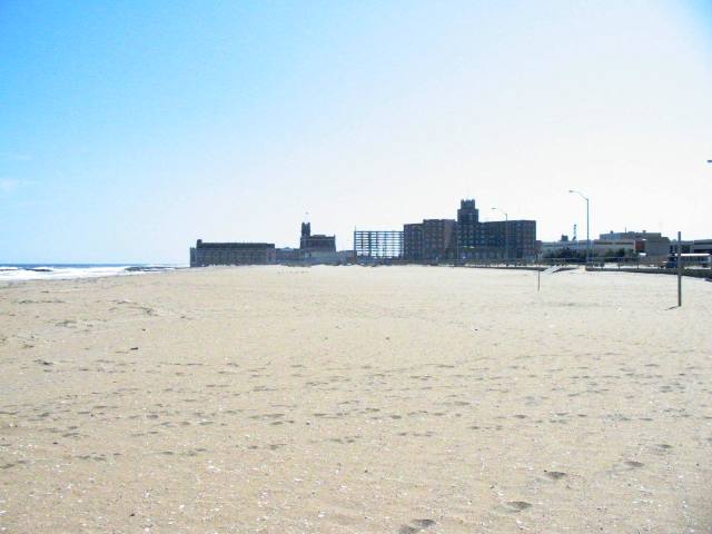
Image:Floating Pool Arrives in NYC. Tyler Hicks/NYTimes

Thursday, October 26, 2006

Business Stewardship Speaker Series - November 7th 2006

BUSINESS STEWARDSHIP SPEAKER SERIES NOVEMBER 2006

RETAIL BUSINESSES AND RESOURCES FOR COASTAL CONSERVATION

Hudson River Foundation
17 Battery Place, Suite 915
November 7th, 2006
9:00 – 10:15 AM

Agenda for Business Stewardship Speaker Series

9:00 AM Introduction to Business Stewardship Speaker Series
Joel Banslaben – Executive Director, CMRC

9:10 AM Building the Sustainable Retail Business Model
Mark Caserta – Owner, 3R Living

9:20 AM Street Sweeping Program in SoHo & Tribeca Business Districts
James Martin – Coordinator, Soho & Tribeca Street Sweeping Services
Eric Klapper – Director of Development, Soho & Tribeca Partnerships

9:30 AM Automotive Service Stations & Used Oil Recycling
Shino Tanikawa – District Manager, NYC Soil & Water Cons. District

9:40 AM Creating Solutions for Business Stewardship
Working session to formulate basic principles on retail business stewardship. Concepts will be incorporated directly into outreach materials to be circulated to local businesses. Topics will include:
· Waste Reduction
· Energy & Water Conservation
· Volunteerism

10:15 AM Adjourn:
The Speaker Series will be followed by an open meeting of the New York Chapter of the Corporate Wetlands Restoration Partnership (NY-CWRP) from 10:30 AM – 12:30 PM. For more information please visit: http://www.cwrp.org/newyork.html

To RSVP please email business.stewardship@thecmrc.org or for more information please visit www.thecmrc.org!

Tuesday, October 24, 2006

In the News: The Biologist and the Sea, Lessons in Marine-Life Restoration

It is easy to forget, in today's day and age, that the marine life on our dinner tables comes from the waters around us. This disconnect and consequent decades of unsustainable fishing practices have led to the demise of several aquatic species. Today, with protection measures in place, many species are rebounding. But, as Biologist and Blue Ocean Institute Founder Carl Safina claims, we need to stay connected to our local coastal ecosystem and develop a "Sea Ethic" to ensure a sustainable balance between nature and our species. JB

Fishing With Carl Safina. The Biologist and the Sea: Lessons in Marine-Life Restoration
By Andrew C. Revkin


MONTAUK, N.Y. For Carl Safina, a biologist, conservationist and prize-winning author, passions and intellectual pursuits are deeply entwined.

The best place to observe this fusion is aboard his 24-foot powerboat First Light at the time of day for which it is named, when Dr. Safina is scanning flocks of terns hovering over the tide-roiled waters between Montauk, the tip of Long Island, and the slate-dark hump of Block Island to the east.

Dr. Safina's doctoral thesis was on the interrelated behaviors and annual rhythms of the common tern and bluefish, which feast on the same bay anchovies and other small prey.
On many days, though, he is carefully tracking the birds not in pursuit of new knowledge, but in hope they will point him to dinner.


On a recent three-hour fishing trip, in snippets of windblown conversation while steering his boat, jigging or casting, then fighting, landing and cleaning fish, Dr. Safina reflected on two decades of work revealing the enormous disruption of ocean ecosystems by industrial-scale fishing and other human activities.

Read more:
http://www.nytimes.com/2006/10/24/science/24conv.html

Video
http://nytimes.feedroom.com/?fr_story=9edb7d48436db6048d7c7b7d0a5560a316f848cc

Blue Ocean Institute
http://www.blueocean.org/

Image: Fishing in Jamaica Bay
Courtesy - One More Cast

Wednesday, October 18, 2006

CMRC to Host Business Stewardship Speaker Series with Corporate Wetlands Restoration Partnership November 7

BUSINESS STEWARDSHIP SPEAKER SERIES – TUESDAY NOVEMBER 7th - SAVE THE DATE!!!

Retail Businesses Leveraging Resources for Conservation

What: CMRC Business Stewardship Speaker Series

When: Tuesday, November 7th from 9:00 – 10:15 AM

Where: Hudson River Foundation, 17 Battery Place, NY, NY

The event will be followed by a kick-off meeting of the New York Corporate Wetlands Restoration Partnership from 10:30 – 12:30. For more details about the NY CWRP please visit (http://www.coastalamerica.gov/text/cwrp.html).

Agenda and details to follow. For more information about the Speaker Series and Business Stewardship Initiative please visit: http://www.thecmrc.org/prog-hbp-bsp.asp.

Minutes from the most recent Business Stewardship Speaker Series can be found at: http://thecmrc.blogspot.com/2006/07/business-stewardship-speaker-series.html

RSVP to: business.stewardship@thecmrc.org. Space is limited!

Tuesday, October 17, 2006

In the News: A Riverfront Oasis Replaces a Bleak Lot in a Bleak Area

Far upstream from the mouth of the Atlantic Ocean, communities are working to improve the environmental quality of, and access to, their waterfronts. The impacts of these efforts are not inconsequential to the overall health of the ecosystem, as what happens in the Westchester, Mahwah and even Albany eventually trickles down to the shores of our estuary. A recent waterfront park opening at Hunt's Point in the Bronx highlighted that strides are being made throughout the watershed to improve water quality and access to coastal resources. JB

By Michelle O'Donnell
Published: October 4, 2006

For years, the contaminated land at the end of Tiffany Street in the Hunts Point section of the Bronx jutted into the East River like nothing more than a mean and bony elbow.

On weekends, hardy neighborhood revelers planted the Puerto Rican flag there and danced and partied at the river's edge, transforming it into a happy outcropping known as La Playita, or the Little Beach. But mostly the lot lay barren amid a stretch of waste-treatment plants and factories.

So the unveiling yesterday of its transformation into Barretto Point Park, a lush five-acre waterfront spot complete with a sandy cove, a small boat ramp, sea grasses and a paved path along the river, was understandably met with glee and no shortage of wonder.


Read more:
http://www.nytimes.com/2006/10/04/nyregion/04park.html

Google Map of Hunt's Point
http://www.google.com/maps?ie=UTF8&z=12&ll=40.811341,-73.882198&spn=0.112774,0.180931&t=h&om=1

Wikipedia - Hunts Point
http://en.wikipedia.org/wiki/Hunts_Point,_Bronx

Friday, October 13, 2006

In the News: Hungry Critters Attack NYC Ships, Piers

Shipworms and gribbles may sound like good costumes for Halloween, but in reality they are a serious threat to vessels, piers and other waterborne structures. As it turns out, the waters of our estuary have become clean enough to support almost ALL of the species that inhabited the region on the 19th century, some of which aren't as welcomed as others. JB

October 09, 2006
By Samanth Gross, Associated Press

NEW YORK — The city's waterfront is getting cleaner, and bothersome river critters not seen in hundreds of years are once again attacking wooden ships and piers.

The waters were once so filthy that early 20th-century sailors could be sure their boats would be safe from such threats because organisms simply couldn't survive in the muck. But scientists are now seeing a resurgence in gribbles, shrimp-like crustaceans that grow to about one-17th of an inch in length and attack wood from the outside, and shipworms, which latch onto the outside of wood and burrow inward, growing up to several feet long as they devour the material.

"As the river gets cleaner, it's easier for things to live in it," Chris Martin of the Hudson River Park Trust said of the return of the tiny mollusks and crustaceans. "We don't make the piers out of wood anymore because of them."

Read more:
http://enn.com/today.html?id=11403

Shipworms on Wikipedia
http://en.wikipedia.org/wiki/Shipworm

Picture A: Shipworm
Picture B : Gribble

Tuesday, October 10, 2006

Conserving our Coasts and Waterfronts: New Jersey DEP's Coastal Management Program

As part of the CMRC's Harbor Bight Policy Initiative we examine the people and programs involved in the conservation and restoration our coasts and waterfronts. These "keepers" of our shore include a variety of government agencies, non-profit organizations, academic institutions, businesses and individuals. This installation of Conserving our Coasts and Waterfronts explores New Jersey DEP's Coastal Management Program. JB

Note: The CMRC is currently preparing a report entitled "Minding the Shore: Who is Responsible" to create a catalog of the entities involved with conserving and restoring our coasts. Stay tuned to www.thecmrc.org for its upcoming release!

New Jersey Department of Environmental Protection (NJDEP) is home to the State's Coastal Management Program (CMP), a collaborative effort that brings together many state agencies and departments to regulate and protect the coasts and waters of the region. Through the CMP, DEP manages the state's diverse coastal area that includes portions of eight counties and 126 municipalities.

The CMP began its efforts in earnest in 1972 following the passage of the Federal Coastal Zone Management Act and was formally approved in 1978. Thirty years later the Program continues to conserve the region's shores and waterfronts, most recently releasing a status report on their efforts called New Jersey's Coast 2005 (PDF).

In addition to CMP's management efforts, the Program also plays a large role in collecting and organizing New Jersey's scientific data on a wide range of topics including:

  • Historical Shoreline and Bathymetric Data
  • Historical Surveys, Maps and Aerial Photography
  • Beach Profile Data
  • Recreational Beach Water Quality

Finally, the CMP is active in ensuring that NJ's residents have ample access to the coastlines and estuaries of the State. They provide and map public access points and also work on waterfront revitalization initiatives such as the Hudson River Waterfront Walkway.

For more information:

NJDEP's Coastal Management Program
http://www.state.nj.us/dep/cmp/

Map of NJ's Coastal Zone
http://www.state.nj.us/dep/cmp/czm_map.html

NJ Department of Environmental Protection
http://www.state.nj.us/dep/

Google Map of the NJ's Atlantic Coast
http://maps.google.com/?ie=UTF8&t=h&om=1&z=8&ll=39.669142,-74.190674&spn=1.835069,3.702393

Wikipedia - "Jersey Shore"
http://en.wikipedia.org/wiki/Jersey_Shore

Picture A. Blue Heron in Hackensack Meadowlands
Picture B. Asbury Park Waterfront

Monday, October 02, 2006

In the News: Scientists Map Canyon Below Atlantic

Ever wonder what the coast of the Harbor Bight looked like 10,000 years ago? Today, with the help of scientists from Rutgers' Institute of Marine & Coastal Sciences, we know exactly what it looks like (even if it is hundreds of feet below sea-level).

The mapping of the "Hudson Canyon," an area over one-hundred miles offshore that acted as a coastlal zone during times of lower sea levels, was completed recently by Peter Rona and other oceanographers. Using a multi-beam sonar system, Rona and his team collected data over a four-year period. The resulting guide to the ocean floor provides some insight into the "last exploration frontier" of our metropolitan region, writes the Environmental News Service. JB

Scientists Map Canyon Below Atlantic
September 05, 2006

By Jeffrey Gold, Associated Press

NEW BRUNSWICK, N.J. - Although just 100
miles off the New Jersey-New York coast, the features of the Hudson Canyon have been largely hidden beneath hundreds of feet of water. Created by the Hudson River centuries ago, parts of the massive, undersea region rival the Grand Canyon in scale. Now, for the first time, scientists have a vivid picture of what the mysterious region looks like.

A four-year study using high-tech tools has produced maps that will allow scientists to study many things, including whether methane gas trapped in frozen sediment below the sea floor is escaping and exacerbating global warming.

Also of interest is whether gas releases could spark undersea landslides that produce tsunamis. Such landslides could also cleave the undersea phone cables that handle much of the nation's overseas communications, said Peter A. Rona, a Rutgers University professor who led the team that produced the maps.

"This region, the Hudson Canyon, is on the doorstep of one of the largest metropolitan areas of the world, and it is an exploration frontier," Rona said as he examined the 3 1/2-by-5-foot maps at the Institute of Marine & Coastal Sciences at Rutgers' Cook College campus.

Read more...
http://www.enn.com/today.html?id=11195

Associated Press Article
http://articles.news.aol.com/news/_a/scientists-map-new-frontier-deep-within/20060903102009990001?cid=2449

USGS Maps
http://pubs.usgs.gov/of/2004/1441/index.html

Rutgers Institute of Marine & Coastal Sciences
http://marine.rutgers.edu/