Thursday, January 18, 2007

In the News: Fuel for debate on the sound

Liquefied Natural Gas or LNG and the high demand for offload facilities in the Northeast will certainly be one of the more contentious debates of the upcoming year. A recent series of public meetings in Long Island brought out proponents and challengers alike, all speaking to the impacts of the planned Broadwater Terminal. Currently in question - a report that found there would be "no significant impacts" in the already heavily degraded Long Island Sound...JB

Photo: Artist Image of Proposed LNG Facility from Underwater from Newsday

By Jennifer Smith
Newsday Staff Writer
January 9, 2007

The contentious debate over a liquefied natural gas terminal proposed for Long Island Sound shifts into high gear this week at a series of public meetings on the project's likely environmental impact.

At issue is a report by federal energy officials which concluded that the massive Broadwater LNG Terminal -- a 1,200-foot-long floating facility that would require about 22 miles of new pipeline under Long Island Sound -- would have no "significant impacts to the environment."

Read more:
http://www.newsday.com/news/local/longisland/ny-liboard0109,0,6932072.story?coll=ny-main-bigpix

Read the Full Report here:
http://www.newsday.com/news/local/longisland/ny-broadwater-report,0,2378274.htmlstory?coll=ny-main-bigpix

Wednesday, January 03, 2007

CMRC State of Our Coasts: 2007

Sea level rise. Combined sewer overflows. Alternative energy. Floating pools. Business stewardship. Sustainability.

What do these topics all have in common?
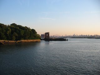
They dominated our headlines in 2006 as our coasts, oceans and waterfronts became a major political, scientific and social area of concern.

----------

The past year brought national and worldwide recognition to the severe degradation of the species, habitats and communities that surround our coastal ecosystem. Simultaneous reports by the US Commission on Ocean Policy and Pew Oceans Commission (now the Joint Ocean Commission) revealed that we are truly at a tipping point for our water-based natural resources, calling for swift and immediate action by our political, academic and business leaders.

Closer to home, Combined Sewer Overflows or CSOs, dominated the news and focus of the NY – NJ Harbor Bight’s coastal managers. The goal – to prevent over 600 outfalls from dumping a mixture of raw sewage and runoff into our estuaries during wet weather storms with rainfall over one-half of an inch. The challenge – how to upgrade treatment plants and reduce stormwater flow upstream to improve water quality at a price the city and its citizens can afford.

Another major issue in 2006 was that of Public Access to the Waterfront. One inventive concept by Ann Buttenwieser created a Floating Pool that will allow people to get near (and in) the water now resides at Brooklyn Bridge Park. Others organizations, such as Metropolitan Waterfront Alliance, worked to examine just how accessible our waterfronts actually are by mapping all of the access points in the urban estuary.

Finally, following on quickly rising oil prices and our nations “addiction” to petroleum, different forms of Renewable Energy came to the forefront. In many cases, these included using the powers of the oceans and our coasts to improve sustainability in the Northeast and Mid-Atlantic. Wind farm proposals were put on the table up-and-down the coast, tidal power pilot projects were introduced in the East River and Liquid Natural Gas facilities were planned for just offshore Sandy Hook and the Long Island Sound.

----------

In 2006, the Coastal Marine Resource Center continued to examine the progress of the above issues, among others, and work to implement sustainable solutions for our habitats and communities with conservation of the Harbor Bight in mind. This included partnering with policy-makers, coastal managers, academic researchers and community, business and environmental leaders to increase awareness of the challenges facing our coasts and oceans.

Our Harbor Bight Policy Program worked with our regional and national leaders to research and develop plans for coastal conservation. In addition, the CMRC worked to catalog the responsibilities of these agencies and officials though our Policy Project Minding the Shore: Who is Responsible? which included the following in 2006 (click link for more information):

In addition, our Sustainable Coasts Program worked to better integrate the natural resources of our waterfronts and oceans with the social capital found in our communities. In Asbury Park, our work translated directly into increased access and economic opportunity for low-income residents in the City. Our Exploring Our Coasts & Waterfronts project continued to document the assets and challenges of waterfront communities both locally and worldwide:

One of the biggest accomplishments for the CMRC in 2006 was the introduction of the Business Stewardship Initiative, a project aimed at bringing together the resources of the private sector with local conservation efforts. Over 100 business and environmental leaders joined together during our workshops and speaker series to discuss the opportunities and outline a strategy for increased collaboration. In addition, the CMRC began efforts to implement its Volunteer Network and Stewards of the Estuary Recognition Program, both of which will be major initiatives of the organization in the upcoming year.

The most exciting venture to evolve out of the Business Stewardship Initiative in 2006 was a joint Green Roofs Project with the Southwest Brooklyn Industrial Development Corp. The project aims to assist local businesses in the area with the planning and implementation of green roofs as a means for increasing energy efficiency and reducing stormwater runoff. The project is currently in planning stages and had identified a local business partner. Stay tuned for more in 2007!

As well, the CMRC, in coordination with Key-East Consulting and Fallout Pictures Kicked off its Virtual Estuary Project in 2006. This multi-media effort, the first of its kind nationwide, will use the current explosion of online visual media to transport students and residents directly to the estuary. Podcasts, interactive maps and even educational games will assist with educating the public on the vast natural resources that exist in our urban metropolitan region and the conservation challenges facing our shores.

Finally, the CMRC had a little fun in 2006. We were able to work with several high profile individuals and businesses to raise awareness for coastal conservation in the NY – NJ ecosystem. In July, International Recording Artist Moby brought his enthusiasm to the stage in support of the CMRC’s efforts, rocking a packed house at East River Park. Our recent end of year Waterfront Luau in Dumbo celebrated a “Superfine” year in coastal conservation. Companies such as Patagonia, Nautica, Brooklyn Brewery, Zipcar, Shift your Gift, Interrupcion, Aveda, Jurlique, Rough Guides, Outside Magazine and 3R Living all provided some greatly appreciated support to make both events a success.

----------

The CMRC will continue to work with our dedicated staff, members, volunteers and partners to put forth a clear and viable plan for advancing the conservation of our coasts, oceans and waterfronts in 2007. It’s apparent that the issues surrounding our waters have come to the surface. Now the challenge will be planning and financing solutions to these concerns.

The CMRC pledges to be at the forefront of coastal planning and policy to assure that resources are made available for the conservation of habitats and communities in the Harbor Bight.

See you in the water!
JB

Thursday, December 14, 2006

CMRC Winter Waterfront Luau ~~~ Tuesday, December 19th!!!

CMRC WINTER WATERFRONT LUAU ~~~ TUESDAY, DECEMBER 19th!!!

Join the CMRC in celebrating a “superfine” year in coastal conservation.
Drinks, food and some waterfront cheer.

Sponsored by Brooklyn Brewery, Outside Magazine, Rough Guides, Patagonia, Jurlique Soho, and many more!

The event is FREE and includes appetizers, cash bar (happy hour 6-7) and access to the DUMBO waterfront nearby. Friends and family welcome!

A suggested donation of $25 receives two (2) drink tickets and a gift bag from our sponsors (including the new “Rough Guide to Climate Change”).

CMRC WINTER WATERFRONT LUAU* Tuesday , December 19th ~~~ 6:00 – 8:00 PM * Superfine, Dumbo, Brooklyn (Map Below)
* RSVP To: info@thecmrc.org

For more information please visit us at http://www.thecmrc.org/ or call 646-515-9290

http://maps.google.com/maps?f=q&hl=en&q=superfine&sll=40.694038,-73.999283&sspn=0.013796,0.021157&ie=UTF8&z=14&ll=40.70797,-73.993778&spn=0.027587,0.042315&t=h&om=1&iwloc=A

CMRC partners with www.shiftyourgift.com for the Holidays!

The CMRC is proud to partner with www.shiftyourgift.com for the Holidays!

Shift Your Gift is a project of Shift Media Group (www.shiftmag.com) that brings sustainable living options to the mainstream. www.shiftyourgift.com has great gifts for the holidays including organic cotton t-shirts, healthy and tasty food and even electric motorcycles!

In addition, when you make a purchase at www.shiftyourgift.com, 5% of the purchase price goes directly to the non-profit organization of your choice!!!

Shift believes that individuals can have a positive impact on the environment through their daily decisions without sacrificing quality of life or style. Shift celebrates the new technologies and new ideas that make sustainable living a real option.

Happy Holidays from the CMRC and www.shiftyourgift.com!
JB

Image: Organic Cotton T-Shirt from Edun

Tuesday, December 12, 2006

Conserving our Coasts & Waterfronts: Water Quality FAQs

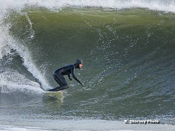
This past Thanksgiving I went for a morning surf in the Rockaways. It was a stormy, windy, rainy day and the waves were in the double overhead range (8-12 ft), water temps in the low 50s. It was a great day to be in the ocean.

Unfortunately, waves weren't the only thing I caught that morning...by the next day an infection was pulsing through my body, most likely from the polluted waters I had swam in the day before. Every time it rains more than a half-inch our city's wastewater system discharges raw sewage mixed with stormwater directly in our harbors and bays making for a bacteria and virus-laden cocktail.

Surfers are often the first to feel the effects of these conditions, but it has to make you think "If we are getting sick every time it rains, then what is happening to the aquatic life that lives in these waters?" Do we even know what the water quality is during rain events and what are the impacts on our ecosystem?"

Below are a few links to more information on water quality in NY and NJ. Combined Sewer Overflows (CSOs) are a significant problem that need a solution to prevent the continued dumping of pollutants into our local waters. There are some solutions that you can assist with at your home or business...things like conserving water when it rains or installing a green roof are just a sampling of the options available .

It starts with everybody from residents and businesses to government regulators and elected officials pitching in to solve this problem. The CMRC is looking forward to working with you to reduce the impacts of CSOs and improve our coasts, oceans and waterfronts in the year to come. See you in the water...JB

Images:
Rockaway Surf - Robert Skorney
Submerged CSO - www.reef-rescue.org

Water Quality (WQ) Links:

NYC Dept. of Environmental Protection
http://www.nyc.gov/html/dep/html/news/hwqs.html
Note: NYCDEP has NO real-time monitoring of WQ online!

NJ Dept. of Environmental Protection
http://www.state.nj.us/dep/beaches/
http://www.state.nj.us/dep/wmm/bmw/
Note: NJDEP has NO real-time monitoring of WQ online!

Surfrider NYC Water quality Testing
http://www.surfrider.org/bwtf/BWTFoutput.asp

CARP - Contamination Assessment & Reduction Project
http://www.carpweb.org/main.html

Southern California's Real Time WQ Monitoring
http://www.earth911.org/waterquality/default.asp?cluster=1

More about CSOs
http://www.seagrant.sunysb.edu/hep/pdf/hep_cso.pdf

Tuesday, December 05, 2006

In the News: On a Sliver of the Bronx, a Waterfront Respite

All along our estuary's waterfront, new access points are being opened to the public in an effort to regain our lost, but unbelievably rich, maritime heritage. The Bronx, lying in the far northern reaches of the NY - NJ Harbor Estuary, has often been the least accessible all of our region's waterfronts. In 2005, Mayor Bloomberg made a large first step in the right direction, providing a 600 foot-long stretch of access in Riverdale. Now we must continue to push forward until the entire coastline is accessible to all...JB

Photo: Bronx Waterfront/The CMRC

By Thomas J. Lueck
Published: December 5, 2006


I'm not sure how many people know how to get here, said Lisa San Felice, an amateur photographer, speaking last Thursday afternoon to the only other visitor to the Riverdale Waterfront Promenade and Fishing Access Site, one of New York City's least likely parks.

A tiny ribbon of land, the Riverdale park in the Bronx is 20 feet wide and 600 feet long, providing benches and a place to fish or take a stroll between Metro-North train tracks and the Hudson shoreline. Getting there involves stairs or elevators, crossing the railroad tracks on an elevated walkway and finding the gate to the park.

Since it was dedicated in 2005 by Mayor Michael R. Bloomberg, the Riverdale retreat has been hailed as an important step, or at least a symbolic gesture, toward providing more public access to the city's underutilized waterfront. But there has also been the awkward question of who
would actually use such a minuscule stretch of river frontage.

Read more:
http://www.nytimes.com/2006/12/05/nyregion/05ink.html

Bronx Borough Presidents Waterfront Plan
http://bronxboropres.nyc.gov/en/gv/president/waterfront.htm

Tuesday, November 21, 2006

In the News: The Coastline Is Retreating. Should the Montauk Lighthouse Stand Its Ground?

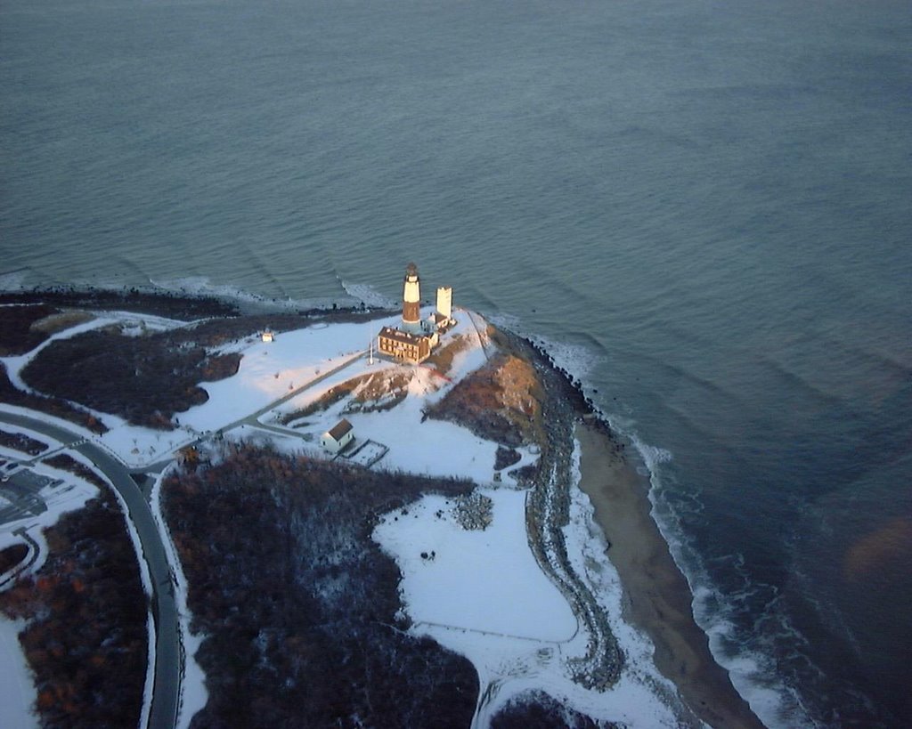
The debate rages on in Montauk regarding its charismatic lighthouse and how to address the ever-encroaching coastline below. Since the structure was built in 1796 (commissioned by George Washington no less!) the buffer between the sea and the towering lighthouse has shrunk from a generous 300 feet to a precarious 75. Now coastal managers, fisherman, surfers and local residents are left to decide whether to retreat or stand their ground...JB

Photo: Anders Brownworth (www.anders.com)

By Cornelia Dean
November 21, 2006


Lighthouses speak to the imagination. They illuminate the darkness, remind us of a vanishing maritime heritage and embody what it means to make it safely home.

So when erosion threatens to send a lighthouse toppling into the sea, people want to save it. But how? The way we answer that question involves more than engineering. It can become a statement about how we intend to live with our eroding coasts.

Read more:
http://www.nytimes.com/2006/11/21/science/earth/21comm.html

Video:
http://nytimes.feedroom.com/?fr_story=4db4f0511aac94767acc5b17838c7ab8d2600bfe

More on the Lighthouse Debate
http://travel2.nytimes.com/2006/11/14/nyregion/14light.html

Google Map of Montauk Lighthouse
http://maps.google.com/maps?f=q&hl=en&q=montauk&sll=40.694038,-73.999283&sspn=0.013796,0.019226&ie=UTF8&z=12&ll=41.058903,-71.899338&spn=0.109764,0.21492&t=h&om=1

Montauk Lighthouse
http://www.montauklighthouse.com/home.htm

Wikipedia - Montauk Lighthouse
http://en.wikipedia.org/wiki/Montauk_Point_Lighthouse

Thursday, November 16, 2006

CMRC Winter Waterfront Luau - Tuesday, December 19th

CMRC WINTER WATERFRONT LUAU ~~~ SAVE THE DATE!!!

Join the CMRC in celebrating a “superfine” year in coastal conservation. Drinks, food and some waterfront cheer.

CMRC WINTER WATERFRONT LUAU* Tuesday , December 19th ~~~ 6:00 – 8:00 PM* Superfine, Dumbo, Brooklyn (Map Link Below) * RSVP To: info@thecmrc.org

Details to follow. For more information please visit us at http://www.thecmrc.org/

http://maps.google.com/maps?f=q&hl=en&q=superfine&sll=40.694038,-73.999283&sspn=0.013796,0.021157&ie=UTF8&z=14&ll=40.70797,-73.993778&spn=0.027587,0.042315&t=h&om=1&iwloc=A

Wednesday, November 15, 2006

CMRC Virtual Estuary Project Now Online!!!

The CMRC's Virtual Estuary Project is an effort that aims to bring the experience of our coasts and waterfronts to residents throughout the NY-NJ region by using technology and media to convey the story of our coastal habitat, species and communities. We are proud to unveil the Virtual Estuary for the first time today at www.virtualestuary.org!

Please stay tuned for frequent updates and feel free to contact us at virtual.estuary@thecmrc.org with ideas, links or questions.
JB

Virtual Estuary Project Overview
The Virtual Estuary Project is an initiative that uses cutting-edge technology and interactive media to create an educational tool that explores the natural resources found within the coastal environment of the New York – New Jersey Harbor Bight.

Project Background
The Harbor Bight is home to one of the largest metropolitan regions in the world. It includes a population of 22 million residents, thousands of academic institutions and an international business community. Unfortunately, the extent of the region’s development puts tremendous stress on the health of the estuary's natural systems. The Virtual Estuary aims to reconnect residents with the coastal ecosystem through a variety of interactive educational tools that increase awareness regarding aquatic species and habitats while simultaneously conveying important conservation lessons to individuals and entire classrooms.

Virtual Estuary Overview
The Virtual Estuary Project is a partnership between the CMRC, Key East Consulting and Fallout Pictures that allow users to experience the Harbor Bight ecosystem through the use of computers and media players. Located at
www.virtualestuary.org, the website offers access to web-based media via multiple gateways. The primary interface will resemble Google’s mapping program (www.maps.google.com) and will include highlighted links to site specific media that showcases a variety of coastal features and topics such as: aquatic species, coastal habitat, waterfront communities and maritime history. It will be accessible first online where information will be downloadable to desktop computers and portable devices and then in a DVD format that will be distributed to after-school programs.

The Virtual Estuary Project includes the following components:

  • Online Map and Searchable Content Interfaces
  • Interactive Species and Habitat Modules
  • Downloadable “Flash” Videos and Podcasts
  • Web-Based Educational Games

By allowing residents to learn about the different species, habitats and coastal communities users will gain a better understanding of the resources and challenges facing our coastlines. Students and teachers will be able use the information to discover the ecology and maritime history of our region. Local residents will be able to experience the Harbor Bight in a new way by exploring our ecosystem and gaining knowledge through easily accessible cutting-edge technologies.

For more information please email virtual.estuary@thecmrc.org

Thursday, November 09, 2006

In the News: LI's wetlands are key to marine health

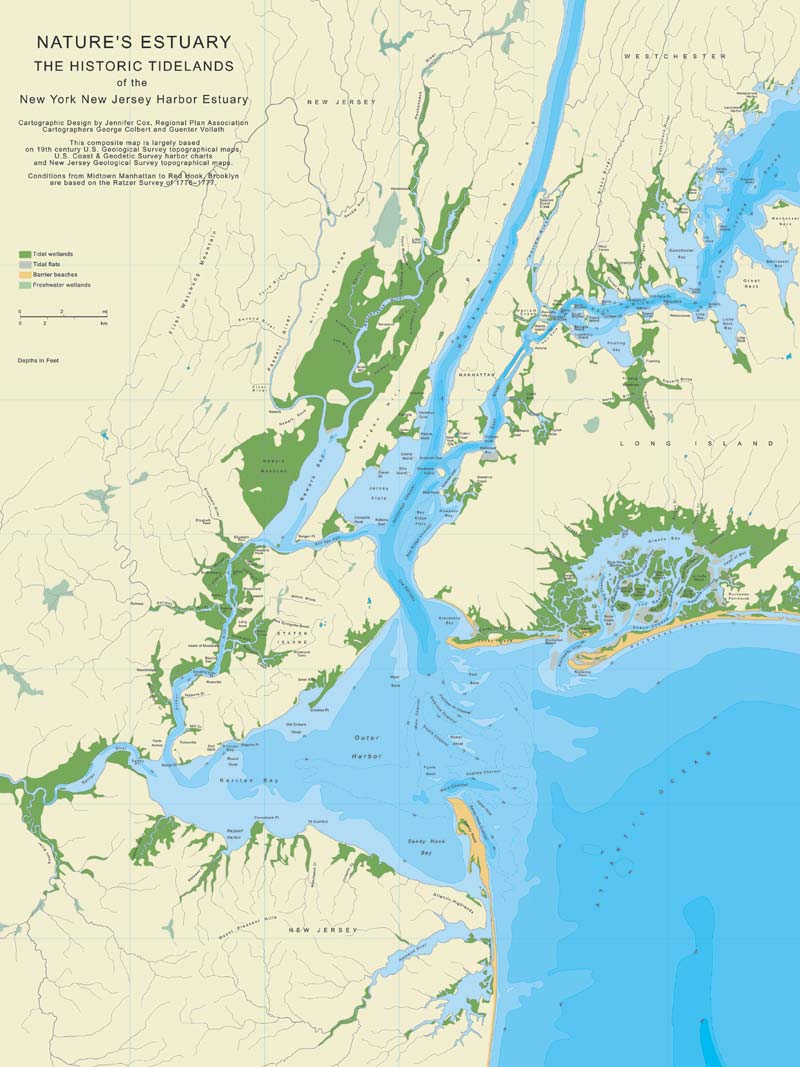
One of the biggest changes to our coastal landscape has been the significant loss of marine habitat to shoreline alteration. Historic maps of the region clearly show that thousands of acres of marshes and submerged lands have been lost (Health of the Harbor, pg 10). The end result, as reported in a recent issue of Science Magazine, is greatly reduced fisheries abundance and species diversity. In order to allow these species to recover, we must begin the costly process of restoring the miles of bulkheaded, filled and hardened shorelines to their natural state...JB

By Jennifer Smith
November 2, 2006

From the crash of the Great South Bay's once-abundant hard clam population to the near disappearance of eelgrass from the bottom of Long Island Sound, Long Island's coastal waters are no strangers to species loss.

This week a study in the journal Science took a larger look at how the loss of aquatic biodiversity -- the total number of fish and plant species in a habitat -- affects the ecosystems that nourish marine species.

In coastal areas, the study linked the regional loss of biodiversity with a decline of viable fisheries and impaired "nursery" habitats such as wetlands and seagrass beds, which shelter young fish.

Read more:
http://www.newsday.com/news/local/longisland/ny-hsloca1103,0,76050.story?coll=ny-longisland-homepage

Additional Coverage in Newsday - "Stability of marine life in severe danger"
http://www.newsday.com/news/health/ny-hssea1103,0,4706897.story?coll=ny-leadhealthnews-headlines

Op-Ed in NY Times - "The fishing industry lobbies Congress for the right to overfish. "
http://www.nytimes.com/2006/11/05/opinion/nyregionopinions/05LI-mcmurray.html

Image A - Crab Meadow, LI
Image B - RPA Map of Wetland Losses

Tuesday, October 31, 2006

In the News: Two More Ladies in the Harbor, a Floating Pool and the Woman Who Had the Idea for It

NYC Department of Parks introduced its new floating pool yesterday as it sailed into the Harbor (all the way from Louisiana!). The project is the vision of Ann Buttenwieser who, like many of us, is interested in attracting residents back to the waterfront. We here at the CMRC hope that this is just the first of many floating parks along our shores and also that one day we will actually be able to swim in, as opposed to on, our local waters again...JB

By James Barron
October 31, 2006


So yesterday the floating pool lady finally got to watch the Floating Pool Lady arrive in New York. The floating pool lady is Ann L. Buttenwieser, a former Parks Department official who had a brainstorm 25 years ago: Why not put a swimming pool on a barge and moor it somewhere along the city’s 578 miles of waterfront?

The Floating Pool Lady is the barge. Standing in a terrace garden in Lower Manhattan yesterday, Ms. Buttenwieser watched the Floating Lady float by after it glided under the Verrazano-Narrows Bridge and past Governors Island. It is now more pool than cargo hauler, but it is still not quite ready for its next life as a destination for dog-paddling, backstroking New Yorkers.

Read more:
http://www.nytimes.com/2006/10/31/nyregion/31pool.html

NYC Department of Parks and Recreation Pools
http://www.nycgovparks.org/sub_things_to_do/facilities/af_pools.html

Swim NYC - Manhattan Island Foundation
http://www.swimnyc.org/

Image:Floating Pool Arrives in NYC. Tyler Hicks/NYTimes

Thursday, October 26, 2006

Business Stewardship Speaker Series - November 7th 2006

BUSINESS STEWARDSHIP SPEAKER SERIES NOVEMBER 2006

RETAIL BUSINESSES AND RESOURCES FOR COASTAL CONSERVATION

Hudson River Foundation
17 Battery Place, Suite 915
November 7th, 2006
9:00 – 10:15 AM

Agenda for Business Stewardship Speaker Series

9:00 AM Introduction to Business Stewardship Speaker Series
Joel Banslaben – Executive Director, CMRC

9:10 AM Building the Sustainable Retail Business Model
Mark Caserta – Owner, 3R Living

9:20 AM Street Sweeping Program in SoHo & Tribeca Business Districts
James Martin – Coordinator, Soho & Tribeca Street Sweeping Services
Eric Klapper – Director of Development, Soho & Tribeca Partnerships

9:30 AM Automotive Service Stations & Used Oil Recycling
Shino Tanikawa – District Manager, NYC Soil & Water Cons. District

9:40 AM Creating Solutions for Business Stewardship
Working session to formulate basic principles on retail business stewardship. Concepts will be incorporated directly into outreach materials to be circulated to local businesses. Topics will include:
· Waste Reduction
· Energy & Water Conservation
· Volunteerism

10:15 AM Adjourn:
The Speaker Series will be followed by an open meeting of the New York Chapter of the Corporate Wetlands Restoration Partnership (NY-CWRP) from 10:30 AM – 12:30 PM. For more information please visit: http://www.cwrp.org/newyork.html

To RSVP please email business.stewardship@thecmrc.org or for more information please visit www.thecmrc.org!

Tuesday, October 24, 2006

In the News: The Biologist and the Sea, Lessons in Marine-Life Restoration

It is easy to forget, in today's day and age, that the marine life on our dinner tables comes from the waters around us. This disconnect and consequent decades of unsustainable fishing practices have led to the demise of several aquatic species. Today, with protection measures in place, many species are rebounding. But, as Biologist and Blue Ocean Institute Founder Carl Safina claims, we need to stay connected to our local coastal ecosystem and develop a "Sea Ethic" to ensure a sustainable balance between nature and our species. JB

Fishing With Carl Safina. The Biologist and the Sea: Lessons in Marine-Life Restoration
By Andrew C. Revkin


MONTAUK, N.Y. For Carl Safina, a biologist, conservationist and prize-winning author, passions and intellectual pursuits are deeply entwined.

The best place to observe this fusion is aboard his 24-foot powerboat First Light at the time of day for which it is named, when Dr. Safina is scanning flocks of terns hovering over the tide-roiled waters between Montauk, the tip of Long Island, and the slate-dark hump of Block Island to the east.

Dr. Safina's doctoral thesis was on the interrelated behaviors and annual rhythms of the common tern and bluefish, which feast on the same bay anchovies and other small prey.
On many days, though, he is carefully tracking the birds not in pursuit of new knowledge, but in hope they will point him to dinner.


On a recent three-hour fishing trip, in snippets of windblown conversation while steering his boat, jigging or casting, then fighting, landing and cleaning fish, Dr. Safina reflected on two decades of work revealing the enormous disruption of ocean ecosystems by industrial-scale fishing and other human activities.

Read more:
http://www.nytimes.com/2006/10/24/science/24conv.html

Video
http://nytimes.feedroom.com/?fr_story=9edb7d48436db6048d7c7b7d0a5560a316f848cc

Blue Ocean Institute
http://www.blueocean.org/

Image: Fishing in Jamaica Bay
Courtesy - One More Cast

Wednesday, October 18, 2006

CMRC to Host Business Stewardship Speaker Series with Corporate Wetlands Restoration Partnership November 7

BUSINESS STEWARDSHIP SPEAKER SERIES – TUESDAY NOVEMBER 7th - SAVE THE DATE!!!

Retail Businesses Leveraging Resources for Conservation

What: CMRC Business Stewardship Speaker Series

When: Tuesday, November 7th from 9:00 – 10:15 AM

Where: Hudson River Foundation, 17 Battery Place, NY, NY

The event will be followed by a kick-off meeting of the New York Corporate Wetlands Restoration Partnership from 10:30 – 12:30. For more details about the NY CWRP please visit (http://www.coastalamerica.gov/text/cwrp.html).

Agenda and details to follow. For more information about the Speaker Series and Business Stewardship Initiative please visit: http://www.thecmrc.org/prog-hbp-bsp.asp.

Minutes from the most recent Business Stewardship Speaker Series can be found at: http://thecmrc.blogspot.com/2006/07/business-stewardship-speaker-series.html

RSVP to: business.stewardship@thecmrc.org. Space is limited!

Tuesday, October 17, 2006

In the News: A Riverfront Oasis Replaces a Bleak Lot in a Bleak Area

Far upstream from the mouth of the Atlantic Ocean, communities are working to improve the environmental quality of, and access to, their waterfronts. The impacts of these efforts are not inconsequential to the overall health of the ecosystem, as what happens in the Westchester, Mahwah and even Albany eventually trickles down to the shores of our estuary. A recent waterfront park opening at Hunt's Point in the Bronx highlighted that strides are being made throughout the watershed to improve water quality and access to coastal resources. JB

By Michelle O'Donnell
Published: October 4, 2006

For years, the contaminated land at the end of Tiffany Street in the Hunts Point section of the Bronx jutted into the East River like nothing more than a mean and bony elbow.

On weekends, hardy neighborhood revelers planted the Puerto Rican flag there and danced and partied at the river's edge, transforming it into a happy outcropping known as La Playita, or the Little Beach. But mostly the lot lay barren amid a stretch of waste-treatment plants and factories.

So the unveiling yesterday of its transformation into Barretto Point Park, a lush five-acre waterfront spot complete with a sandy cove, a small boat ramp, sea grasses and a paved path along the river, was understandably met with glee and no shortage of wonder.


Read more:
http://www.nytimes.com/2006/10/04/nyregion/04park.html

Google Map of Hunt's Point
http://www.google.com/maps?ie=UTF8&z=12&ll=40.811341,-73.882198&spn=0.112774,0.180931&t=h&om=1

Wikipedia - Hunts Point
http://en.wikipedia.org/wiki/Hunts_Point,_Bronx

Friday, October 13, 2006

In the News: Hungry Critters Attack NYC Ships, Piers

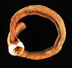
Shipworms and gribbles may sound like good costumes for Halloween, but in reality they are a serious threat to vessels, piers and other waterborne structures. As it turns out, the waters of our estuary have become clean enough to support almost ALL of the species that inhabited the region on the 19th century, some of which aren't as welcomed as others. JB

October 09, 2006
By Samanth Gross, Associated Press

NEW YORK — The city's waterfront is getting cleaner, and bothersome river critters not seen in hundreds of years are once again attacking wooden ships and piers.

The waters were once so filthy that early 20th-century sailors could be sure their boats would be safe from such threats because organisms simply couldn't survive in the muck. But scientists are now seeing a resurgence in gribbles, shrimp-like crustaceans that grow to about one-17th of an inch in length and attack wood from the outside, and shipworms, which latch onto the outside of wood and burrow inward, growing up to several feet long as they devour the material.

"As the river gets cleaner, it's easier for things to live in it," Chris Martin of the Hudson River Park Trust said of the return of the tiny mollusks and crustaceans. "We don't make the piers out of wood anymore because of them."

Read more:
http://enn.com/today.html?id=11403

Shipworms on Wikipedia
http://en.wikipedia.org/wiki/Shipworm

Picture A: Shipworm
Picture B : Gribble

Tuesday, October 10, 2006

Conserving our Coasts and Waterfronts: New Jersey DEP's Coastal Management Program

As part of the CMRC's Harbor Bight Policy Initiative we examine the people and programs involved in the conservation and restoration our coasts and waterfronts. These "keepers" of our shore include a variety of government agencies, non-profit organizations, academic institutions, businesses and individuals. This installation of Conserving our Coasts and Waterfronts explores New Jersey DEP's Coastal Management Program. JB

Note: The CMRC is currently preparing a report entitled "Minding the Shore: Who is Responsible" to create a catalog of the entities involved with conserving and restoring our coasts. Stay tuned to www.thecmrc.org for its upcoming release!

New Jersey Department of Environmental Protection (NJDEP) is home to the State's Coastal Management Program (CMP), a collaborative effort that brings together many state agencies and departments to regulate and protect the coasts and waters of the region. Through the CMP, DEP manages the state's diverse coastal area that includes portions of eight counties and 126 municipalities.

The CMP began its efforts in earnest in 1972 following the passage of the Federal Coastal Zone Management Act and was formally approved in 1978. Thirty years later the Program continues to conserve the region's shores and waterfronts, most recently releasing a status report on their efforts called New Jersey's Coast 2005 (PDF).

In addition to CMP's management efforts, the Program also plays a large role in collecting and organizing New Jersey's scientific data on a wide range of topics including:

  • Historical Shoreline and Bathymetric Data
  • Historical Surveys, Maps and Aerial Photography
  • Beach Profile Data
  • Recreational Beach Water Quality

Finally, the CMP is active in ensuring that NJ's residents have ample access to the coastlines and estuaries of the State. They provide and map public access points and also work on waterfront revitalization initiatives such as the Hudson River Waterfront Walkway.

For more information:

NJDEP's Coastal Management Program
http://www.state.nj.us/dep/cmp/

Map of NJ's Coastal Zone
http://www.state.nj.us/dep/cmp/czm_map.html

NJ Department of Environmental Protection
http://www.state.nj.us/dep/

Google Map of the NJ's Atlantic Coast
http://maps.google.com/?ie=UTF8&t=h&om=1&z=8&ll=39.669142,-74.190674&spn=1.835069,3.702393

Wikipedia - "Jersey Shore"
http://en.wikipedia.org/wiki/Jersey_Shore

Picture A. Blue Heron in Hackensack Meadowlands
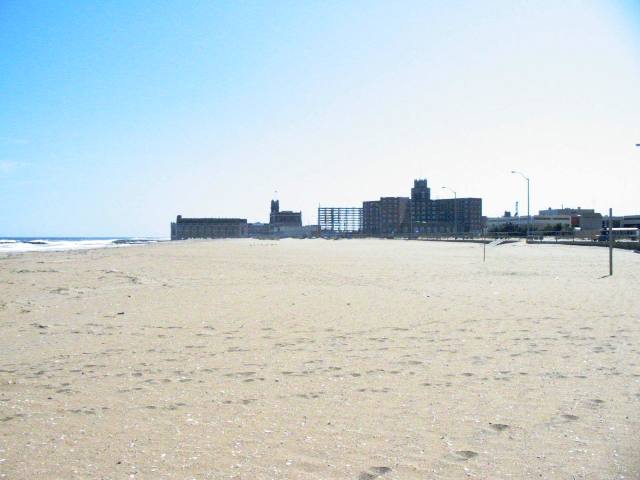
Picture B. Asbury Park Waterfront

Monday, October 02, 2006

In the News: Scientists Map Canyon Below Atlantic

Ever wonder what the coast of the Harbor Bight looked like 10,000 years ago? Today, with the help of scientists from Rutgers' Institute of Marine & Coastal Sciences, we know exactly what it looks like (even if it is hundreds of feet below sea-level).

The mapping of the "Hudson Canyon," an area over one-hundred miles offshore that acted as a coastlal zone during times of lower sea levels, was completed recently by Peter Rona and other oceanographers. Using a multi-beam sonar system, Rona and his team collected data over a four-year period. The resulting guide to the ocean floor provides some insight into the "last exploration frontier" of our metropolitan region, writes the Environmental News Service. JB

Scientists Map Canyon Below Atlantic
September 05, 2006

By Jeffrey Gold, Associated Press

NEW BRUNSWICK, N.J. - Although just 100
miles off the New Jersey-New York coast, the features of the Hudson Canyon have been largely hidden beneath hundreds of feet of water. Created by the Hudson River centuries ago, parts of the massive, undersea region rival the Grand Canyon in scale. Now, for the first time, scientists have a vivid picture of what the mysterious region looks like.

A four-year study using high-tech tools has produced maps that will allow scientists to study many things, including whether methane gas trapped in frozen sediment below the sea floor is escaping and exacerbating global warming.

Also of interest is whether gas releases could spark undersea landslides that produce tsunamis. Such landslides could also cleave the undersea phone cables that handle much of the nation's overseas communications, said Peter A. Rona, a Rutgers University professor who led the team that produced the maps.

"This region, the Hudson Canyon, is on the doorstep of one of the largest metropolitan areas of the world, and it is an exploration frontier," Rona said as he examined the 3 1/2-by-5-foot maps at the Institute of Marine & Coastal Sciences at Rutgers' Cook College campus.

Read more...
http://www.enn.com/today.html?id=11195

Associated Press Article
http://articles.news.aol.com/news/_a/scientists-map-new-frontier-deep-within/20060903102009990001?cid=2449

USGS Maps
http://pubs.usgs.gov/of/2004/1441/index.html

Rutgers Institute of Marine & Coastal Sciences
http://marine.rutgers.edu/

Monday, September 25, 2006

In the News: Mayor Bloomberg Announces Creation of Office of Long-term Planning and Sustainability

Mayor Bloomberg announced this past Friday that the City will create a new office of Long-Term Planning and Sustainability to focus on reducing greenhouse gases and developing "environmentally sound" policies and practices for the region. The Press Conference took place in California with Governor Schwarzenegger after touring a sustainable energy facility that highlighted the potential for green economic development. In his presentation the Mayor took a moment to highlight the value of our coasts and waterways stating, "The water along our shoreline is cleaner than it has been in generations – but we want it cleaner still, so that we can fish, swim, and enjoy the rivers that have always been the City’s most distinctive feature." JB

FOR IMMEDIATE RELEASE September 21, 2006

MAYOR BLOOMBERG ANNOUNCES CREATION OF OFFICE OF LONG-TERM PLANNING AND SUSTAINABILITY

New Office and Advisory Board to Create Agenda to Make New York City an Environmental Leader and Guide City Efforts Towards Environmentally Sound Future

Mayor Michael R. Bloomberg today announced a series of initiatives to move forward the Administration’s plans to create an ambitious environmental agenda for New York City and its municipal government. The key components of the plan include the creation of the Office of Long-term Planning and Sustainability within the Mayor’s Office of Operations; the undertaking of a major greenhouse gas inventory for City government and the City overall; the appointment of a Sustainability Advisory Board to advise the City on environmentally sound policies and practices; that Douglas I. Foy, former Massachusetts Secretary for Commonwealth Development, will serve as a special advisor on sustainability; and the creation of a new partnership with the Earth Institute of Columbia University to provide the City with scientific research and advice on environmental and climate change-related issues.

The announcement took place during a visit with California Governor Arnold Schwarzenegger to Bloom Energy in Sunnyvale, California, where the Mayor and Governor talked about the State of California’s groundbreaking sustainability initiatives. Prior to the announcement, the Mayor and Governor toured the facility, which manufactures fuel cells that generate power by converting hydrogen into electricity and produce only water as exhaust.

“Sustainability is all about ensuring that economic growth and development today is compatible with the ability of our children and grandchildren to meet their needs in the future,” said Mayor Bloomberg. “To that end, in May I made a pledge to the New York League of Conservation Voters to establish the Office of Long-Term Planning and Sustainability, and create an advisory board comprised of New York’s leading experts, activists, and businesspeople in this field to set goals, and help shape and guide the City’s sustainability agenda.

“Like California, New York City has a long tradition of leadership in environmental protection - from creating the largest municipal park system in the nation, to pioneering water conservation, to banning second-hand smoke in public places. Now, we intend to make New York City a national leader in meeting the challenge of making ours an environmentally sustainable city. To make New York a truly sustainable city, we need a bold plan to use our land in the smartest way possible – not only by developing areas ripe for growth, but also by cleaning up brownfields so that no piece of New York City is too contaminated to be used for employment, housing, or recreation. The water along our shoreline is cleaner than it has been in generations – but we want it cleaner still, so that we can fish, swim, and enjoy the rivers that have always been the City’s most distinctive feature. We’ve made great strides in cleaning up our air but we still have too much pollution. And the constant threat of global warming means that we have to think about the urban heat island effect that makes our summer days even hotter than the greener areas around our City.”

Read more:
http://www.nyc.gov/portal/site/nycgov/menuitem.c0935b9a57bb4ef3daf2f1c701c789a0/index.jsp?pageID=mayor_press_release&catID=1194&doc_name=http%3A%2F%2Fwww.nyc.gov%2Fhtml%2Fom%2Fhtml%2F2006b%2Fpr335-06.html&cc=unused1978&rc=1194&ndi=1

Watch Video of Announcement with Mayor Bloomberg and Governor Schwarzenegger
http://www.nyc.gov/html/om/html/2006b/media/pc092106-la300k.asx

Columbia University's Earth Institute
http://www.earthinstitute.columbia.edu/news/2006/story09-22-06.php

Friday, September 08, 2006

In the News: Storm damage estimates at Shore being compiled

With the recent passing of the remnants of hurricane Ernesto and tropical storm Florence churning in the Atlantic it has become apparent that this is going to be another active tropical season for the east coast. The question seems not if but when the next major system will arrive in the Harbor Bight ecosystem. Are we ready? The article below from the Asbury Park Press shows that we have good risk management programs in place, but our overall coastal planning approach still needs significant improvement to limit the impacts of these storms on our economy and the environment. JB

Posted by the Asbury Park Press on 09/6/06
By Bob Jordan and
Brian Prince

The bill from Ernesto's damage is expected to exceed $500,000 in Monmouth County, but Ocean County officials are still calculating the amount of damage inflicted by the one-time hurricane when it struck the Shore on Friday and Saturday.

Municipal officials said the tropical depression's impact also will be felt if local services or projects are delayed because of storm cleanup work.

"We may have to have a special brush and limb pickup because of the storm, and if so, it will mean taking our Public Works employees off other projects for about two weeks so they can do it," said Thomas Antus, Freehold Township administrator. "In terms of actual additional costs for cleanup, it's not much, outside of Police Department overtime during the storm event, but it will delay what Public Works can do for two weeks."

Cleanup continued Tuesday from the storm, in which gusts of up to about 60 mph felled trees and knocked down about 500 Jersey Central Power & Light Co. wires in Monmouth and Ocean counties.

Read more...
http://www.app.com/apps/pbcs.dll/article?AID=2006609060339

National Hurricane Center:
http://www.nhc.noaa.gov/

Hurricane Preparedness
http://www.nhc.noaa.gov/HAW2/english/intro.shtml