 the spaces at the southern end of the Piers and the EDC is determining how to connect these uses with public access and community interaction. Below is an excerpt from the EDC website with presentations from the workshop. JB
Brooklyn Piers 7-12
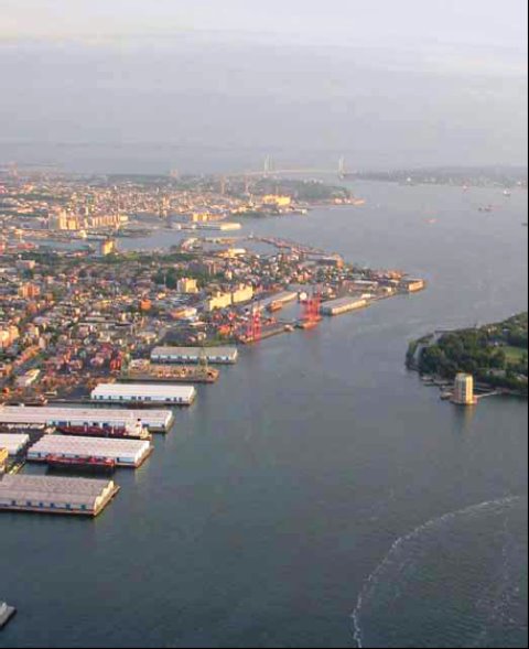
NYCEDC is undertaking a planning and redevelopment initiative to help guide the future of Brooklyn Piers 7-12.
The guiding principles for redevelopment would include:
Sustaining and enhancing Red Hook's maritime identity;
Creating new economic development opportunities and jobs;
Providing waterfront access;
Improving transportation (on water and land); and
Strengthening connections between upland neighborhoods and the water's edge.
As we progress with this initiative, we will be posting additional information on this site. We look forward to your input.
Presentations and Public Documents:
Community Board 6 Presentation (April 3rd, 2006)
http://www.nycedc.com/Library/Studies/Piers7-12workshop20060403.pdf
Community Board 6 Presentation (November 28th, 2005) (pdf)
http://www.nycedc.com/Library/Studies/7-12PlanningNov28Revised.pdf
Community Board 6 Waterfront Committee
http://www.brooklyncb6.org/committees/?a=detail&content_id=45
Google Map of Brooklyn Piers 7-12
http://maps.google.com/?ll=40.685552,-74.008627&spn=0.014124,0.028582&t=h&om=0
No comments:
Post a Comment